Foggy Bay to Ketchikan

We knew that the rest of the Mother Goose fleet was completing their 7-day tour of Misty Fiords. Our boat was to join up with the fleet in Ketchikan. Knowing that if we let the rest of the fleet get there first, they would find slip accommodations and we could then join up with them, ensuring that all the boats were conveniently moored.  So we hung out til about 10am and then headed north to Ketchikan.

Again, it was fairly calm, and we dodged a few  gillnetters as we motored north. It wasn’t too long before the rest of the “fleet” popped up on AIS, and they were about an hour ahead of us. Perfect! We contacted Captain Bill by phone and told him our position and asked if he’d be sure to get us a slip when he brought the rest of the goslings into Ketchikan.  All organized, we sat back and enjoyed the 5 hour trip. About 15 minutes out, we called Customs to tell them that we would meet them at the Fuel Dock, so that we were able to kill two birds with one stone.  We filled up with diesel, filled up the propane tank, and cleared customs easily.  However, when it came time to leave the dock, we were wedged in front and aft, with a fishing boat’s stern sticking out only inches behind us and a nice Nordhavn tight in front. The Nordie captain and the fuel  dock attendant helped us wedge our way out by holding the bow in while we swung the aft out into the channel, and all was well.

20110622Foggy Bay to Ketchikan-4-Edit

A rare sight. Only one cruise ship in Ketchikan. That will change soon!

It was a short ride up to Bar Harbor to join  the rest of the Grand Banks fleet, and we passed some cruise ships along the way. Met by smiling faces and helping hands, we docked Alaskan Dream near Deception (the lead boat) and proceeded to greet friends we hadn’t seen since January. 

Some summary statistics: we were on the boat for 35 days. Of those days, 86% were at anchor and only 14% at a dock. When we anchored, 77%% of the time we were totally alone in the anchorage with no other boats and 13% of the time there was only one other boat with us. Definitely some solitude on this trip!

It was a lot of fun, this trip…and we left the boat in Ketchikan already thinking of where we could go and what we could do in 2012!

Brundige Inlet to Foggy Bay, AK

In my never-ending desire to avoid long days of crossings, we planned to go about 30 miles and overnight in Foggy Bay, Alaska. It will be good to get back to US waters!  Foggy Bay is an anchorage that US Customs allows boats to stop in prior to clearing Customs in Ketchikan. We had made prior arrangements to do so from Prince Rupert, so there was no stress.

We were off by 7:52, having heard that winds will be strong from the SE. We wanted to get up and going, expecting some lumpy seas as we headed north across this open body of water. Instead, we found calm conditions crossing Dixon Entrance.  Very little wind or swell. The weather gods have definitely been kind to us on this trip.

I was at the helm when we crossed the boundary line. At one point on the electronic navigation charts, the bow (and I!) were in the US but our stern (and Bob!) still in Canada!  Once we crossed into Alaska, we started to see more targets on the AIS, including the St. Jude, the same fish buying vessel (it anchors near the fishing fleet where they off load their catch and go back to the fishing grounds) we saw last year taking on Salmon in Elfin Cove.  It’s a small world!  And we also started to see lots and lots of fishing boats on the horizon.  As we approached, it was clear they were gillnetters. It took a while to “see” the picture: orange balls marking the end of nets, but which ball went with which boat? Bob took over and ducked and weaved and dodged his way forward, in very calm and smooth conditions.

We entered Foggy Bay, enjoying the smooth ride in. It was a zero tide, so we saw lots of rocks and reefs exposed along our route.  We made our way to the inner bay and were totally alone...yet again. The anchor set well and we had planned to go kayak exploring. Before we could get ready, that wind from the SE really started to come on strong. Plus, it was misting and drizzling, not the most conducive weather for kayaking. So we started to pack up all our stuff instead, anticipating tomorrow’s unloading at Ketchikan.

Late in the evening, a small gillnetter motored by and graciously offered us a fresh salmon. We had to decline, given that it was our last night on the boat and it would go to waste. What a bummer! At least we had one boat for company on our last night at anchor.


Prince Rupert to Brundige Inlet

We were up at a reasonably early hour to head through Venn Passage and the Duncan Bay “shortcut”, knowing this route would shorten our trip to Dundas Island considerably.  We had not heard much about Venn Passage, and the Douglass book certainly made it sound quite doable – but a couple we had spoken with at Ocean Falls was extremely negative on the pass and said that they had many friends who had tried to take the shortcut and had ended up grounded.

Hmm…a quick call to Brian Pemberton at NWExplorations, our charter company,  and we were back on track, heading through Venn Passage,  prepared to keep extra sharp situational awareness with the range and various channel markers.

So…we wake up to hit a nice high tide in Venn…and find fog. Not totally obscured, as we pilots would say, but enough to get your attention.  The wind was calm, though, and we got off the dock easily, slipping away with ease. Given all the wood and kelp in the water between the boat and the dock, I had worried that we might have more difficulty than we did. We liked Prince Rupert and look forward to coming  back.

20110620Prince Rupert to Foggy Bay-12

The fog settles in Prince Rupert harbour.

20110620Prince Rupert to Foggy Bay-13-Edit

Prince Rupert peeks out from under the fog.

Good thing Bob is an IFR pilot, we had to keep a very close eye on the radar. The navigation over toward the start of Venn Passage was uneventful, except for all the fast moving fishing boats that would appear, ghostly and silent.

We had enough visibility to identify the airport dock and to validate that the Nobeltec marker placement was spot on. However, when we had to turn onto the range markers, they were totally obscured. Luckily, about halfway through, the fog started to lift and we could see Metlakatla in the distance. About this time, water taxis and fishing boats started to zip by. Glad we could see better!

We followed the buoys through a very circuitous route and kept an eye on all the fishing boats coming in through Duncan Bay from the north. We felt this passage was not a big deal and would do it again in a heartbeat.

The weather was calm, and we set course for Dundas Island. I had always wanted to go there. Why? I’m not sure…it’s the northernmost part of Canada that was on our course, and it would make for an easy day the next day to Foggy Bay, AK.  I had heard that the horseflies were bad in Brundige, but we hadn’t had any problems so far and how bad could it be, right?

So off we went, sunshine abounding. We were being quasi-paralleled and overtaken by a tug (Ocean Navigator) with tow. The AIS kept forecasting that we would pass quite close, and I wanted to fall off and let the tug take the lead, but Bob insisted we hold our course. About the time we got to the lovely Green Island Lighthouse and dodged a few small fishing boats, we had to give way so that the tug could pass and we could cut west.

As we rounded the top of Dundas, we saw a fancy floating fishing resort and some of their boats tooling around. Headed into Brundige, we saw one lonely sailboat headed out to cross Dixon Entrance back into the US. That would be us tomorrow.

We arrived about noon. Brundige Inlet was very long and not that visually exciting, but as we dropped anchor at the head,  I was excited about doing some kayak exploring. However, as I was outside doing the anchor dance, I was enveloped in a sea of flying insects that were totally annoying. I was too busy to see exactly what they were, and I was totally covered except for my head.  The anchor did not bite the first time, so we had to reset, extending my exposure to the flying (but apparently not biting) creatures. I even pulled my hood up to keep the darned things out of my face. Bob told me later my jacket was bug-covered when I was dropping the anchor.

As soon as I came inside, though – a different story. I had bites the size of goose eggs on my forehead, neck and hairline. They HURT! And they were a real pain for at least 3 days. This immediately dissuaded me from any attempt at outside exploration. YUCK!  We were extra appreciative of the custom door screens on Alaskan Dream that allowed us ventilation without having our blood sucked dry.

We watched a movie, and later in the afternoon we saw two large sandhill cranes on one of the beaches. I was bummed we couldn’t go out and get closer to these magnificent creatures, but there was no way I was getting more bites.

Dinner was grilled pork and mashed sweet potatoes. I admit I thought Bob would get eaten alive while grilling the pork outside, but though he saw lots of flies and bugs, nothing bit him. Guess he’s not as sweet.

We watched the movie Wimbledon and were joined by the boat Whiskey Way out of Price Rupert about 9pm.  Like many, he came into the anchorage at full speed and waked us for no apparent reason other than that he could. Grrrr.

We had a good night’s sleep, as it was quiet once his wake settled down and all was well.


Prince Rupert

We had planned to stay 2 days in Prince Rupert, and we’re glad we did. It was nice to see people and all the harbour action after so many days away from other people and boats. Bob rented a car from “Car Go”, an old Impala “beater.”  We went to Cowpuccino’s for a great latte and homemade apple/carrot/raisin muffin before heading out to the North Pacific Cannery Museum in Port Edward. It was a short drive, maybe 15-20 minutes, but the Cannery Tour was superb. It was just Bob and I with a guide. This cannery is one of the only remaining North BC canneries that is not in total ruins (or still totally operational). It closed in the early 80’s, and the decision was made to turn it into a museum before too much was destroyed, burned or otherwise destroyed. 

20110619Prince Rupert-1-Edit

Karen gets some more detail from our guide

20110619Prince Rupert-6_7_8-Edit

The net loft where the fishermen's nets were repaired

The tour gave us a lot of information about the canning process, before and after. They showed us the PC-incorrect “Iron Chink”, a machine so named because it replaced 30 Chinese fish “butchers” who had to cut the heads and tails off the fish and gut them before the fish moved on to the “slime tables”, where First Nations women washed them off. I can only imagine the smell of these canneries.

20110619Prince Rupert-24_5-Edit

The cannery process is fully laid out in North Pacific Cannery Museum

You get to see the cannery and the different sections, as well as what remains of the housing. It’s clear that the housing was totally segregated – Chinese from First Nations from “Europeans” from the Japanese. Again, hard to fathom today.

20110619Prince Rupert-9_10_11-Edit

The boardwalk in the “European” housing section of the cannery

The cannery is right on the train tracks, and three big CN trains came by while we were in Port Edward.

20110619Prince Rupert-30

We're right on the tracks

We continued our sight-seeing on the way back to Rupert by detouring to Ridley Island, and driving all the way out to the Grainery and coal plant. You could get very close to the large ships and it was cool to see. We also stopped at Butze Rapids, which weren’t running all that hard at the time. We drove to Seal Cove to see the Seaplane  Base and were rewarded with a seaplane that landed and taxied in. We drove to Rushbrooke Floats, which were dominated by commercial fishing vessels. The street was  lined with big Ford 350 trucks and boat trailers, as Rushbrooke has the only boat launch in the area. We felt out of place in our Impala!

We leveraged our “city location” by getting a Starbucks Iced Tea for me and another Slurpee for Bob before heading back to the boat. More laundry, then off to dinner at the Crest Hotel.  WE had forgotten that it was Father’s Day, and it was really busy. We had a nice meal though, I had Halibut Cheeks and Bob had an Alberta Sirloin.

We dropped off the car and walked back to the boat. There was a lot going on. We saw the Canadian Coast Guard boat The Arrow Post come by and fuel up, then spend the night at the fuel docks. Also a large cargo ship anchored just off the PRRYC docks in the main channel. Lots to see in this busy port!

Captain Cove to Prince Rupert

We departed Captain Cove at 7:25am, anticipating a 5+ hour trip to Rupert. Coming out the top of Petrel Channel into Ogden Channel, we saw the BC Ferry Northern Expedition heading south, and the Coast Guard Ship Tanu (the one we had seen via AIS earlier this week) heading north. These were the first boats we’d seen in days. Made us feel like we were headed back toward civilization a bit!  We also started to see prawning boats and a few pleasure boats as we headed up Arthur Passage.

20110618Captain Cove to Prince R-4

The ubiquitous BC Ferry crosses our path

Bob had plotted a course slightly “starboard” of the normal traffic flow, which was fun because it brought us closer to the extremely shallow sand  flats off the Skeena River. We were in deep water, but we could surely see the shallow areas.

We also started seeing a lot of cargo ships. Prince Rupert is a big port, and the train runs from Rupert east all the way to Memphis.  One cargo ship, the Ogna, was anchored in mid channel. The Coast Guard Ship Tanu reversed course to go over and give her a close look before continuing on patrol.

You can see Prince Rupert from a long ways off, especially the Grainery on Ridley Island. It took a long while, especially at reduced speeds of 5 knots, to really get into Prince Rupert proper. Prince Rupert is located on Kaien Island, and has a population of about 20,000, so it’s a real city. Apparently, it’s also the 3rd deepest natural harbour in the world. Entering from the south, you see big ships being loaded with coal or grain, and then lots and lots of ferries and fishing boats at Fairview. We continued north In the harbour to our destination of Cow Bay.

20110618Captain Cove to Prince R-25

Loading grain from the Canadian Plains at the Prince Rupert Grainery terminal

20110618Captain Cove to Prince R-32-Edit

Container port at Prince Rupert is hard to miss

We had called Prince Rupert Rowing and Yacht Club in advance, to get a mooring reservation. We were told it was a “waiting list” system, and when we arrived there was room for us, but it was on the outside dock that runs perpendicular to the shore. Prior cruiser stories had prepared us for the fact that this dock was going to be bouncy.

Docking conditions were favorable I guess – the wind was howling toward the dock and the current was running toward the dock, so we nestled in pretty easily. Departing would have been a different story! Dockhands caught our lines and also hauled the garbage off the boat, so I was happy for the assist. We saw a few boats at Prince Rupert that we had seen earlier in the trip.  One good thing about these docks was that unlike the typical bullrails, where tying off is always a challenge, they had “cleats” made of half inch steel rod. Very easy and fast to secure the lines to these. We did have to seriously fender the boat due to all the wake, fetch and swells. If you are prone to seasickness, this dock is not for you. To me, it was like riding a horse…with a bad gait.

20110618Captain Cove to Prince R-41-Edit

Prince Rupert Rowing and Yacht Club. See the little yellow object in the lower right?

20110618Captain Cove to Prince R-43-Edit

PRR&YC always has a smile, visible even at high tide.

We walked to lunch at the Cow Bay Café, which was terrific. I had a slice of brie and sun-dried tomato quiche, and Bob had a good chicken quesadilla. It rained, then the sun came out.  The Café was totally booked for dinner, and then closed for a few days – definitely a good place to check out next time. Cute, small, and good home cooking.

We walked into town and visited the Museum of Northern British Columbia, which was lovely and had lots of First Nations historical pieces as well as displays about Prince Rupert and the history of the port. Bob was more thrilled at finding a 7-11, where he could indulge his need for a Slurpee.

When we got back to the docks, a 65’ Fleming (Dorado) and a 54’ Ocean Alexander (Sunshine) had come in behind us on the outer dock. They were all rocking and rolling, just like us. We had internet access on the docks, and we were happy. Bob was able to post some of the blog and check email, while I downloaded a few more books for the Nook.

On the “T” portion of the dock, the Ocean Light II, a 71’ ketch sailboat that is a crewed charter boat, was preparing to sail the next day. They were onloading and offloading kayaks, and it was fun to watch. They had so many, 2 were stowed on the sail cradles on the two booms! Wild!

Did a couple loads of laundry and had a nice burger for dinner at the Breakers Pub just up at the head of the docks. It was a busy evening in Prince Rupert, we saw lots of vessels coming and going all night. Also lots of eagles in the area. The wake and fetch finally quieted down, and we had a good night’s sleep.

Newcombe Harbour to Captain Cove

Even though Captain Cove was just another 12 miles up Principe/Petrel, we decided to make the move so that tomorrow’s slog to Prince Rupert would be shorter. We have decided that we don’t like long mileage days when we can avoid them, so this repositioning made sense to us. We were also excited because the Nobeltec chart made it look like there might be a channel through the mudflats to a river that we could kayak at high tide.

20110617Newcomb Inlet to Captain Cove-8-Edit

Another example of the local signage you find in this area

It was an uneventful trip, though again I had to dodge lots of logs and debris while at the helm. We went into the Cove, saw that the river really didn’t exist as per the chart, and so we took the very protected spot behind the islets. It was pretty, and there were eagles around to watch.

20110618Newcomb Inlet to Captain Cove-88

Rainy days make you look for pictures in the smallest details. Here the rain brings the surface of the fender and its stainless steel holder come alive.

20110618Newcomb Inlet to Captain Cove-96_7_8-Edit-Edit

Wake ripples created on an absolutely calm water surface

Dinner was Thai peanut chicken, jasmine rice and cookies! We are ready for Prince Rupert – and to get our land legs back!


Princess Diana Cove, Patterson Inlet to Newcombe Harbour

Last night we were all alone at anchor again, and we were feeling a bit disconnected from the world. We had seen that the Canadian Coast Guard Vessel “Tanu” had been anchored in Anger Anchorage, not too far north of Patterson Inlet. We were hoping that she would still be there when we went by this morning, but no joy.  We suspect she anchored there to watch the last game of the Stanley Cup, and then motored off into the distance once the Vancouver Canucks lost!

We had a fast trip up to Newcombe, and I was at the helm, enjoying some smoking fast currents and dodging lots and lots of logs and drift in the channel.

20110617Princess Diana to Newcomb Inlet-10

Some of the flotsam that drifts by the boat is beautiful

Newcombe is a large anchorage, with some mudflats, but nothing as spectacular as Khutze or Culpepper Lagoon. Again, we weren’t terribly inspired to do much exploring. I had chosen this route to Price Rupert in lieu of Grenville Channel (aka, the “Ditch), thinking it would be prettier or more “extreme”.  Now I wonder if I made the right decision?

20110617Princess Diana to Newcomb Inlet-14-Edit_HIGH TIDE

These two photos show the dramatic changes in the tides and what lies just beneath the surface

20110617Princess Diana to Newcomb Inlet-14-Edit_LOW TIDE

The rocks and the extensive mud flats reveal themselves at low tide

Dinner was more Pizza, with more Comedy Channel laughs and a few episodes of The Good Wife. A pleasant day.


Monckton Inlet to Princess Diana Cove, Patterson Inlet

The weather was somewhat improved, so we took off for our next destination in some wind and clouds. We had a nice ride up to Princess Diana Cove, which wasn’t very far away.  I had wanted to go into Buchan Inlet, but the Douglass book was vague about it and I had found little on the internet about it from other boats. There’s a very narrow section and some tight turns that would be tricky…and we didn’t feel much like being tricky today.

20110615Monckton Inlet to Princess Diana-3-Edit

Some local signage, just in case you were wondering what inlet you're entering

Patterson Inlet also has a long and pretty entrance to the North Arm, which is informally called

Princess Diana Cove.  We anchored in 50’ of water again. Saw lots of gulls and some eagles. I would say that it wasn’t particularly inspiring in terms of dinghy exploration or kayaking. Perhaps we are just feeling a bit boat bound today.

We had grilled pork and sweet potatoes for dinner and then got some laughs watching Jon Stewart and Stephen Colbert on the Comedy Channel.


Monckton Inlet

I was up early – to find the promised rain and low clouds. I worked on updating our logbook while I waited for Bob to arise. We decided we were running ahead of our planned schedule, so we’d take a lazy day and spend it in Monckton.  We really did absolutely nothing!

We watched two movies, A Different Loyalty (with DiCaprio and Crowe), and Rumor Has It, which was kind of funny. We were lucky the owner of Alaskan Dream had a good DVD selection to keep us entertained.

Dinner was Bob’s excellent homemade pizza and some wine. It was a great day to just stay warm, look out at the rain, and relax.


Hawk Bay to Monckton Inlet

We woke to fog and low visibility. We couldn’t even really see out from the anchorage into the channel. We didn’t have that far to go today, and despite the fact that the forecast was for increasing winds, we decided to hunker down for a while and see if the weather and visibility improved any.

Somehow those lazy mornings get away from you!  We had decided we were going to leave about 2pm to catch the most favorable currents, and so we watched the movie Ronin (with Robert De Niro and Jean Reno, from 1998)to pass the time.  Just as we were leaving, the Nordhavn Feisty Lady came into the anchorage.  We gave him a call on the radio to let him know we were leaving, so that he could drop his hook close to us and get the best spot.

Visibility was somewhat improved, but as soon as we stuck our nose out of Hawk Bay we kind of realized how Squally Channel got its name. The wind and waves were on the beam, so we modified our course more towards Campania Island to get a more comfortable ride. Definitely a hand-steer passage rather than autopilot! The 49 is a solid boat, though, and between the stabilizers and the weight of the boat, the ride wasn’t uncomfortable. Visibility was up and down, and as the visibility cleared, we could see signs that a front was passing. Once we turned up into Otter Passage and then Principe Channel, the wind and waves were more on the stern, and we surfed our way up to Monckton Inlet, which is near the south tip of Pitt Island. We kept a sharp eye out for whales, but were skunked. We did see the Norwegian Pearl pass by well ahead of us.  Visibility continued to be inconsistent. Principe Channel is 4 miles wide at the south end, and Banks Island (4 miles across the Channel) was often totally obscured during our trip.

There is a long entrance into Monckton Inlet, but it also provides protection from the weather. We took the anchorage behind Roy Island, a nice flat-bottomed bay with some interesting islets to look at. We got the anchor firmly set in 50’ of water, and spent the evening all alone in the anchorage, watching the boat dance around due to the winds.  Two episodes of The Good Wife, and a great time was had by all. Forecast for tomorrow? Rain.


Khutze Inlet to Butedale to Hawk Bay, Fin Island

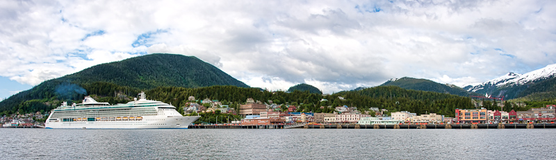
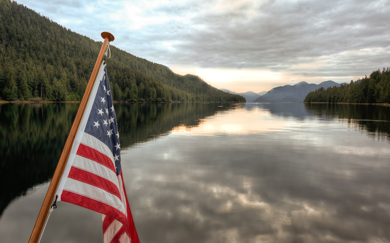
We were up early again to catch a favorable current to Butedale. It was overcast and not very nice out. Bob flaked the anchor chain as I brought it up, which seems to help avoid the anchor chain jams we’d had to wrestle with earlier in the trip. Preventive medicine works wonders!

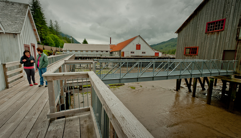
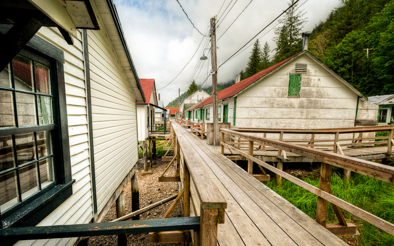
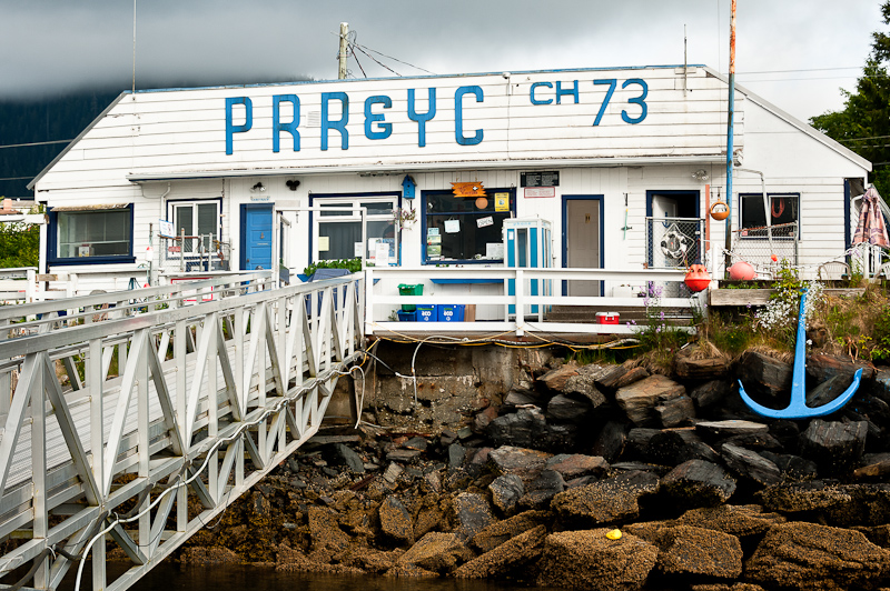
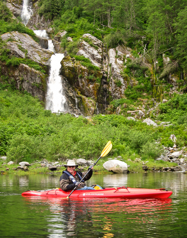
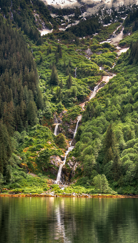
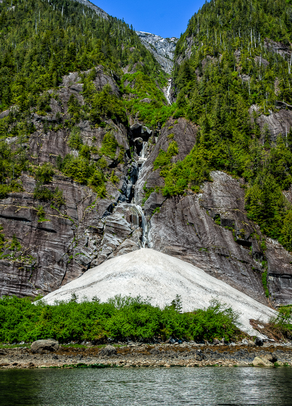
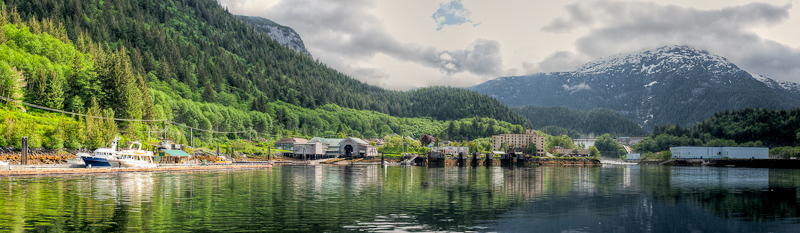
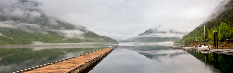
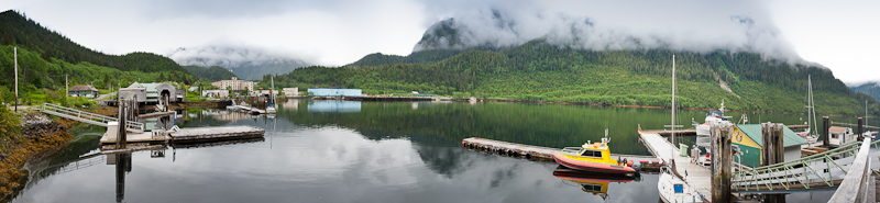
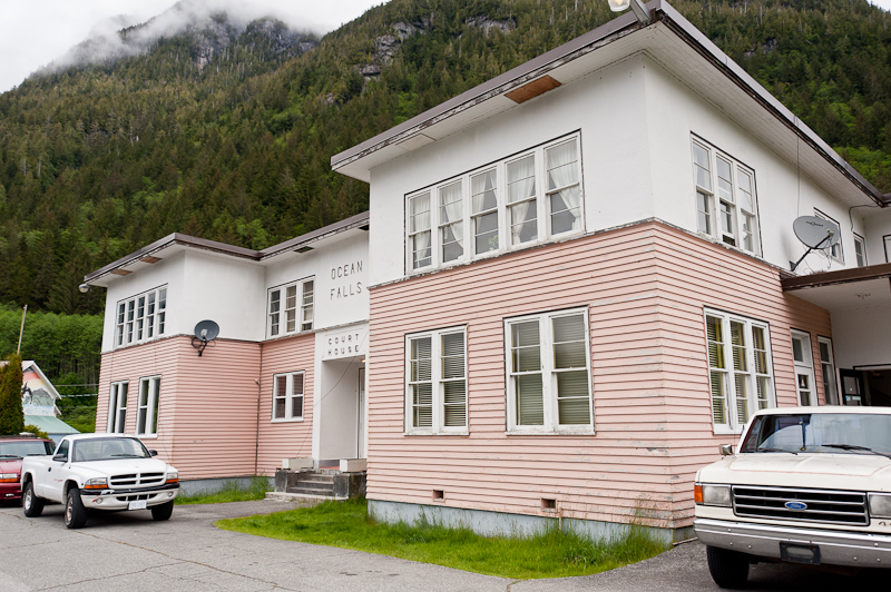
Our friends on Zucchini had told us it was worth stopping at Butedale, even though it is a falling down mess of old cannery ruins. It sounded interesting, and the caretaker was reputed to be friendly and inventive. So off we went. As we approached, you could see what used to be a thriving settlement and cannery. There is a lovely large waterfall, and then the main area with all the buildings. On first approach, it was tough to see where the right dock was, but it came clear when we saw the gangway to shore.

20110612Khutze Inlet to Hawk Bay-229_30_31_32_33-Edit

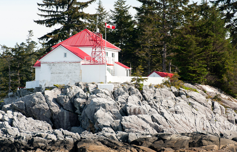
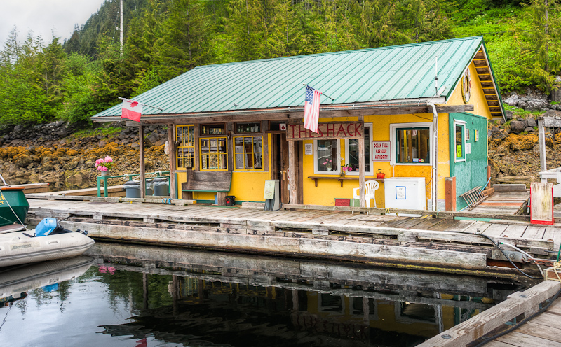
"Welcome" to Butedale

20110612karen upload thru 6_15_2011-28

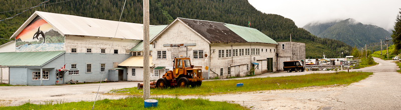
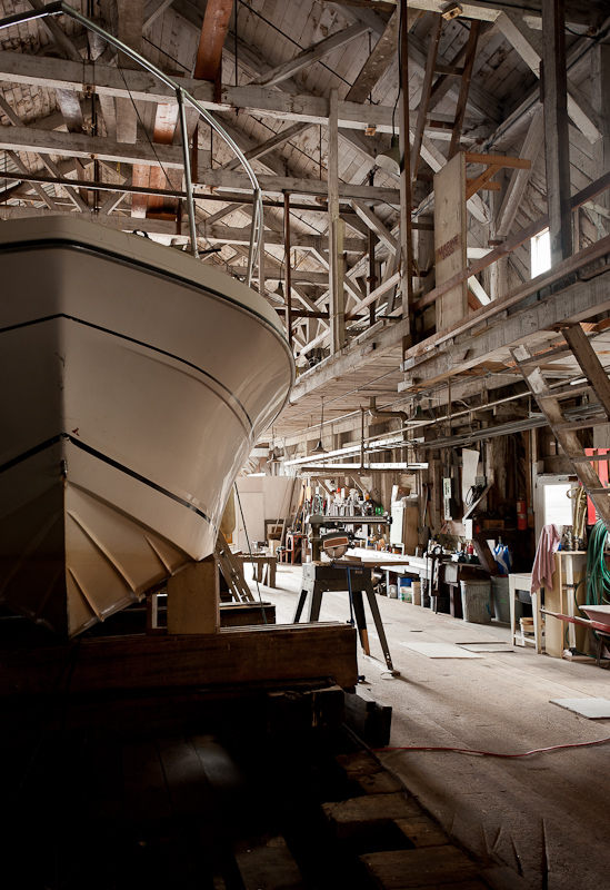
Butedale is a mixture of collapsed structures or soon to be collapsed structures

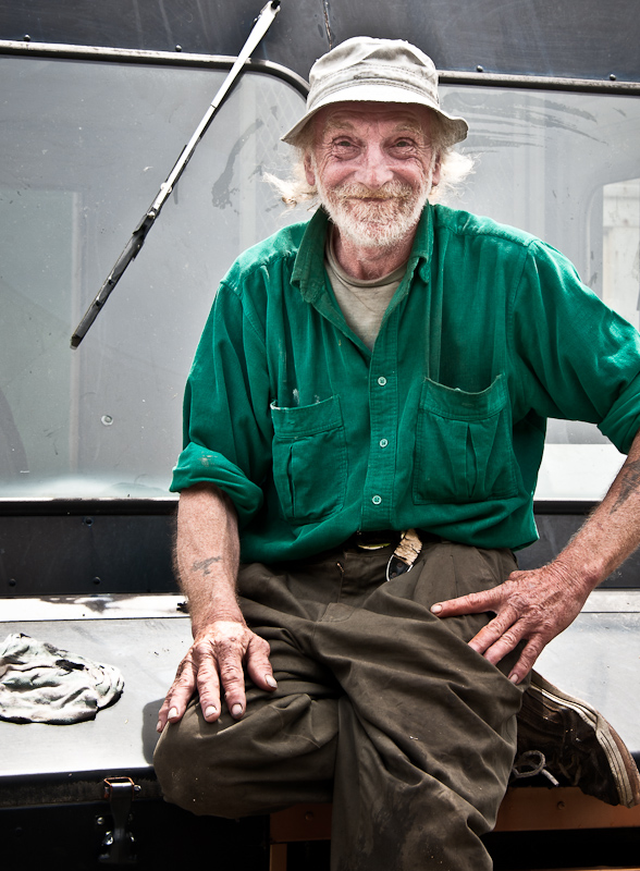
We were the only boat there, and as we were tying up to the docks which were sturdy but had no bull rails, just metal eye hooks. Cory the “new” caretaker came down to greet us. Cory is working as a caretaker with Lou, the longstanding Butedale caretaker, with hopes of taking over for Lou when we retires. Cory’s greeting party consisted of Burt the dog and Tiger the cat, a big orange male who was super friendly.

20110612Khutze Inlet to Hawk Bay-223_4_5

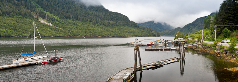
The dock is solid, despite your first impression. I've paid $1 a foot for a less sturdy tie

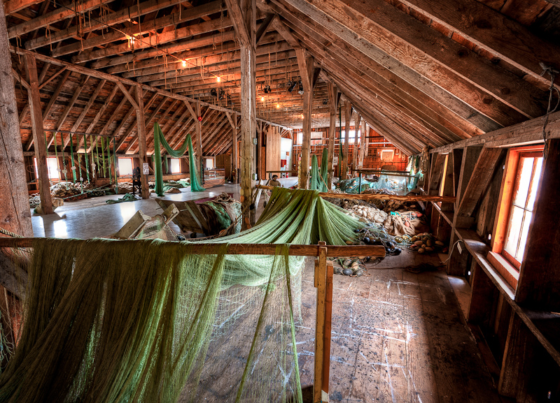
Cory took us on a great guided tour of Butedale – which was not only needed for the inside information about what we were looking at, but also to keep us safe. There is a lot of stuff that is falling down and not OSHA certified. “Enter at your own risk” signs made sense to me.

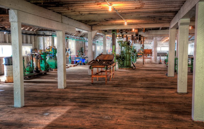
We saw the power plant, with the 2 turbines from 1939, and how they had it rigged to provide some electricity to the cookhouse where Cory and Lou live. We walked up to the “flume”, which Lou and a friend built several years ago when the old pipeline failed and water was needed to keep the power going. It is an engineering feat, that’s for sure. We then saw the two old houses that are rented out to the occasional kayaker or small boat captain, and the large warehouse that housed a makeshift bowling alley.

20110612Khutze Inlet to Hawk Bay-20-Edit

Cory leads the way into the power plant

20110612Khutze Inlet to Hawk Bay-50-Edit

The water from the lake arrives in the powerhouse and is controlled by this massive valve

20110612Khutze Inlet to Hawk Bay-45_6_7_8-Edit

All the force of the water now drives a small alternator

20110612Khutze Inlet to Hawk Bay-95_TWO

The handmade flume seems to spill more than it carries, but it works!

Butedale’s history was interesting, and it’s hard to believe that it was still running about 30-40 years ago. Time has certainly taken its toll. Lou and Cory do their best to hold back time, but they hope for a new owner (Butedale is for sale) to infuse the place with cash and dreams.

20110612Khutze Inlet to Hawk Bay-17_8_9-Edit

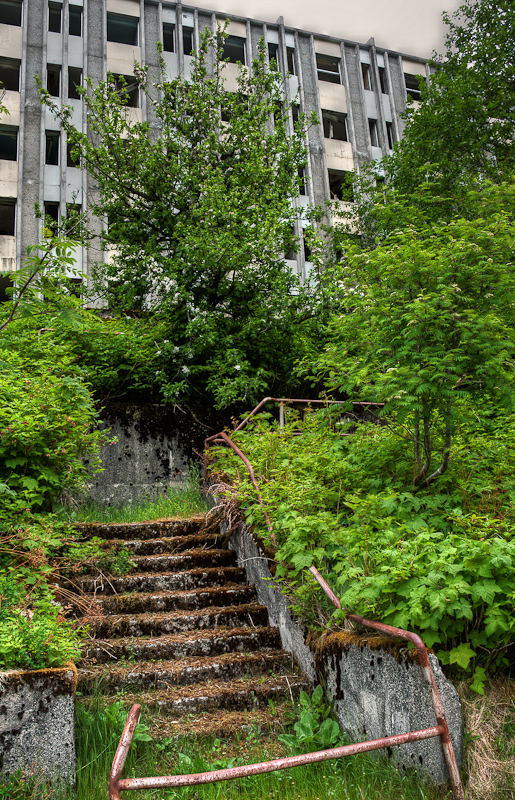
One of the many buildings whose fate is undeniable

20110612Khutze Inlet to Hawk Bay-188_89_90_91

We're standing at the end of the warehouse that abuts the shore. The open end is falling into the sea.

20110612Khutze Inlet to Hawk Bay-173_4_5_6-Edit

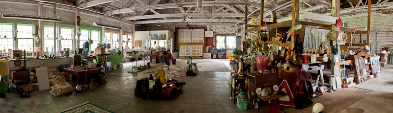
The makeshift bowling alley

20110612Khutze Inlet to Hawk Bay-148_49_50_51_52

“I know I put it here someplace in the warehouse”

20110612Khutze Inlet to Hawk Bay-202_3_4_5_6-Edit

Each day, a little more is reclaimed by Mother Nature

Cory ended the tour at the cookhouse. We met Lou, who was making and then enjoying his breakfast, and we saw lots of old pictures of Butedale before it started to decay. Apparently, when it was abandoned, the lights were left on, so it was a true ghost town. Cory said fishermen used to tie up and take showers because the boilers were left working as well – at least they worked for a while.

20110612Khutze Inlet to Hawk Bay-125_6_7

The cook house, home to Cory and Lou, keeps warm with 100 cords of wood a year

Lou is a character. He and Cory get their provisions from Kitimat, and they have a great story about losing the engine on Christmas Day on their way up Douglas Channel, and having to wait in 5’ seas for the Coast Guard auxiliary to rescue them, as the Coasties had to be roused from their Christmas plans to come to work!

Lou does some really cool carving art, and we bought a nice one of a killer whale. We enjoyed our time at Butedale, and think it’s definitely a worthwhile stop. Plus, it was good to stretch our legs, we were feeling a bit boat-bound!

20110612Khutze Inlet to Hawk Bay-239-Edit-Edit

Lou at work in his artists studio

20110612Khutze Inlet to Hawk Bay-252-Edit

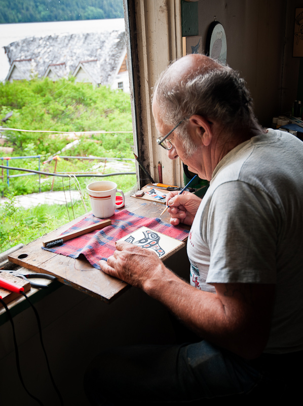
Lou is very skilled in his craft

20110612Khutze Inlet to Hawk Bay-208

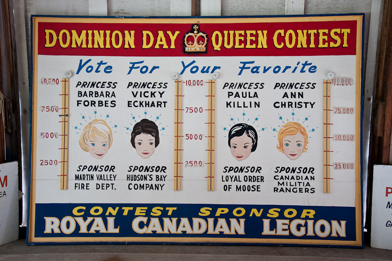
A photo of Butedale in its prime

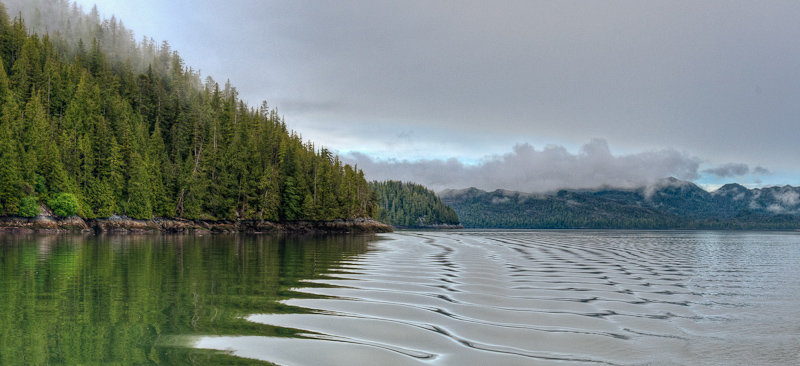
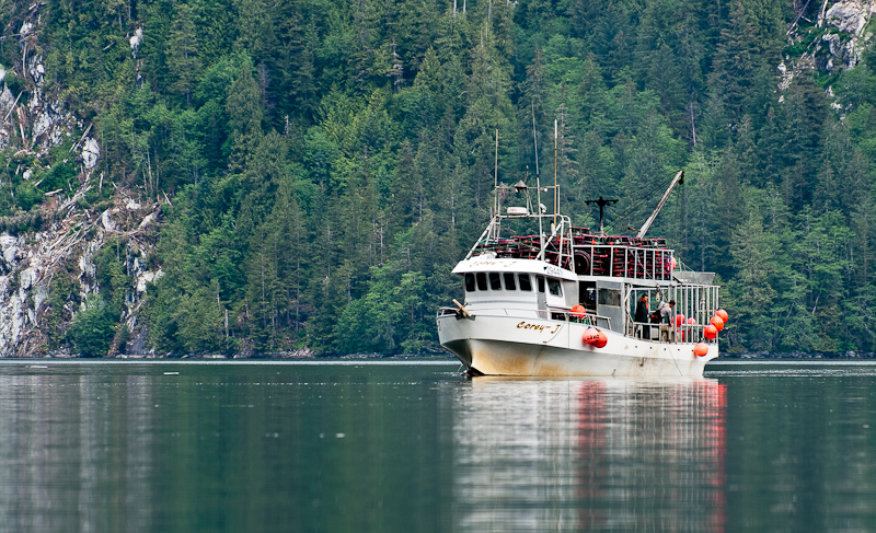
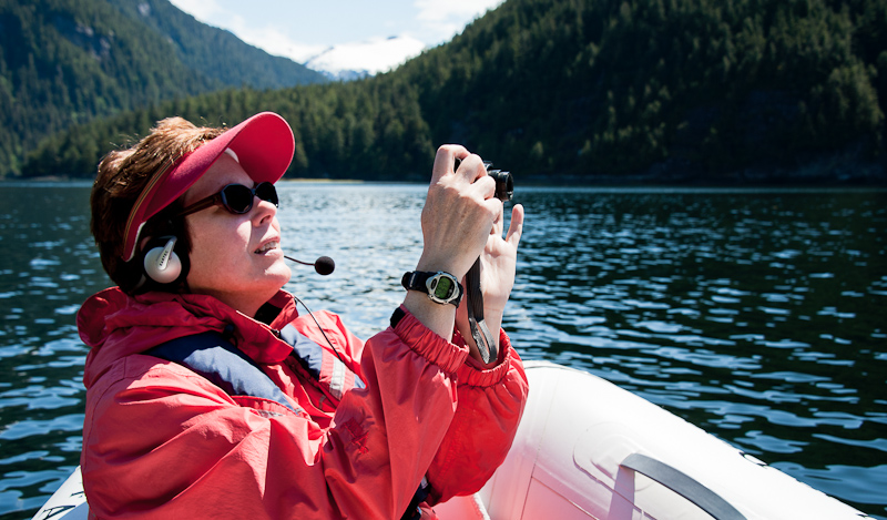
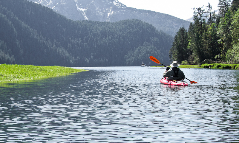
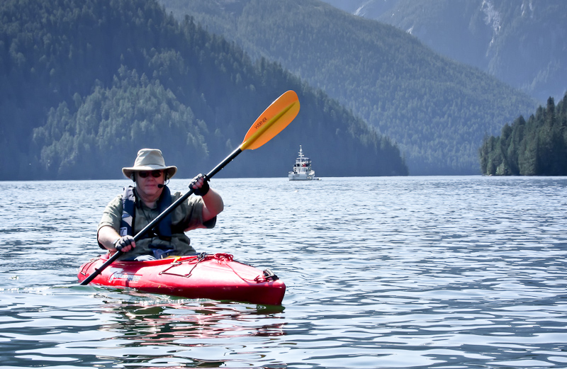
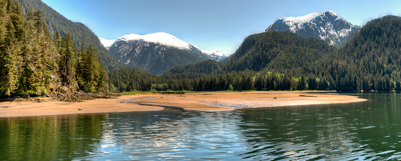
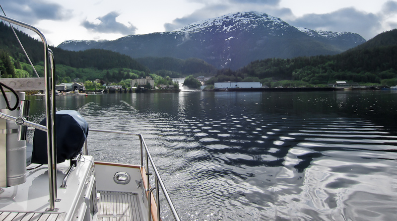
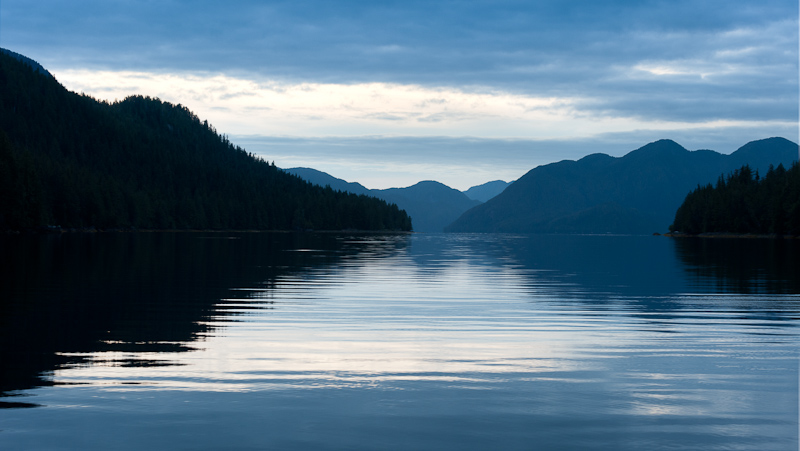
Back in the boat, we headed north. I worked on blog updates, while Bob helmed. After about an hour or so and following a great lunch of meatloaf sandwiches, we traded spots. Bob took a nap while I enjoyed helm duties on an overcast but calm day. Even Wright Sound was peaceful and flat as we made our way to Hawk Bay.  At one point, I saw a pleasure boat go by… it was the same boat from last night’s anchorage. I was pleased to see it heading at full tilt boogie to a different destination from ours, white wake flying from the boat as it went by.

20110612Khutze Inlet to Hawk Bay-271

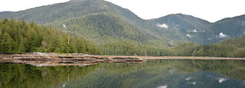
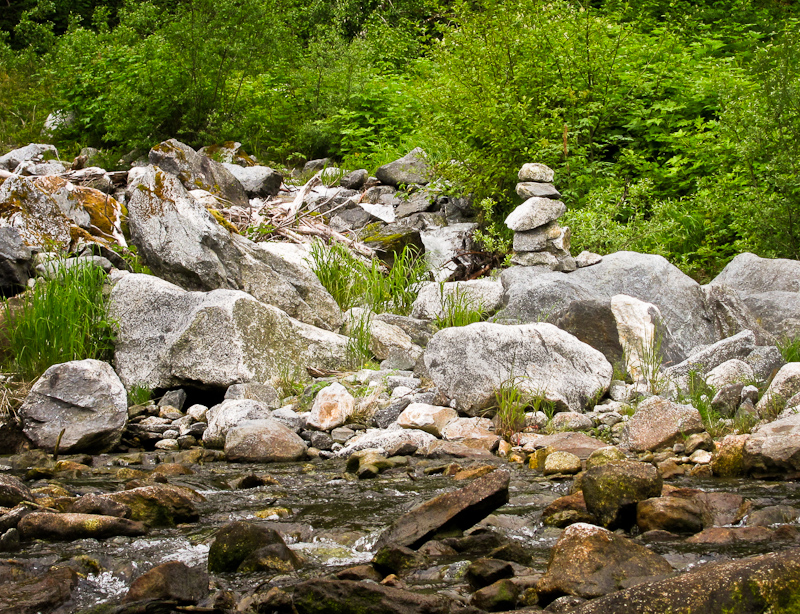
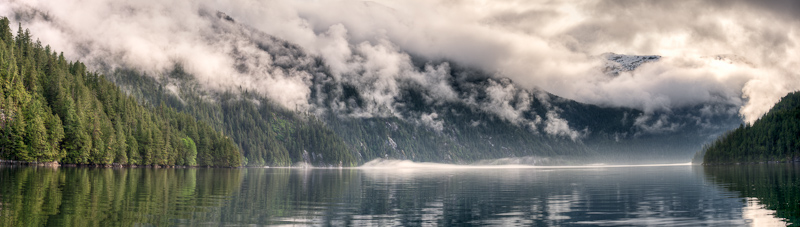
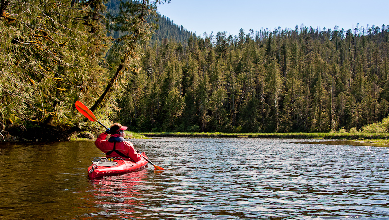
Just us and the grand Pacific Northwest

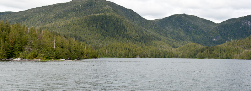
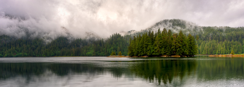
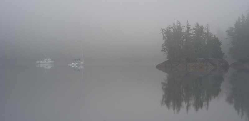
We knew Hawk Bay was just a place to sleep, and were not expecting much in the way of scenery. We were right. There was a bottom sampling barge in the bay, but it was otherwise empty and we dropped the hook and settled in about 5pm.

Dinner was curried chicken salad and Bob’s homemade drop biscuits, and an early night.


Khutze Inlet

Today was a planned lay day, and we wanted to kayak up the Khutze River as far as we could at high tide. Energized by coffee and bacon sandwiches, we headed out at 9:40am. We were out over two hours and had a great paddle. We went over the mudflats and into the river, which was fairly wide and full of current that made paddling feel a bit like we were in molasses instead of water. 20110611Khutze Inlet-19-Edit

This is why kayaking back home always seems to be something less majestic.

We saw some waterfalls, and seals, and lots of birds and waterfowl. No bear or bear prints in the mud that we could see, although you KNOW they were there somewhere. The valley is pretty and extensive. At one point, the river was almost blocked by fallen trees, but we got around those. Later, though, our path was blocked about a wide swath of boulders and rapids and shallow water.

20110611karen upload thru 6_15_2011-1-Edit

Karen puts Bob in the lead when there is an obstruction to navigate. Am I a trusted skilled kayaker, or sacrificial pawn?

We turned around and enjoyed the push of the river current as we made our way back. We detoured over by the large waterfall, and were tracked by curious seals. I saw an inuschuck someone made on a large rock near the base of the waterfall. It was lovely out, and we enjoyed the paddle.

20110611karen upload thru 6_15_2011-24-Edit

Some industrious individual built this inuschuck at the base of the waterfall

Before we got back to the boat, The Connor J came back into the anchorage and picked up his prawn pots. He made no wake. After we got back to the boat, it became colder and windier – the weather was changing again.

20110611Khutze Inlet-83-Edit

Prawn boat Connor J picks up his posts after a 24hr soak

20110611Khutze Inlet-124-Edit

This seal stayed close, but not too close. His was fascinated by us.

20110611Khutze Inlet-80_1_2

Karen poses in front of the waterfall

20110611karen upload thru 6_15_2011-20-Edit

Bob gets his turn at the “postcard” spot

We expected to spend the evening alone, but about 8pm a boat came FLYING into the anchorage at full tilt boogie. To protect the skipper’s identity, I will only say that the boat’s name had to do with fly fishing and it was from a ritzy suburb in Illinois. Despite the implied fishing ability and high income land-dwelling, this fellow had no common courtesy when it came to entering an anchorage. He waked us so badly that we had worse yawing and rolling motion than anything Cape Caution or Queens Sound had served up. We rolled hard for quite a while, as his wake kept bouncing off the walls of the anchorage. I was not a happy camper and mumbled nasties under my breath.

No sooner had he anchored off the waterfall (guess he had a GPS location , because he did absolutely no soundings or anchor circles before dropping the anchor at warp speed), the group started to fish off the back of the boat. He later went into full reverse at anchor to drop a few pots off the back of the boat before killing the engines and letting the anchor chain pull the boat forward away from the pots and the line. His radar was going – and going – and kept going all night long. Nice neighbors.

We enjoyed pork tenderloin with onion balsamic glaze for dinner and watched “Body of Lies”, which was truly a forgettable movie despite Leo de Caprio and Russell Crowe in the lead roles. Tomorrow’s destination? Butedale, and beyond!

Horsefly Cove (Green Inlet) to Khutze Inlet

We had another early call, as the tides and currents said that an early departure would make the best travel to Khutze. Unfortunately, an early call after last night’s anchor watch was a bit difficult! Still, we decided to get up and go.

We retrieved the stern tie with no problems, and headed out Tolmie Channel and Graham Reach for Khutze. The only problem was that riding the favorable currents meant that we’d arrive at Khutze at high tide. Khutze is another anchorage with mud flats and silt from the Khutze River and the waterfall, so it meant that finding the elusive anchor spot would be more challenging than at low tide.

As we headed north, we saw the old cannery ruins in Swanson Bay, but no one showed up on AIS. As we neared the entrance to Khutze Inlet, a small fishing dinghy came tearing out and made a line for us. He wanted to know if we’d seen a white prawn boat in the vicinity. Bob had noticed it behind us by a few miles, and he shared that with the dinghy driver, who sped off to the south. As we entered Khutze, it started to clear some. We passed Green Spit anchorage, which to us seemed kind of ho-hum, unless you just needed a place right off the major pass to lay down the hook. We continued to the head, encountering dissipating fog.

Horsefly Cove to Khutze Inlet-68_69_70_71-Edit

Fog was giving way as we enter Khutze

The head of Khutze is lovely, with a very large green valley sandwiched between mountains. There is a very pretty waterfall on the right (as you face the head) and the Khutze River empties to the left. Finding the anchor spot was a challenge….it was quite deep, and then the mudflats came up sharply. Bob’s diligent plotting coupled with my adding marks to the electronic charts with depths helped us see the spot. We dropped 300’ in 100’ of water and set the hook well. Based on our calculations, we would never swing into water less than 40’ deep.

Bob took a short nap to fight off the ills of the previous night’s anchor watch, while I read all day.  It was cool out, but not windy, and there were lots of seals and gulls to watch, along with an occasional eagle. As the tide went out, the picture was so very different. You could clearly see the mudflats as well as the uncharted silt spits emanating from the Khutze River and also over by the waterfall. At anchor, we were often dive-bombed by swallows – three of them kept coming over to the boat and trying to fly in the windows. We had to close them to keep the darned things out. And we were once again visited by a hummingbird, though the closed windows also kept him from coming inside to say hello.

Horsefly Cove to Khutze Inlet-161_2_3_4_5

Anchored opposite this tall waterfall made for a pleasing sound all the while we were in Khutze

Later that afternoon, the white prawn boat (accompanied by the same dinghy we had seen that morning) came into the anchorage. Her name was The Connor J, from Nan., BC (Nanaimo?). She set a long string of prawn pots abeam us, and it was fun to watch the process.  That was probably the activity highlight of the day!

Dinner was salmon gorgonzola with fusilli and a few lemon cookies and two more extremely good episodes of The Good Wife, and then bed.  A peaceful night in a glorious spot.


Windy Bay to Horsefly Cove (Green Inlet)

As suspected, we awoke to light rain. It always seems to rain when I have to haul anchor! For the first time in a long time, we saw some targets on the AIS, tugs headed both north and south in Tolmie Channel. So there is boat traffic up here somewhere, hmm?

We had an uneventful trip through Hiekish Narrows, which was no big deal and easy to navigate.

Shortly afterwards, we turned into Green Inlet and headed in .6 miles to Horsefly Cove. The buzz on this anchorage was mixed, with some saying it was too deep and small to anchor comfortably without a stern tie. We decided to check it out for ourselves.

It’s a nice intimate spot, where you look back out at Green Inlet between a few islets. As we measured depths in our potential anchor spots and searched for the optimal place to drop the hook, we saw two gray wolves swim from one of the islets to the main body of land. We clearly surprised them – they froze when they saw us, and we watched each other for a long while. They eventually disappeared into the woods, never to reappear.

Windy Bay to Horsefly Cove-13_4_5_6-Edit-Edit

The view from Horsefly Cove

Finding that anchor spot was a challenge. It is deep, about 100 feet, and it’s not easy to back down enough to set the anchor without running into the shore. So we decided to stern tie, and thus the stern tie dance began. We actually set the anchor in about 70 feet, dropped 150’ of chain, and got close enough to do the stern tie without too many problems (and without having to leave the dinghy – no mountain goating for me this time). It was chilly and damp, and we were happy to get the boat secured. Not long after we were done, a sailing vessel exited the Inlet. We do not know where it had anchored, but it was clearly further down the inlet towards the rapids and lagoon.

Windy Bay to Horsefly Cove-4-Edit-3

I always wonder what forces placed this log here, standing at attention.

I wanted to dinghy down to see the rapids when they were flowing, despite the rain and wind, so I convinced Bob to take the excursion. It was a cold ride, and our eyes were definitely watering as we headed to the rapids. They were running hard, you could see all the boulders and from our perspective, it looked like a 2-3’ drop from the lagoon down to the inlet. These rapids are marked in the books as “unnavigable” – hard to say, but maybe you could portage the kayaks over the rocks off to the side and then paddle inside the lagoon? Too cold and wet to give it much thought.

20110609REM G2 uload thru 6_15_2011-15

The “entrance” to the lagoon is certainly imposing

On our way back, we stopped briefly at the small beach and creek across from Horsefly Cove, enjoying the sight of old pilings at low tide. We were happy to get back to the boat and warm up. As we were heading back to the boat, we did see one pleasure boat heading down the major channel outside of Green Inlet. It was the 2nd pleasure boat we’d seen in days.

Aboard, we decided to watch “Black Swan”, which was well acted but definitely creepy. Bob made meatloaf and we enjoyed it with mashed potato casserole. The Sat TV worked again to bring us the  Comedy Channel, which is how we get our news. Apparently the Weiner scandal will NOT go away.

As we went to bed, we heard loud scraping noises, which had us jumping up to see what was going on . The shift in the wind and current had moved us so that the anchor chain scraped rocks on the bottom. All looked good, so we went to sleep about 11:00.

The anchor alarm sounded about 12:30 am. Frankly, it’s most often a GPS anomaly, so I let Bob handle it. When he did not come back to bed right away, and I saw flashlight glare outside the cabin window, it was clear that I needed to get up as well.

The anchor alarm was just an anomaly. But the current had changed, and there was a tremendous amount of pressure on our stern line, and we had swung quite far to starboard, putting us closer to shore than we liked. Pulling up some anchor chain wasn’t  helpful, as the stern tie was so tight. It took a lot of elbow grease to loosen that tie enough to let the boat swing to a better spot. About an hour later, the current died down and the boat went back to its preferred lie, but we were both uncertain about how the rest of the night would go. So Bob slept on the couch in the saloon with the anchor circle image on our computer angled so he could see it. I think I got back to sleep about 3am. Oh yes…and it was raining.

Culpepper Lagoon

I had planned for us to spend 2 nights in Culpepper Lagoon, and I was glad of it. The morning was sunny and calm, without those crazy winds of yesterday.  We were certainly slow to get going. I wanted to take the dinghy back to the narrows and go out again at low tide, to check out the head of Kynoch Inlet from the vantage point of the dinghy, and just tool around a bit. Brian had told us that he finds slack to be about an hour after Tom Bay, rather than 15-30 minutes before Bella Bella, which the guidebooks suggest. So we wanted to check out how close the Tom Bay calculations matched the actual conditions at the narrows.

20110606Culpepper Lagoon-82_3_4-Edit

Snow Ice still sits at the foot of this waterfall at the head of Kynoch Inlet. Even more amazing since it faces south.

The fact that we were so slow to get going was a bit of a problem, because by the time we got in the dinghy it was howling wind again and there were whitecaps in the Lagoon. It was going to be a wet ride up to the narrows! But, the narrows were nicely slack at about 1 hour after low tide at Tom Bay, so we now will use Brian’s method of calculating slack at Culpepper.

20110607Culpepper Lagoon-94-Edit

Karen capturing more memories during out dinghy ride

We exited the lagoon, tooled around the head of the inlet near the mudflats, and then headed over to Riot Creek (back inside the Lagoon) where an old cabin used to be located. There were no signs left of the cabin, but the creek was beautiful and the current was riotous. It hit the water of the lagoon and made some choppy waves, but as soon as we headed back to the boat, there was no more wind and chop. We passed by ‘seal rock’ and saw the seals basking in the sun again.

20110607Culpepper Lagoon-200_1_2_3-Edit

Riot Creek earned its name

20110607Culpepper Lagoon-218-Edit

Rock + Sun = Seal haul out

We agreed that we needed to go kayaking when the tide was nearing the high, so that we could go across the mudflats and up Lard Creek as far as possible. There was time to kill, so Bob worked on pictures while I sat upstairs and read. Apparently the hummingbird from yesterday came back into the boat through an open window, and Bob had to don his oven mitts and rescue it again, freeing it from captivity inside of Alaskan Dream. It must be attracted to the red kayaks.

We were anxious to kayak, so we left a bit early, say at mid-tide, rather than nearly high tide. We crossed the mudflats with no issue and soon were paddling up the creek with the stony bottom clearly visible in the clear water. We went a good ways up, and had to battle the creek’s current. We were finally blocked from proceeding further by rapids over a downed tree. We needed at least another foot of water to move ahead, and so we turned around.

20110607Culpepper Lagoon Paddle-19-Edit

Warm sun, clear river, snow capped mountains in the background. Pretty great!

The ride out was great, due to the favorable current at our backs. We saw bear prints in the muddy banks of the river, but none of the animals themselves. The creek banks were full of lavender fireweed, and we enjoyed some photo ops in the sun.

IMG_0602-Edit

We think the name of the purple flowers in the background is lavender fireweed.

IMG_0606

Paddling back to Alaskan Dream

IMG_0612-Edit-Edit

It's a short sleeved day. A first for this trip!

As we headed back to the boat, a Sailboat appeared and the wind started to pick up. The sailboat was apparently single-handed by a man – he set his anchor twice, was satisfied the 2nd time, dropped his kayak overboard and immediately went for a long paddle. The name of his boat was Imagine.

We had my favorite meal – Bob’s meatloaf – with drop biscuits and mashed sweet potatoes for dinner. We turned in early, because we had an early departure (6:30am) to catch high slack at the narrows to exit the lagoon.

James Bay to Culpepper Lagoon

We were up early again, so that we could catch low slack at Culpepper Lagoon (10ish). We decided to have breakfast enroute. As Bob was cooking and I was helming, I suddenly saw the Mother Goose fleet on AIS, about 5 miles ahead of us. We had suspected we would run into them as they departed Culpepper, but they were already out of Kynoch Inlet and headed up to Mathieson Narrows.

Bob hailed Brian on Deception and we got the skinny on good anchor spots and were also told that the Lagoon was devoid of boats at the time. That sounded good to us. As we headed up Kynoch Inlet, we saw lots of waterfalls and high mountains with snowy peaks along the way. It was really breathtaking. When we reached the head of the Inlet, we took a look at the Narrows and could easily tell from the white water flowing out that we were early.

James Bay to Cu;pepper Lagoon-79_80_81

Culpepper Lagoon rapids still running strong

We kind of figured that, because we were about an hour ahead of our calculated slack. So we enjoyed the scenery at the very attractive valley (with mudflats) at the head of Kynoch and patiently waited for slack. Bob maneuvered the boat in all directions, watching the birdlife on the flats and the seals, while I read a while. About 10:45 the narrows looked pretty good, and that was after when the guidebooks said slack would occur, so we decided to go for it.

Entering Culpepper Lagoon from Robert Minkus on Vimeo.

That entrance sure looks rocky and narrow at low water. As we got into the approach, we found 4kts of adverse current in the narrowest part, and Bob had to add power to the engines to keep good forward speed.We saw 12.7’ of water on a 2 foot low tide at Bella Bella. That was plenty of water for us, but definitely had our attention.

Once through, we toured the lagoon, passing a rock full of seals basking in the sun. We then got to the head, and were thankful we had arrived at low tide. You could see the mudflats, which was helpful, but it was still time consuming to find the right spot to anchor. We made a very careful set of anchor circles, marking the depth along the way, to make sure we could anchor safely and let out enough scope to ride any winds without swinging onto the flats. The anchor dance took about an hour. Once we set the anchor…the peaceful lagoon became a wind tunnel. Bob took a nap, and I sat glued to the computer image of the anchor “circle”, making sure we were really holding and not dragging toward those flats. Despite the wind, we held firm, and we had a relaxing afternoon. A hummingbird decided to come aboard, and Bob had to put on the oven mitts and gently capture it in his hands, then toss it out the window to free it from confinement in the boat.

The visual picture of the anchorage was totally different by high tide. All the mud flats were completely covered over and it seemed like we were anchored so far out from the grassy shore! We were again so glad we had come at low tide our first time into the lagoon. We remained all alone, though we did see a small boat come in, set a few prawn pots, and then leave again.

James Bay to Cu;pepper Lagoon-336_7_8-Edit_FLOOD2

The view at high tide

James Bay to Cu;pepper Lagoon-336_7_8-Edit_EBB2

The same view at low tide with the mud flats revealed (when we anchored)

Dinner was excellent grilled salmon with orange marmalade glaze, jasmine rice with craisins and pine nuts, and Bob’s homemade drop biscuits. YUM! About 9pm, the winds finally died down. We watched the movie “The Fighter” (we both didn’t like it) and hit the sack about 11pm.

James Bay to Cu;pepper Lagoon-359

The wild salmon you find out here is nothing like what you get anywhere else, even if you purchase it in a grocery store as I did.

Discovery Cove to James Bay

We heard the “fishing camp” depart at 5:30am this morning. We arose at 6:45am to fog. The weather forecast was still icky through Thursday, although Bob was still having difficulty “seeing” the weather maker on the Garmin. I worried a bit that we needed to get through Millbank Sound and Ivory Island now, rather than waiting for winds to pick up. So we left without breakfast (or showers!) at 7:30. We move pretty fast when we make a decision!It was very foggy. I went up on the flybridge to set up the automatic fog horn, but could not seem to get it to deploy more than once. While I heard it on the flybridge, Bob heard nothing inside the boat. We figured it required further programming, so we decided to ignore it for now.

Discovery Cove to James Bay-83

Our neighbors in the next cove were still resting when we departed

The fog lifted after about an hour, and it turned into a pretty day sky-wise. Our ride was absolutely great in Seaforth Channel, though it got a bit more rolly as we approached Millbank Sound, with some “hobby horse” swells but nothing particularly problematic. We could see the Ivory Island Lighthouse Complex from a long distance away – those white buildings with red roofs really “stick out” against the sea and trees and sky. It was really pretty. During this entire ride, we saw no other pleasure boats.

Discovery Cove to James Bay-158_59_60

The fog lifts revealing a gorgeous day

Discovery Cove to James Bay-166

Ivory Island Lighthouse, a well equipped compound

Discovery Cove to James Bay-173-Edit

If you want to be a light keeper, this might be the place to pursue your dreams

As we neared Ivory Island, Bob took a lot of pictures while I kept at the helm, following the course plotted by Bob. I kept looking for the red buoy in Reid Passage and never saw it, but I figured we just hadn’t gotten there yet. Our ride was good, and all of a sudden I saw we were approaching Perceval Narrows. How could that happen? Where was Reid Passage? Was I asleep at the wheel?

No, Bob had simply plotted a different course than I had told him to, which went around Ivory Island. We had a great ride, and we didn’t need Reid Passage’s calm water route anyway, so it all was good.  Perceval Narrows we had timed for slack, and it was. Quite pretty in and around that area, and we saw a prawner, so we weren’t totally alone.

As we came out into Mathieson Channel, it was really sunny and the scenery was gorgeous.  As pilots, we called it CAVU (Clear above, visibility unlimited). Our destination was Rescue Bay, and as we neared it we saw a humpback whale. In fact, it surprised us, as we saw the blow just off the bow of the boat. We slowed immediately and it fluked right in front of us. Bob had his camera out, but it was on a bum setting, and so the great shots of the whale tail that filled the frame are out of focus. We hung around a while, trying to see if we’d get any more great shots, and grabbed a few that were OK but not as good as that first fluke. I was also able to confirm that whale breath is quite stinky.

Discovery Cove to James Bay-116

Here you see the reason they are called humpback whales

Discovery Cove to James Bay-146-Edit-Edit

A fluke and he's gone

We headed over to Rescue Bay and …wow…what a disappointment. It is large and apparently well protected, but scenic it was not. We looked at each other, looked at the tides and currents, and decided to make a run up-channel to Culpepper Lagoon in Kynoch Inlet.

After about 30 minutes, it became clear the adverse current was going to impede our ability to arrive at the narrows at the necessary slack current for entry. So we decided to give James Bay a shot. It’s not one of those anchorages that anyone really talks about, making it a well-kept secret!

It’s a long bay surrounded by mountains, some snow-capped. There was some logging that had recently occurred along with some log holding pens that were empty, but our anchor spot took that pretty much out of play. James Bay has extensive mud flats at the head, and it took us quite a while to find the right spot that wasn’t too deep (though it was nearly 90 feet) and yet allowed us to set enough scope to be safe yet stay off the flats.

It was a glorious day, and we decided to go kayaking. The charts showed a small river on the other side of the flats, and we’re always game to explore. We didn’t quite make the desired timing of entering on the last of the rising tide, but we did get out about high tide. We were met by a phalanx of seals, there were like 10-12 of them in the water, playing and spying on us as we glided by. It was lovely.

The best part was the river itself. Narrowish, green grass on both sides, and just fun to explore. We went as far as we could, until our paddles started hitting bottom with every stoke…and knowing the tide was already going out on the mudflats, we decided the better part of valor was to turn around. I could have paddled there all day and definitely want to go back!

Discovery Cove to James Bay-114-Edit-Edit

The James River proved to be a great paddle


Discovery Cove to James Bay-90-Edit

The river keeps going


IMG_0549-Edit

Shortly we had to turn back. Next time we'll go for a higher tide so we can go farther upstream

IMG_0561-Edit

The tannin color of the water shows clearly. However, it is safe to drink and tastes fine.

It was a long haul back to the boat due to wind in our faces. I thought, at one point in the trip, it would take me about 40 paddle strokes to get back to the boat. It took 175. These distances are really deceiving!

We had a nice evening, and we really liked this anchorage. The views were great in all directions, and the paddling was an unexpected bonus.

Clatse Bay, Roscoe Inlet to Discovery Cove

We arose to grayish skies and did not have the desire to explore all of Roscoe, as many of the towering mountains were covered by low clouds. So we decided to amend the float plan again and head for Discovery Cove on Cunningham Island. It was written up as being very well protected (important in the event those winds materialize), and required us to go through Troup Narrows to get there.

Clatse Bay to Discovery Cove-42_3_4-Edit-Edit

Farewell to Clatse Bay

Clatse Bay to Discovery Cove-64

Seals were the highlight of our trip today. No man nor other beast was spotted.

But first, I convinced Bob to head up Roscoe just to the next bay and give me a peek “up the narrows” to see what could be seen. I think the lack of sunshine made the trip lack excitement, and when we reached Boukind Bay, we were not terribly impressed, and turned around, ready to head to new pastures (or anchorages).

Troup Narrows was fun…it is well charted and has decent landmarks. More than that, it’s narrow and pretty! Our only company was a small fishing boat that had been present in Clatse Bay earlier in the morning, zooming to shore, and then zooming off. We haven’t seen another pleasure boat since we passed “Mr Butts Too” (quite a name!) as they exited Gunboat Passage yesterday.

As we approached the entrance to Discovery Cove, I spied two dinghies, which immediately told us we would be sharing this anchorage. Two boats were in the northern nook, so we took the one further west, and it was just right for us. It’s cozier in person than it looks on the chart, and certainly well protected from wind. We launched the dinghy and went tooling about, saying hi to the 2 boats in the other nook (Soleil and Luminosa, both from Washington State and owners of the 2 dinghies we had seen earlier) and generally checking out the cove. It turned into a nice afternoon, and the sun was out. We saw several good bear beaches, but no bears.

As Bob was cooking dinner, he looked up about 7:00pm and all of a sudden a zillion boats came into our anchorage. They didn’t come into the nook, but anchored further out. It was a floating fish lodge from Craig, AK. We suspect they were moving the operation north, and needed a place to tuck in for the night. There was the Mother Ship, called Northern Legacy, a fairly sizable sportfishing boat, a smaller sportfishing boat, and 3 more small fishing boats. All were in color coordinated paint schemes, white with teal stripes. All had “Alaskan” names like Grubstake and Golddigger and Whiskey Punk. Some anchored out and some rafted to each other. As soon as all were secure, the big tender from the Mothership came to bring them over to dinner (and, we suspect, to sleep).

Clatse Bay to Discovery Cove-59

En route, the “fishing fleet” gets a quite night in Discovery Cove

That was the big excitement for the day, and one episode of The Good Wife later, we called it a night. It was dead calm, no winds. Where are these gales? Out in the ocean, I expect. Certainly not here with us.

Ocean Falls to Clatse Bay, Roscoe Inlet

I have been excited about visiting Roscoe Inlet, and several cruisers we met told us it’s really pretty all the way up to the head (21 miles). I had planned for us to go to the southernmost bay, Clatse, and then decided what to do from there.

)cean Falls-201_2_3-Edit

So long Ocean Falls

IMG_0545

Another view of the town, the falls and the new fish hatchery (blue building on right)

We said goodbye to Blue C’s and headed out about 9:30. It was sunny in Ocean Falls, but that changed pretty much by the time we turned down Cousins Inlet…back to gray skies. We traced our steps back to the end of Gunboat Passage and turned up Johnson Channel, where it was calm and nice. Bob returned Brian Pemberton’s call on the Sat Phone and found out they were only about 6 miles behind us, at Shearwater. I was at the helm while Bob did a variety of boat duties. I pretty much helmed until we approached Clatse Bay.

Ocean Falls to Clatse Bay-27_28_29_30_31

The weather keeps astounding us with it s good graces

Clatse is a big and open bay, with a grassy meadow at the head. It’s fairly deep, but we got the anchor to set with no issues. However, the wind was blowing down the bay, creating a bit of fetch that slopped our boat around. We were feeling rather lacking in energy, and it was windy and cold outside, so we both ended up taking a 90 minute nap!

After about 6:30 or so, the wind died down and it became a calm and still evening. Bob made curry burgers with gorgonzola and rosemary garlic pan-baked potatoes. Coupled with some good wine and 2 episodes of The Good Wife; it was a great night. However, the weather forecast was calling for gale force Northwest winds for days…and we wondered if that might affect our plans.

Ocean Falls to Clatse Bay-32_3_4_5-Edit

Looks like it is going to be a peaceful night 

Ocean Falls

Our plan for the day was to take a walk around town before heading on. Ocean Falls is an interesting place; it’s really a ghost town. In its heyday, it was a Crown Zellerbach paper plant town, complete with hotel and cafes and high school, hospital and Olympic size swimming pool and fire station and houses. Now it’s mostly falling down, as Crown Zellerback departed in 1980 or so, and only a few hardy souls hang on. The owner of the dam/power company just sold it to a Quebec company, and was doing re-facing work on the dam, so we wanted to see that as well.

)cean Falls-7-Edit-Edit

Morning brings some fog, which quickly lifts

)cean Falls-51_2_3

“The Shack” at Ocean Falls

)cean Falls-62-Edit-Edit

Docks on the right, Ocean Falls on the left

)cean Falls-83-Edit

View back to the docks from the road to town

)cean Falls-187_8_9-Edit

The Mermaid of Ocean Falls

I was over doing some more recycling when the folks from Zucchini asked me aboard to chat about destinations and whatnot. Bob found me there about a half hour later. We chatted in their comfy pilot house and got some ideas about more places to go, and we recommended Elcho Harbour to them. They were waiting for Herb Carpenter, the Harbourmaster and owner of the Marine Ways, to come by to say hi. We were still aboard when he arrived, so we were able to spend some quality time with Herb. He is amazing – great sense of humor, incredible stories to tell (the bear and Cosmo Mike was my favorite) – we had a blast. He is originally from Kodiak, AK, but now makes his home in Ocean Falls. He bought the Marine Ways and has rebuilt it, and his wife Lena has a small gift shop there as well. Lena was not around, but Herb opened the shop for Diane and I to peruse. Lena has great artistic talent, most of the things for sale are items she made, knitted and/or painted. After spending some money, all four of us (the Zucchini team was there with us!) got a room by room tour of the Marine Ways. I think Herb said it was 20,000 square feet. One room after another had treasures to see – boats, engines, woodworking shop, apartments, and even Herb’s version of a “Man Cave”, which is a great room with a kitchen and a screened in porch overlooking the harbor where he entertains his buddies on Wednesdays.

)cean Falls-166-Edit-Edit

The gift shop is located under the Orca

)cean Falls-77

Inside one of the marine ways

On the 2nd floor is the “museum” that houses all the stuff from Ocean Falls that Norman Brown (a.k.a. Barely Normal Norman, a nickname I think is proud of) has found in the years he has lived there. It seems as if the prior residents left tons of stuff behind when the town was deserted. There are old signs and dinnerware, and a totally cool 1940’s egg boiler and timer that still works, as well as old bowling pins, jewelry, toys…you name it. A lot of fun to look at, all lovingly found and catalogued by Norman.

)cean Falls-95-Edit

Memorabilia abounds in the “museum”

)cean Falls-92

I wonder who the winner was

)cean Falls-89

Ocean Falls produced world class swimmers that competed internationally

)cean Falls-101

Nearly Normal Norman, recorded in a photo in his “museum”

)cean Falls-174-Edit

Norman today

Team Zucchini headed back to their boat, and we decided to walk up to the dam and Link Lake above it. The views are amazing of the dam and the water pouring over from Link Lake. The lake itself is massive, and we only saw a small portion of it. On our way back we walked past the old Garden apartments that are totally unsafe, the old Co-op, the old hotel, the old high school, the church (it’s in better shape), and a lodge that is where the dam repair crew is being housed. Under the growth, you can see the entire infrastructure that exists in this town, from curbs to sewers. You can almost hear the voices and bustle of the town in its heyday. Right now, you need a lot of imagination.

)cean Falls-107

The court house is the center of attention in the town

)cean Falls-108_9-Edit

Mother Nature is quickly reclaiming the unused structures of Ocean Falls

)cean Falls-131_2_3-Edit

The once proud Ocean Falls Firehouse

)cean Falls-117_pano collage-Edit

The dam is the reason Ocean Falls exists. Hydro-electric power is sent to Bella Bella and Shearwater

)cean Falls-144_5_6-Edit

Built in the early 1900's, the dam is an impressive sight

When we got back to the boat about 1:30, a large blue-hulled motor vessel was at the docks where Zucchini had been. It was the 57’ Blue C’s, and I recognized this boat from last year in Alaska, when we were anchored in Takatz Harbor. We introduced ourselves to Carl and Carol (the “C’s in Blue C’s), and had a great chat. They shared some route plans with us, and we sat in their pilothouse for a while and chatted, and Bob got a tour of the engine room. By the time we left so they could walk the town, it was 3:45pm and we decided to stay another night!

Bob made halibut tacos and we watched another round of his favorite Comedy Channel shows and did a load of laundry. Another peaceful night.

 )cean Falls-190-Edit

It's halibut taco night!