Windfall Harbor to Tracy Arm Cove

We woke to a dreary forecast and decided we’d rather face the weather underway than sit through another soggy lay day. With southeast winds and seas predicted under two feet in Stephens Passage, we aimed for Tracy Arm Cove—our jumping-off point to see the glaciers.

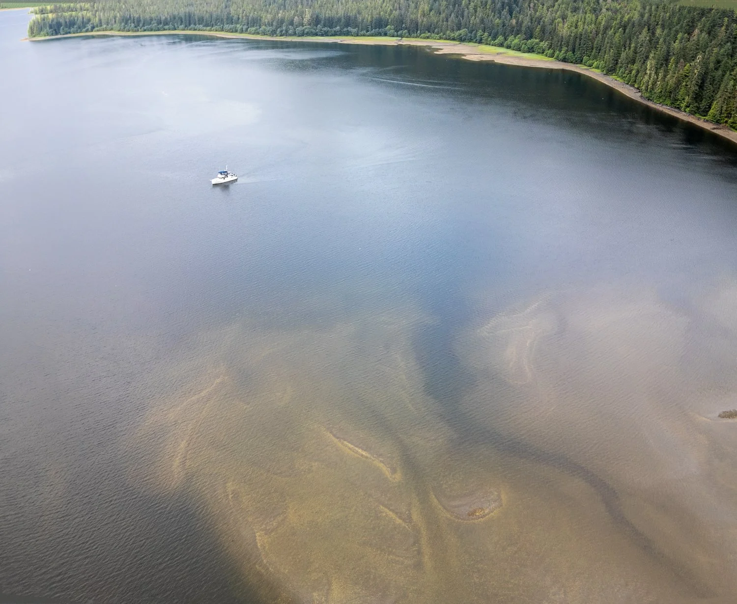
The most fog we have seen so far

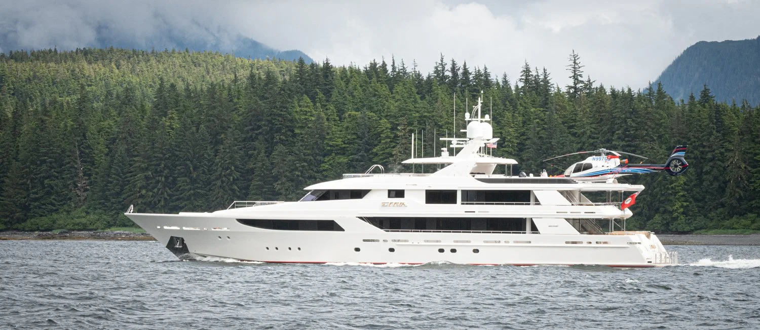
M/v evviva, a 163 foot westport with helicopter, passed us as we departed windfall harbor

Seymour Canal gave us a proper Alaskan sendoff: 25–30 knot headwinds and a current running with the wind made for a choppy ride and the occasional blast of green water over the windshield. Not terrible, but definitely not dry.

As we rounded Point Hugh, the ride turned sporty. Swells hit us broadside, and OceanFlyer gave us a lean that felt like 45 degrees (though we know it wasn’t quite that dramatic). Still, anything not battened down went flying.

Despite the conditions, Point Hugh delivered what we came for— whales. A humpback mother and calf surfaced right across our bow, forcing a brief pause. Later, an orca breached nearby, and the pod cruised by. No photos this time — too wet, too rolly — but the memory sticks.

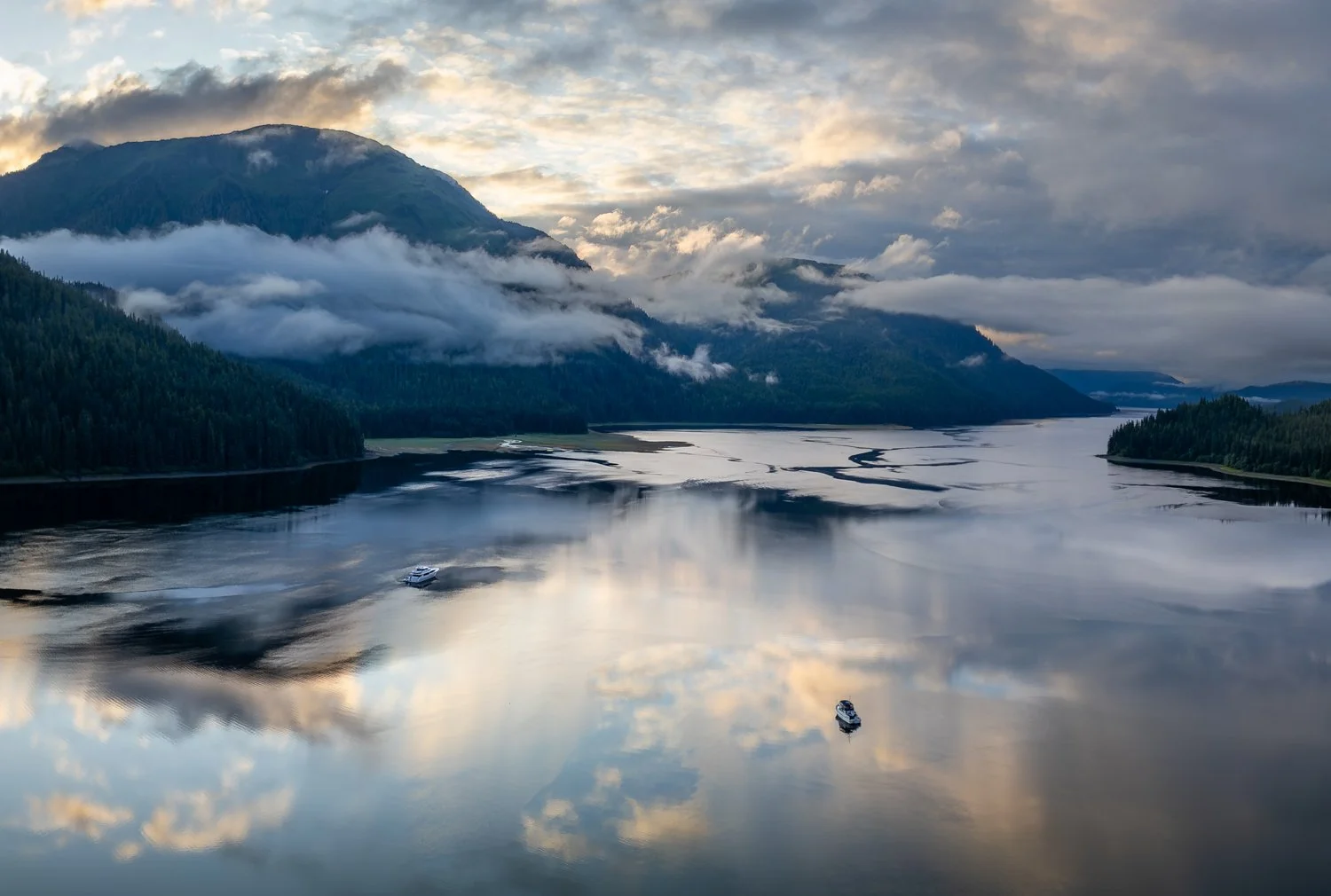
Crossing Stephens Passage, we adjusted course to smooth out the ride in the confused following seas. Entering Tracy Arm was easy with slack water and well-marked buoys. We know from past experience how fast the current can run here—those markers lean hard during full ebb or flood.

We anchored on the west side of the cove, hoping the shallow shoals would block any rogue icebergs. One boat was already on the east side, and three more joined them later, probably seeking shelter from the forecasted southeast wind. Spoiler alert: the cove offers little protection from that direction.

The afternoon brought a parade of squalls. One hit 50 knots, kicking up a full field of whitecaps. Definitely our roughest day since leaving Bellingham—but still nothing to complain about.

Evening settled in with shifting clouds, bursts of rain, and calming winds. By nightfall, OceanFlyer was quiet and still, ready for tomorrow’s adventure up Tracy Arm.

Lay Day in Windfall Harbor

With the forecast promising dry skies until early afternoon, we launched the dinghy mid-morning for a loop around the harbor. Our mission: scout out anchoring alternatives and keep an eye out for wildlife.

No bears this time, but we did spot eight deer, including a fawn sticking close to its mother—a quiet highlight along the rugged shoreline.

Common Merganser and her chicks

After 4.7 miles of slow exploring, we returned to OceanFlyer just as the first raindrops began to fall—right on schedule. PredictWind continues to impress us with its accuracy. After years of use, it’s become our go-to forecast tool.

our neighbors in windfall harbor and its mini-me

same two boats shows the scale of alaska

oceanflyer is also dwarfed in windfall harbor by the snowcaped mountians

looking for yummy stuff in the mud

“not all sea birds want to get wet” says a bonaparte’s Gull

The weather service issued a gale warning for the afternoon into tomorrow morning, so we hunkered down. But by bedtime, the only thing blowing was a light 5-knot breeze. We’ll take it.

Hobart Bay to Windfall Harbor

After two soggy days in Hobart Bay, we pointed OceanFlyer north up Seymour Canal in search of a change of scenery—and hopefully, fewer clouds.

Our destination was Windfall Harbor, just a few miles shy of Pack Creek, the popular bear-viewing area managed by the Forest Service. Mid-June to mid-July is the slow season for bear activity there, so we skipped the permit hassle and opted for Windfall instead. Karen had read that you can see just as many bears from your own deck—and she wasn’t wrong.

The cruise up was quiet and smooth: low gray skies, light rain, calm seas. Whale blows and tail slaps marked our entrance into Seymour Canal, and a few Dall’s porpoise gave us a brief bow-ride—though they seemed as weary of the rain as we were, surfacing less often than usual.

We found just one other boat anchored in Windfall, leaving us plenty of room to choose our spot. The harbor is big, with good holding in 50–60 feet. Just watch out at the head: the shoal extends far beyond what’s charted, and we quickly bounced from 50 feet to 12 feet when we nudged too close. Crab pots mark the edge—consider them the unofficial boundary line.

Windfall Harbor

the shallow mud flats extend well into the anchorage

the aluvial fan at the head of windfall harbor

Once settled, the harbor lived up to its reputation. As the tide dropped, the bears came out—grizzlies lumbering along the shoreline, turning rocks and sniffing for snacks. Late in the day, the clouds lifted just enough to catch a glimpse of the mountains and sneak in a quick drone flight.

Alpenglow kisses the mountians in the clouds

mother nature puts on a show at sunset in widfall harbor

Tomorrow we’re hoping for a dry morning to explore the creeks by dinghy. Fingers crossed.

Hobart Bay Lay Day

I woke early for no particular reason, but lucked into a five-minute break in the rain—just enough time to launch the drone and snap a few low-tide shots of the anchorage. Then the skies promptly closed back up, and the steady rain resumed.

hobart bay

good look at the surrounding mud flats

It was a day of shifting cloud layers and fleeting glimpses of the surrounding peaks—just enough to remind us what we were missing. With no letup in the weather, we declared it a “work day” and caught up on paperwork and business tasks from the dry comfort of the salon.

A lone fishing skiff made its rounds mid-afternoon, quietly checking a string of crab pots. He kept maybe half his haul—not exactly a big payday once you factor in the fuel—but he moved through the bay like a ghost, slipping away into the rain just as silently as he arrived.

Despite keeping watch, not a single critter showed itself—our first wildlife no-show in quite a while.

Even socked in, Hobart Bay is a peaceful and protected anchorage, and we can only imagine how beautiful it must be when the sun decides to return.

Honeydew Cove to Hobart Bay

Yesterday’s blue skies were just a tease—this morning brought a steady drizzle and low clouds, right on cue. With a possible weather break five days out, we decided to make some eastward progress toward Tracy Arm, Endicott Arm, and Windfall Harbor, hoping to time our visit with a patch of sunshine.

Today's destination: Hobart Bay. Friends on Empress and Escapade had recommended the North Cove, so we decided to check it out. Light winds and a favorable current made for a smooth, comfortable ride. We spotted several humpbacks along the way, including a few shoreline blows that hinted at just how many were nearby.

Approaching Hobart Bay, we were treated to a real show—a pod of Dall’s porpoise leaping and zigzagging in our bow wake for a solid 15 minutes. Karen, soaked in the rain but grinning ear to ear, had the best view from the bow.

The entrance past Entrance Island is well-charted, and the kelp helpfully marked the shoals and rocks. But the North Cove held a surprise: we steered north between two charted islets (keeping them to port), and suddenly the bottom shot up fast. We paused and drifted over just 8 feet under the keel on a +10.7' tide—clearly, the shoaling off the eastern shore extends much farther than charted.

Despite what the chart promises, you won’t find 30-foot depths in most of this cove. After sounding a 200-foot circle, we settled into 60 feet of water with decent swinging room and carefully avoided a minefield of a dozen crab pots. Alone in the anchorage, we dropped the hook and tucked in.

The scenery was subdued but still striking—low clouds shifted all afternoon, occasionally lifting just enough to reveal rugged peaks beyond the tree line. If tomorrow clears, Hobart Bay may yet show off the beauty it’s hiding behind the mist.