

Mary Basin to Tahsis
/We planned to arrive in Tahsis about 1 PM so we lifted the
anchor at eight. It was somewhat sunny as we started out and we saw kayakers
camping at Benson point. They were enjoying some very nice sandy beaches at the
point.

Mary Basin
We started feeling the swells early and by the time we got to Louie Cove we were “hobby horsing” in the swells. Once we were able to turn so the waves were no longer on the beam, the ride improved. And when we turned up Esperanza Inlet the ride was smooth. For our next visit we said we would try Nuchatlitz anchorage because it was more on the way and probably offered more to see.

Radar transponder reutrn
Another first on this trip was the passing of a buoy with a transponder. I have read about these but never experienced one. It is designed to send a radar signal that shows up on your screen as a series on Morse code busts. This very distinctive display leaves no question as to the identity of what you are seeing on the radar display.
There are lots of fish farms in the channel and we spotted more being built in McBride Bay. The traffic was very light. We spotted a few small fishing boats but no pleasure craft. Esperanza Inlet wasn’t much to write home about for sightseeing. We did see a small fishing lodge in Tahsis Narrows called Ceepeecee Lodge. The narrows themselves were unremarkable and we saw kayakers as we exited and headed north to the Westview Marina.

Fish Farm Hecate Channel

Lots of little "settlements" dot the landscape

You wish you had the time to stop everywhere and find out their story

Westview Marina on the left, the town of Tahsis on the right
The town of Tahsis is at the end of the inlet, and the marina is to port before you get to the town. It’s a bit of a confusing and narrow entry between the log breakwaters. We backed down onto the outer side of docks as the marina staff grabbed our lines and asked for our trash. Karen's ribs were very grateful for the help.
It was Tuesday, which is the cook's day off, so the menu only had burgers. So lunch was burgers and they were really good as was the coleslaw that came with. The marina provides free Wi-Fi and has a courtesy car that we borrowed for a trip into town. There was not much to see. The grocery store was designed to service more than just boaters, and had a little bit of everything, but was still just the basic items. We wanted to buy beer but the selection was not to our liking. The store staff was very nice and very helpful.

The General Store in Tahsis
We drove around town but there was not really much to see. We did drive up Cardiac Climb (appropriately named for its steepness) before we went down to see the government docks and the Maquinna Lodge. We found the health center that was closed but the sign said there was an on-call nurse on duty 24 hours.
After our brief explorations we returned to the boat to do three loads of laundry and use the marina’s reliable 20 amp power.

The "Filet Ballet"
As the afternoon came, a steady stream of little fishing boats came in to populate the far side of the docks. We went back to the docks to watch the “filet ballet” that went on for several hours as the boats returned and offloaded their catch onto the fish cleaning stations.
As the fishing boats tied up at the docks they were meet by the government “reel surveyor” who took count of the catch and noted the size of the fish. There was an amazing assembly of filet tables and types of fish. A Seal came to grab a discarded carcass. It was really entertaining to watch as the guides made quick work of prepping the fish and the seals would “shark” around the docks looking for a tasty carcass.
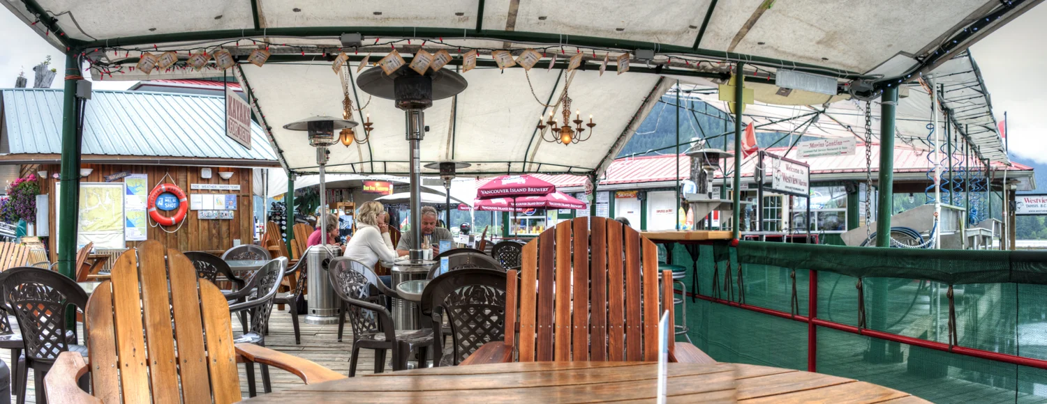
Restaurant seating is on the docks under the tent
Come dinner time, and lacking any ambition, we were back on the restaurant docks for beers and more burgers. Top that off with another episode of LOST and that was our day. This is a great stop, the marina provides a nice oasis with pleasant outdoor seating, clean showers in the bathrooms, excellent water pressure and helpful, nice staff.


