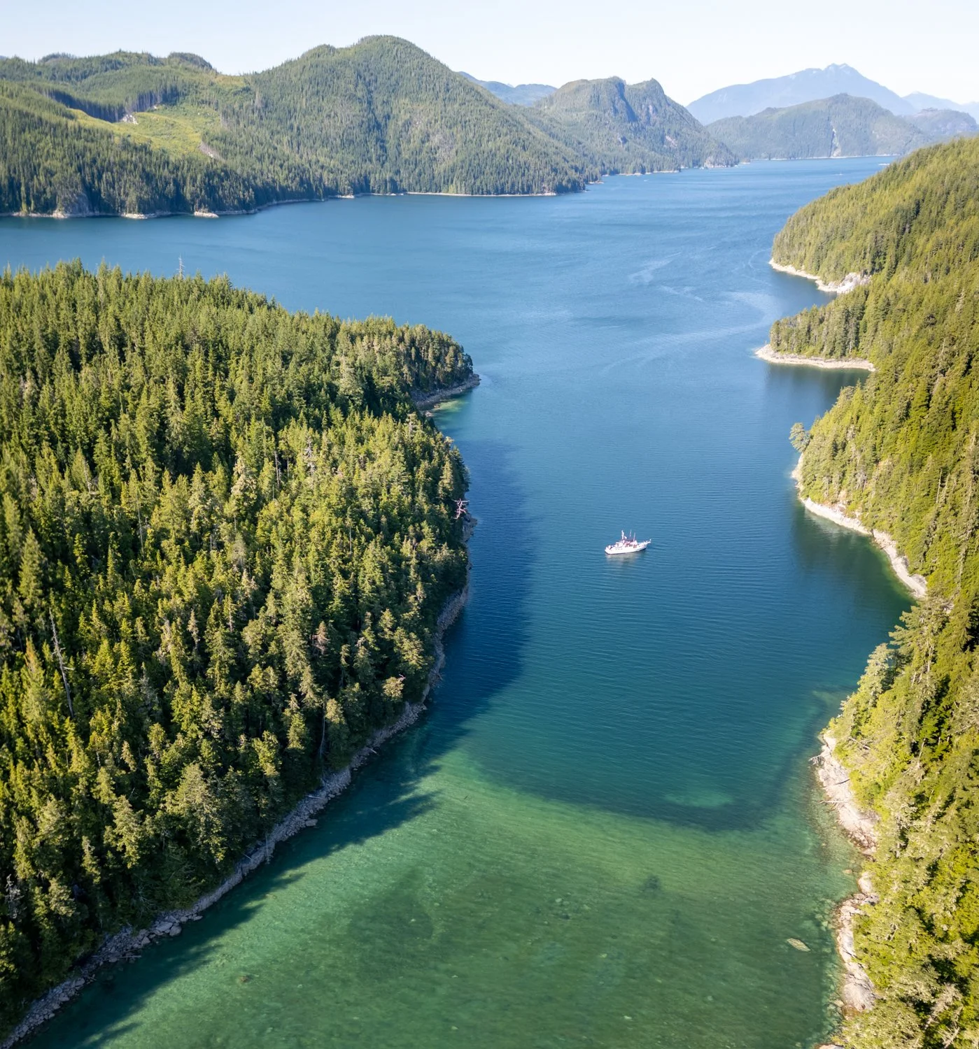
Texada Boat Club to Pender Harbour

We have not been to Pender Harbour for many years. We tend to pass up the crowds found here in our quest for more remote anchorages.

However, this year we are going to wait here to time our crossing of the Strait of Georgia and explore to this large anchorage to see what has changed in our absence.

Given the calm weather, it was tempting to go all the way across today (Karen’s suggestion), but that would put us in the “crazy zone” of pink AIS targets south of Nanaimo for too many days.

As we made our way south from Texada, we could see a stream of boats leaving Pender Harbour on the AIS. This should mean we will find room!

Sure enough, the anchorages were not super crowded when we arrived around 11am. We poked around and decided to anchor SE of Garden Peninsula (just outside Garden Bay) and trade some boat wakes for better views and breezes. With a forecast for low 70’s and light winds, we did not want to anchor where we might bake. We’ve learned that lesson in the past.
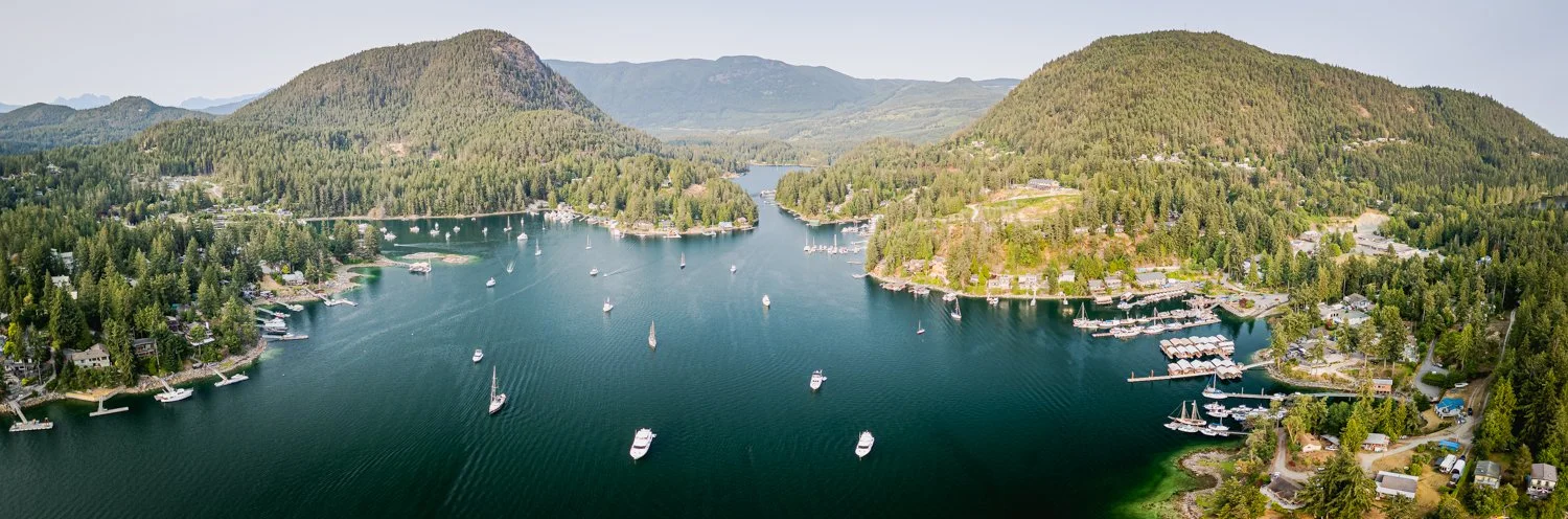
Pender Harbour. Garden bay on the left Gunboat bay in the distance and Maderia PArk MArina on the Right

After lunch we did a dinghy circumnavigation of every inch of the shoreline. Fun to see the houses, boats, marinas and everything else. It’s been a while and there have been many changes.

Pender Harbour looking back to the strait of georgia

First up was Gunboat Bay. Guarded by a rock and a shallow bar, few visitors seem to make their way into Gunboat, which is quite large and rimmed with summer homes, some quite stunning. If you want solitude in the summer in Pender Harbour, this would be the place. We meandered all along the shoreline and found lots of homes that were appealing to us, some quite recently completed.

Leaving Gunboat, we headed into Garden Bay. First we stopped to check out the Seattle Yacht Club outstation, which is quite nice. We have a view of the outstation from our anchorage, and could see the large yachts coming and going.

As we went toward the head of Garden Bay, there are a lot of abandoned long linear docks that used to be recreational moorage. The pub at Garden Bay burned several years ago, and is still just sitting there, charred and roofless. We couldn’t find out what the plans are for this area. The Royal Vancouver Yacht Club outstation, also in Garden Bay, was hopping with little room to be found for anyone showing up later in the afternoon.

Hugging the shoreline, we headed next for John Henry’s in Hospital Bay, which has expanded to include what used to be Fisherman’s Resort. The “Fisherman’s” docks are in great condition, and the marina was quite busy. For fun, we had looked to see if we could make an online reservation and they were booked out for quite a while.

After peeking into Duncan Cove, we crossed over to the smaller shallow pass between Donnely Landing and Calder Island. Lots to see, including (as we went deeper into Gerrans Bay) what looks like a ship salvage “yard”, with a myriad of boats from 150 feet to dinghies, all in a sad state, mostly in the water. We felt bad for those with nice home up on the hill that looked out over this mess.

We passed just off Whiskey Slough public wharf and headed toward the Painted Boat Resort. Boy, it’s shallow in there, lots of shoals and rocks although some shallow draft boats were at the docks.

Next we headed over to Madeira Park to check out where we could tie up the dinghy when going ashore in the next day or two. The dinghy dock, near shore, was busy. There were a few spots for larger boats on transient Dock B, but those were soon taken (and stayed that way throughout our time in Pender Harbour).

All in all, we covered 8.2 nm in about two hours of snooping around, and it was lots of fun. Headline: lots of new homes being built in Pender Harbour, most of which are modern yet appealing. There are issues with the BC government and reconciliation with the First Nations tribes regarding existing and future Sunshine Coast boathouses and docks - apparently still a bit in the air. We saw lots of yellow signs that said: “We will not give up our Marine Assets without a Fight”. 
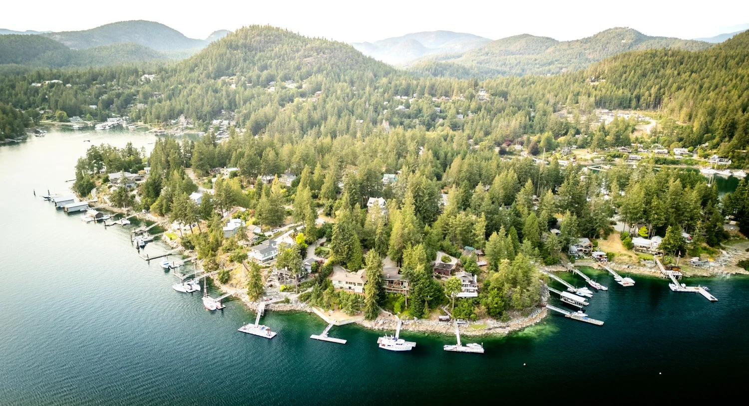
homes and docks ring the shoreline of pender harbour
Bend Island to Lagoon Cove

Bend Island turned out to be a delightful anchorage and we had a peaceful night.

Calm weather makes almost any anchorage drama free. However, we did very much enjoy the views and the interesting rock formations that line the shorelines.

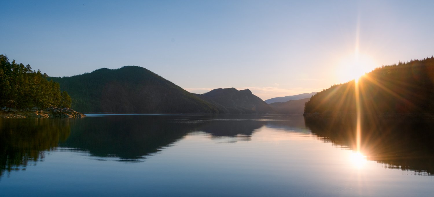
sunrise bend island

low water reveals the rocks in bend island anchorage

drying bar in bend island pass looking north

one more view of the bend island anchorage

Next stop is Lagoon Cove, our second visit this trip. Why?  Because we like it so much and we really want to support Dan and Kelly maintain Lagoon Cove as a premier stop for cruisers in the area.

Unlike our first visit in May, where we were alone for the first day, Dan said they are fully booked for the two days we will be here, including the “honeymoon/overflow” dock. Always good to have reservations! Karen especially loves the fact that you can book online, so it’s easy with Starlink.

perfeectly calm day enroute to lagoon cove

Dan manages the dock space extremely well. He always has a plan, making visits stress free. He and Kelly or their staff are always there to catch lines. It’s a truly welcoming marina.

We like to arrive earlier in the day (before lunch), when boats from the previous night have departed but before the afternoon crowds arrive. We took on some water, did a bunch of boat chores, worked on the blog and prepared our happy hour contribution. We call it Lagoon Cove dip, because I developed it a few years ago on these very docks, and it’s always a hit.

Happy Hour was delightful, as always, with a wide range of edibles including the prawns supplied by Dan and Kelly. We stayed on the deck for a long while, happily ensconced under an umbrella and chatting with dock neighbors.

a good time is had by all at the lagoon cove happy hour

Pearl Pass to Bend Island

Today we are going to take a roundabout route to our destination, Bend Island in Clio Channel. We want to see some whales so we’re taking a detour through Blackfish Sound.

fog cleaning in pearl pass, one of the beautiful views in this anchorage

It was a reasonably calm day, so it was comfortable to drift at idle in the Sound. We were soon rewarded by seeing a humpback and her calf. We watched for an hour as they fed just off Compton Island.

mom and calf in blackfish sound

Another feature of Blackfish Sound (which is not always visible) is the breathtaking scenery. Snow capped mountain ranges to the East and Vancouver Island mountains to the West. Clear skies and unlimited visibility made for a delightful spot to stop and watch Mother Nature’s glory.

We went briefly out into Johnstone Strait before turning off into Baronet Passage. Currents were not favorable, so we had a slow ride. There was very little traffic, though we saw some AIS targets in Potts Lagoon as we passed by.

Our destination for the night is Bend Island. This anchorage puts us close to Lagoon Cove, our next stop – where we like to arrive reasonably early as the docks are less crowded.

Bend Island is new to us. Karen read about it in the Waggoner Guide.  There are anchorages in both the east and west ends just off the drying area behind the island. We chose the east end, which was more favorable given the winds and fetch in Clio Channel.

oceanflyer anchored in east end of bend island

The drying area behind the island is very well defined on the charts and depending on the tide height, you can clearly see the line of demarcation between drying area and deeper water through distinct changes in water color.

low tide bings the drying areas into focus

The key to anchoring here is determining the balance between water depth and distance back to the drying shoal. We anchored in 50 feet at high tide and put out 200 feet of rode. That was enough to keep us off the shoal and our swing circle just within the width of the anchorage. In anchorages such as this, the boat often tends to just move back and forth in the center of the channel with very little movement towards the shorelines, so we weren’t too worried.

We anchored early enough in the day that we saw a full tide change and confirmed how the boat moved in the current and winds. It was a strange picture, as rather than facing into the wind with our stern to the drying shoal, we often set crosswise in the channel, bow and stern to the rocky shorelines.

we’ll be back to Bend Island anchorage

Rather than set an anchor circle on the Garmin MFD, I set an anchor polygon with the left and right sides narrower than the front to back. That way, especially when sitting crosswise, if we got an unexpected move toward one of the shorelines, we would get an alarm in plenty of time to react.

We were, once again, all alone in this anchorage. It has very a remote feeling despite being not far off Johnstone Strait or from Lagoon Cove.

Monday Anchorage to Pearl Pass

We had a good night in Monday Anchorage. There is some fetch that can be felt, but it was minimal and did not bother us.

Today we are off to anchor in Pearl Pass and visit Mimkwamlis , an abandoned First Nations site on Village Island.

Pearl Pass is an unusual “anchorage”.  We have visited often, first learning about it in the Dreamspeaker guide. We have never found another boat in this anchorage. It simply does not look like your typical place to set the hook. With Crease Island and Mound Island anchorages close by, it’s easily overlooked. Pearl Pass became a favorite before Starlink because it had reliable cell service. We would anchor here and catch up on work, back in the day.

the view to the west from pearl pass

The obstructions are well marked and if you enter at low tide, you get a better look at the kelp patches. Anchor in 15-20 feet with good holding, although set your anchor with a soft tug.

The biggest problem with the anchorage is finding a spot amongst the crab pots. We’ve always made it work, but it takes a moment to scope out all the parameters. So be patient, and you’ll find your spot.

The views in all quadrants can be spectacular on a clear day like today.

loooking east into pearl pass

Pearl Pass is also a great base to visit Mimkwamlis [“village with rock and island out front”], most often referred to as Mamalilikulla, which is really the name of the First Nation tribe associated with the uninhabited village. It’s their ancestral home. It’s only about a mile away from Pearl Pass by dinghy. You could also anchor the big boat in the bay off the docks.

very nice dock at Mimkwamlis

Visiting Mimkwamlis requires permission, as the uplands are protected Indian Reserve land. You can get permission via an online request to the Mamalilikulla First Nation Band office. There is a fee to tie up your dinghy ($1/foot) and a $20 fee per person to visit. Most of the remains are from the early twenty century when the village was abandoned. So, no ancient relics, but we nevertheless always find it interesting to visit historical places.

it an easy process to gain permission to the site

As you walk along the path with the falling structures  and longhouse remains on your left and the drying bay on your right you can use your imagination to see what this settlement must have been like. Like many settlements,  they have a defense against raiding parties making a surprise attack. In this case it is a large drying bay that helps protect vessels from landing on the near shore in all but the highest tides.

mother nature is winning the battle on the man made structures

loooking back toward the bay in front of Mimkwamlis

counld not find out if this is a modern structure or has an older history

Our one disappointment was that there was no information about the the history of Mimkwamlis on-site. We hope this is added so visitors understand more about where they are.

large beach reveals as the tide goes out. eventually the whole bay dries

abanoned engine is becomming part of the beach

a guided kayak tour visits Mimkwamlis

the drying bay in from of the settlement

As we were leaving, the Band’s guardian boat docked. We spent a while chatting with the lead guardian who is running the program. He lived in Mimkwamlis as a child and has some great insight about life there. We enjoyed speaking with him, as it added much needed history to our visit.

We took the dinghy in a narrow rocky passage in an attempt to approach the beach in front of the village. Like Haida raiders in the past, we were kept away by rocks and very shallow water!

Sullivan Bay to Booker Lagoon

It’s been a long time since we visited Booker Lagoon – about 17 years –  so this year it is on our list of stops.

nice ride on the way to booker lagoon

The lagoon is guarded by a narrows. It’s short but has a dogleg approach from Cullen Harbour, making for a blind entrance until you make the 90-degree turn. Therefore, a Sécurité call is in order going both ways.

To predict the slack water, we use Alert Bay about ½ hour after either high or low.

We accidentally miscalculated slack, and entered with about 2kts of adverse current, with enough swirlies that we needed to add a bit of power. We saw 14’ at 11:59am on an 6-foot tide.

We had our choice of lagoon “arms” to anchor in,  but we went with our previous favorite, a one-boat cove in the NNW corner, protected by a small islet and drying area.

out spot in the one boat cove

looking our from our anchorage

another view shows two of the other arms in booker lagoon

one more view

cozy in booker lagoon

Eventually all the arms had a boat or two in them, but because they are so large, no one was lacking enough space.

We did our typical circumnavigation to check out our neighbors and scout for other locations we might like to try on our visit. The only other spot that appealed was the small cove just around the corner from the narrows in the SE corner. It has the added feature of looking out to the narrows so you can watch boats pass in or out. It is also seems to offer protection from SW winds, which our favorite spot does not. It also hangs on to the sunshine later into the afternoon. A smaller Grand Banks was anchored there, and we chatted about the Broughtons for a while before moving on.

We then went back though the narrows to check the current flows closer to max. We went through just fine in the dinghy. The outer harbour, Cullen, was full of boats. While views from there are pretty, we aren’t sure why boats prefer to anchor in a crowd out there and be exposed to fetch. Next, we explored the other “entrance” to the lagoon. It located between Long Island and Broughton Island. At 3:40pm we saw 13’ on an 8.7-foot tide. It is narrow and best transited in a small shallow draft boat or dinghy. But fun to explore, nevertheless.

The lagoon is large – our tour was 8.6 nautical miles and took us about 2 hours to complete.