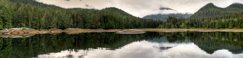
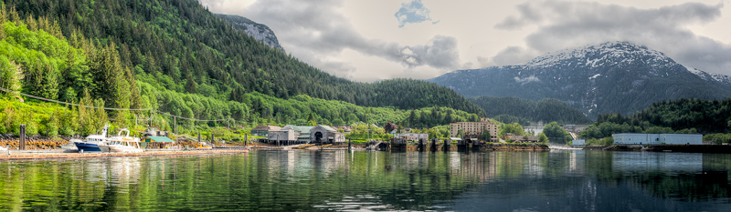
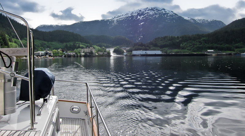
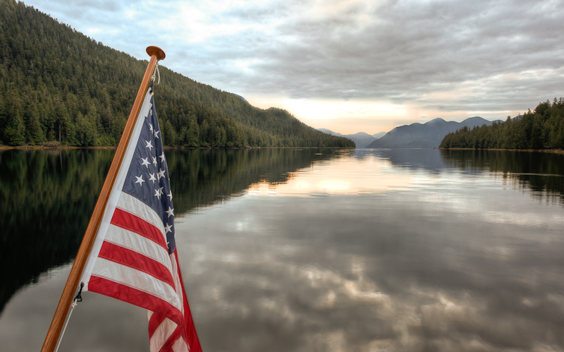
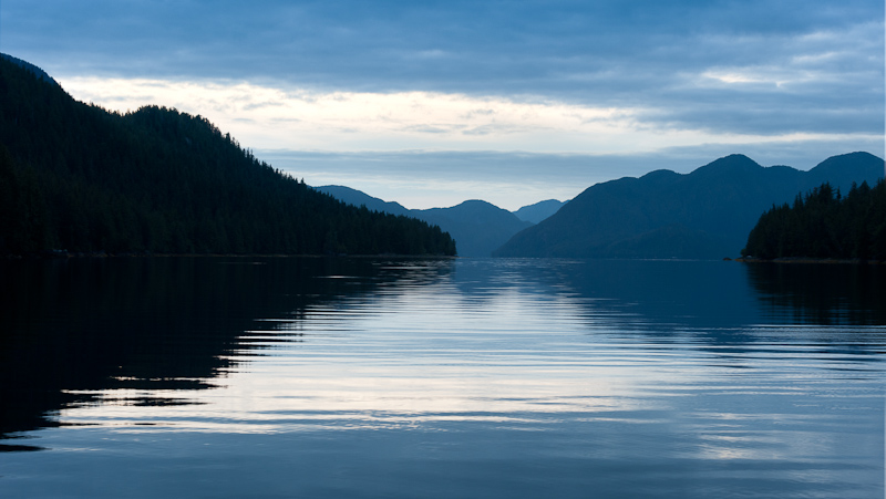
Culpepper Lagoon

I had planned for us to spend 2 nights in Culpepper Lagoon, and I was glad of it. The morning was sunny and calm, without those crazy winds of yesterday.  We were certainly slow to get going. I wanted to take the dinghy back to the narrows and go out again at low tide, to check out the head of Kynoch Inlet from the vantage point of the dinghy, and just tool around a bit. Brian had told us that he finds slack to be about an hour after Tom Bay, rather than 15-30 minutes before Bella Bella, which the guidebooks suggest. So we wanted to check out how close the Tom Bay calculations matched the actual conditions at the narrows.

20110606Culpepper Lagoon-82_3_4-Edit

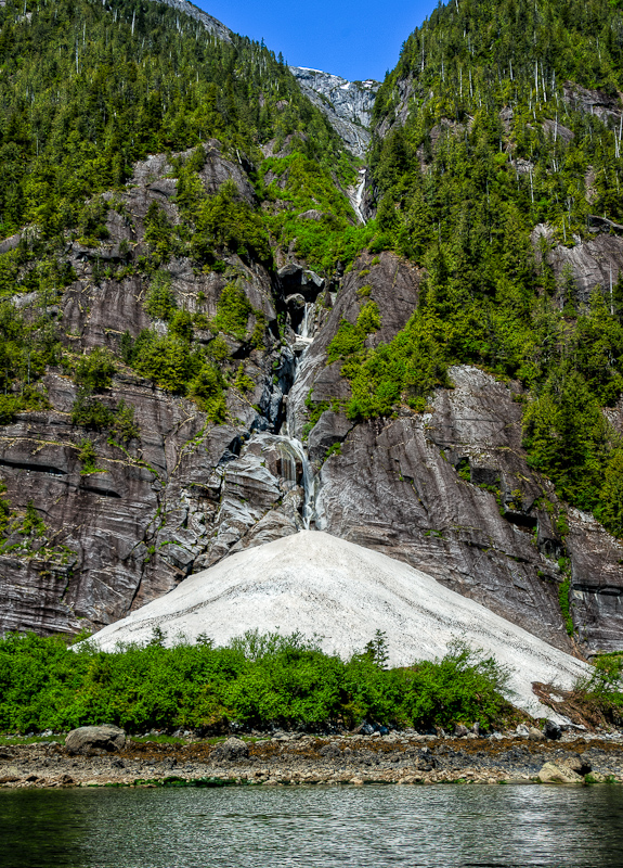
Snow Ice still sits at the foot of this waterfall at the head of Kynoch Inlet. Even more amazing since it faces south.

The fact that we were so slow to get going was a bit of a problem, because by the time we got in the dinghy it was howling wind again and there were whitecaps in the Lagoon. It was going to be a wet ride up to the narrows! But, the narrows were nicely slack at about 1 hour after low tide at Tom Bay, so we now will use Brian’s method of calculating slack at Culpepper.

20110607Culpepper Lagoon-94-Edit

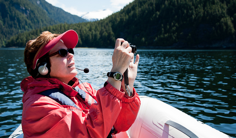
Karen capturing more memories during out dinghy ride

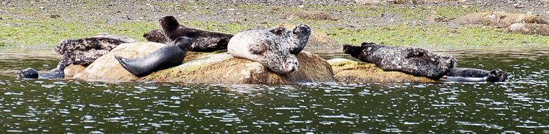
We exited the lagoon, tooled around the head of the inlet near the mudflats, and then headed over to Riot Creek (back inside the Lagoon) where an old cabin used to be located. There were no signs left of the cabin, but the creek was beautiful and the current was riotous. It hit the water of the lagoon and made some choppy waves, but as soon as we headed back to the boat, there was no more wind and chop. We passed by ‘seal rock’ and saw the seals basking in the sun again.

20110607Culpepper Lagoon-200_1_2_3-Edit

Riot Creek earned its name

20110607Culpepper Lagoon-218-Edit

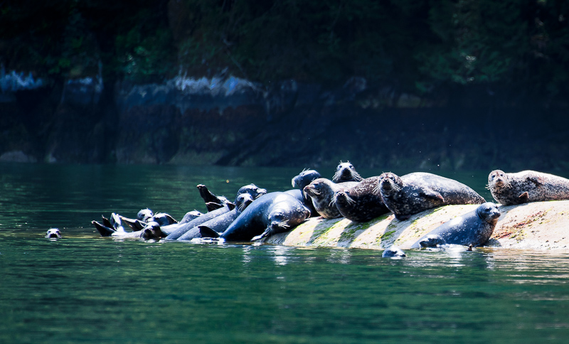
Rock + Sun = Seal haul out

We agreed that we needed to go kayaking when the tide was nearing the high, so that we could go across the mudflats and up Lard Creek as far as possible. There was time to kill, so Bob worked on pictures while I sat upstairs and read. Apparently the hummingbird from yesterday came back into the boat through an open window, and Bob had to don his oven mitts and rescue it again, freeing it from captivity inside of Alaskan Dream. It must be attracted to the red kayaks.

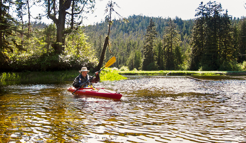
We were anxious to kayak, so we left a bit early, say at mid-tide, rather than nearly high tide. We crossed the mudflats with no issue and soon were paddling up the creek with the stony bottom clearly visible in the clear water. We went a good ways up, and had to battle the creek’s current. We were finally blocked from proceeding further by rapids over a downed tree. We needed at least another foot of water to move ahead, and so we turned around.

20110607Culpepper Lagoon Paddle-19-Edit

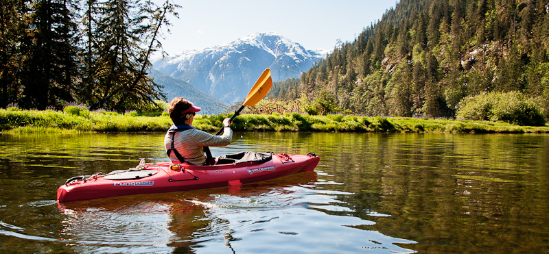
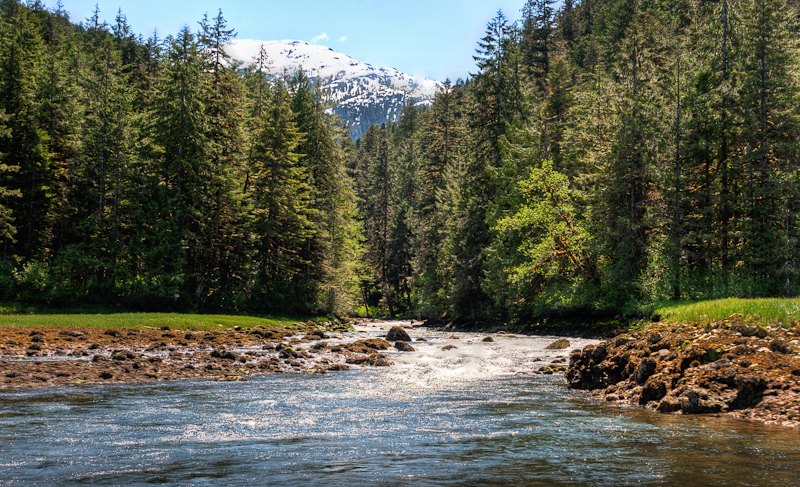
Warm sun, clear river, snow capped mountains in the background. Pretty great!

The ride out was great, due to the favorable current at our backs. We saw bear prints in the muddy banks of the river, but none of the animals themselves. The creek banks were full of lavender fireweed, and we enjoyed some photo ops in the sun.

IMG_0602-Edit

We think the name of the purple flowers in the background is lavender fireweed.

IMG_0606

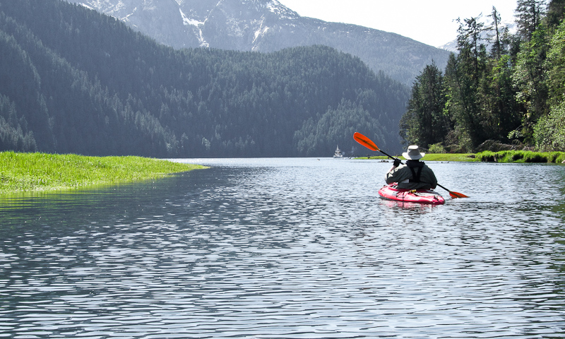
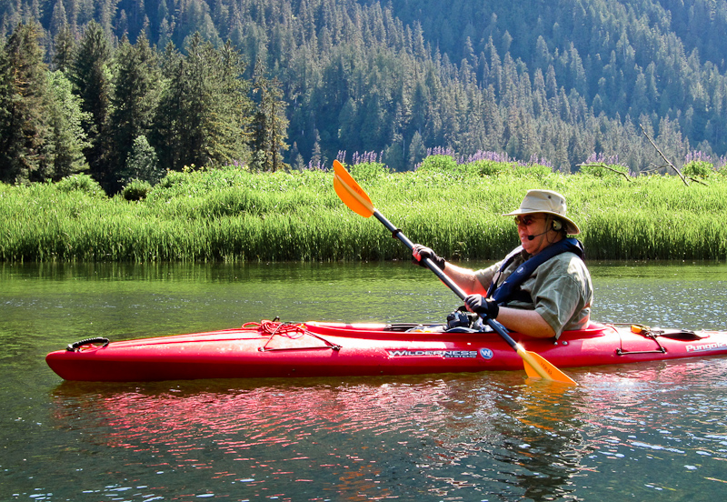
Paddling back to Alaskan Dream

IMG_0612-Edit-Edit

It's a short sleeved day. A first for this trip!

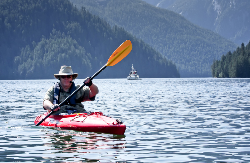
As we headed back to the boat, a Sailboat appeared and the wind started to pick up. The sailboat was apparently single-handed by a man – he set his anchor twice, was satisfied the 2nd time, dropped his kayak overboard and immediately went for a long paddle. The name of his boat was Imagine.

We had my favorite meal – Bob’s meatloaf – with drop biscuits and mashed sweet potatoes for dinner. We turned in early, because we had an early departure (6:30am) to catch high slack at the narrows to exit the lagoon.

James Bay to Culpepper Lagoon

We were up early again, so that we could catch low slack at Culpepper Lagoon (10ish). We decided to have breakfast enroute. As Bob was cooking and I was helming, I suddenly saw the Mother Goose fleet on AIS, about 5 miles ahead of us. We had suspected we would run into them as they departed Culpepper, but they were already out of Kynoch Inlet and headed up to Mathieson Narrows.

Bob hailed Brian on Deception and we got the skinny on good anchor spots and were also told that the Lagoon was devoid of boats at the time. That sounded good to us. As we headed up Kynoch Inlet, we saw lots of waterfalls and high mountains with snowy peaks along the way. It was really breathtaking. When we reached the head of the Inlet, we took a look at the Narrows and could easily tell from the white water flowing out that we were early.

James Bay to Cu;pepper Lagoon-79_80_81

Culpepper Lagoon rapids still running strong

We kind of figured that, because we were about an hour ahead of our calculated slack. So we enjoyed the scenery at the very attractive valley (with mudflats) at the head of Kynoch and patiently waited for slack. Bob maneuvered the boat in all directions, watching the birdlife on the flats and the seals, while I read a while. About 10:45 the narrows looked pretty good, and that was after when the guidebooks said slack would occur, so we decided to go for it.

Entering Culpepper Lagoon from Robert Minkus on Vimeo.

That entrance sure looks rocky and narrow at low water. As we got into the approach, we found 4kts of adverse current in the narrowest part, and Bob had to add power to the engines to keep good forward speed.We saw 12.7’ of water on a 2 foot low tide at Bella Bella. That was plenty of water for us, but definitely had our attention.

Once through, we toured the lagoon, passing a rock full of seals basking in the sun. We then got to the head, and were thankful we had arrived at low tide. You could see the mudflats, which was helpful, but it was still time consuming to find the right spot to anchor. We made a very careful set of anchor circles, marking the depth along the way, to make sure we could anchor safely and let out enough scope to ride any winds without swinging onto the flats. The anchor dance took about an hour. Once we set the anchor…the peaceful lagoon became a wind tunnel. Bob took a nap, and I sat glued to the computer image of the anchor “circle”, making sure we were really holding and not dragging toward those flats. Despite the wind, we held firm, and we had a relaxing afternoon. A hummingbird decided to come aboard, and Bob had to put on the oven mitts and gently capture it in his hands, then toss it out the window to free it from confinement in the boat.

The visual picture of the anchorage was totally different by high tide. All the mud flats were completely covered over and it seemed like we were anchored so far out from the grassy shore! We were again so glad we had come at low tide our first time into the lagoon. We remained all alone, though we did see a small boat come in, set a few prawn pots, and then leave again.

James Bay to Cu;pepper Lagoon-336_7_8-Edit_FLOOD2

The view at high tide

James Bay to Cu;pepper Lagoon-336_7_8-Edit_EBB2

The same view at low tide with the mud flats revealed (when we anchored)

Dinner was excellent grilled salmon with orange marmalade glaze, jasmine rice with craisins and pine nuts, and Bob’s homemade drop biscuits. YUM! About 9pm, the winds finally died down. We watched the movie “The Fighter” (we both didn’t like it) and hit the sack about 11pm.

James Bay to Cu;pepper Lagoon-359

The wild salmon you find out here is nothing like what you get anywhere else, even if you purchase it in a grocery store as I did.

Discovery Cove to James Bay

We heard the “fishing camp” depart at 5:30am this morning. We arose at 6:45am to fog. The weather forecast was still icky through Thursday, although Bob was still having difficulty “seeing” the weather maker on the Garmin. I worried a bit that we needed to get through Millbank Sound and Ivory Island now, rather than waiting for winds to pick up. So we left without breakfast (or showers!) at 7:30. We move pretty fast when we make a decision!It was very foggy. I went up on the flybridge to set up the automatic fog horn, but could not seem to get it to deploy more than once. While I heard it on the flybridge, Bob heard nothing inside the boat. We figured it required further programming, so we decided to ignore it for now.

Discovery Cove to James Bay-83

Our neighbors in the next cove were still resting when we departed

The fog lifted after about an hour, and it turned into a pretty day sky-wise. Our ride was absolutely great in Seaforth Channel, though it got a bit more rolly as we approached Millbank Sound, with some “hobby horse” swells but nothing particularly problematic. We could see the Ivory Island Lighthouse Complex from a long distance away – those white buildings with red roofs really “stick out” against the sea and trees and sky. It was really pretty. During this entire ride, we saw no other pleasure boats.

Discovery Cove to James Bay-158_59_60

The fog lifts revealing a gorgeous day

Discovery Cove to James Bay-166

Ivory Island Lighthouse, a well equipped compound

Discovery Cove to James Bay-173-Edit

If you want to be a light keeper, this might be the place to pursue your dreams

As we neared Ivory Island, Bob took a lot of pictures while I kept at the helm, following the course plotted by Bob. I kept looking for the red buoy in Reid Passage and never saw it, but I figured we just hadn’t gotten there yet. Our ride was good, and all of a sudden I saw we were approaching Perceval Narrows. How could that happen? Where was Reid Passage? Was I asleep at the wheel?

No, Bob had simply plotted a different course than I had told him to, which went around Ivory Island. We had a great ride, and we didn’t need Reid Passage’s calm water route anyway, so it all was good.  Perceval Narrows we had timed for slack, and it was. Quite pretty in and around that area, and we saw a prawner, so we weren’t totally alone.

As we came out into Mathieson Channel, it was really sunny and the scenery was gorgeous.  As pilots, we called it CAVU (Clear above, visibility unlimited). Our destination was Rescue Bay, and as we neared it we saw a humpback whale. In fact, it surprised us, as we saw the blow just off the bow of the boat. We slowed immediately and it fluked right in front of us. Bob had his camera out, but it was on a bum setting, and so the great shots of the whale tail that filled the frame are out of focus. We hung around a while, trying to see if we’d get any more great shots, and grabbed a few that were OK but not as good as that first fluke. I was also able to confirm that whale breath is quite stinky.

Discovery Cove to James Bay-116

Here you see the reason they are called humpback whales

Discovery Cove to James Bay-146-Edit-Edit

A fluke and he's gone

We headed over to Rescue Bay and …wow…what a disappointment. It is large and apparently well protected, but scenic it was not. We looked at each other, looked at the tides and currents, and decided to make a run up-channel to Culpepper Lagoon in Kynoch Inlet.

After about 30 minutes, it became clear the adverse current was going to impede our ability to arrive at the narrows at the necessary slack current for entry. So we decided to give James Bay a shot. It’s not one of those anchorages that anyone really talks about, making it a well-kept secret!

It’s a long bay surrounded by mountains, some snow-capped. There was some logging that had recently occurred along with some log holding pens that were empty, but our anchor spot took that pretty much out of play. James Bay has extensive mud flats at the head, and it took us quite a while to find the right spot that wasn’t too deep (though it was nearly 90 feet) and yet allowed us to set enough scope to be safe yet stay off the flats.

It was a glorious day, and we decided to go kayaking. The charts showed a small river on the other side of the flats, and we’re always game to explore. We didn’t quite make the desired timing of entering on the last of the rising tide, but we did get out about high tide. We were met by a phalanx of seals, there were like 10-12 of them in the water, playing and spying on us as we glided by. It was lovely.

The best part was the river itself. Narrowish, green grass on both sides, and just fun to explore. We went as far as we could, until our paddles started hitting bottom with every stoke…and knowing the tide was already going out on the mudflats, we decided the better part of valor was to turn around. I could have paddled there all day and definitely want to go back!

Discovery Cove to James Bay-114-Edit-Edit

The James River proved to be a great paddle


Discovery Cove to James Bay-90-Edit

The river keeps going


IMG_0549-Edit

Shortly we had to turn back. Next time we'll go for a higher tide so we can go farther upstream

IMG_0561-Edit

The tannin color of the water shows clearly. However, it is safe to drink and tastes fine.

It was a long haul back to the boat due to wind in our faces. I thought, at one point in the trip, it would take me about 40 paddle strokes to get back to the boat. It took 175. These distances are really deceiving!

We had a nice evening, and we really liked this anchorage. The views were great in all directions, and the paddling was an unexpected bonus.

Clatse Bay, Roscoe Inlet to Discovery Cove

We arose to grayish skies and did not have the desire to explore all of Roscoe, as many of the towering mountains were covered by low clouds. So we decided to amend the float plan again and head for Discovery Cove on Cunningham Island. It was written up as being very well protected (important in the event those winds materialize), and required us to go through Troup Narrows to get there.

Clatse Bay to Discovery Cove-42_3_4-Edit-Edit

Farewell to Clatse Bay

Clatse Bay to Discovery Cove-64

Seals were the highlight of our trip today. No man nor other beast was spotted.

But first, I convinced Bob to head up Roscoe just to the next bay and give me a peek “up the narrows” to see what could be seen. I think the lack of sunshine made the trip lack excitement, and when we reached Boukind Bay, we were not terribly impressed, and turned around, ready to head to new pastures (or anchorages).

Troup Narrows was fun…it is well charted and has decent landmarks. More than that, it’s narrow and pretty! Our only company was a small fishing boat that had been present in Clatse Bay earlier in the morning, zooming to shore, and then zooming off. We haven’t seen another pleasure boat since we passed “Mr Butts Too” (quite a name!) as they exited Gunboat Passage yesterday.

As we approached the entrance to Discovery Cove, I spied two dinghies, which immediately told us we would be sharing this anchorage. Two boats were in the northern nook, so we took the one further west, and it was just right for us. It’s cozier in person than it looks on the chart, and certainly well protected from wind. We launched the dinghy and went tooling about, saying hi to the 2 boats in the other nook (Soleil and Luminosa, both from Washington State and owners of the 2 dinghies we had seen earlier) and generally checking out the cove. It turned into a nice afternoon, and the sun was out. We saw several good bear beaches, but no bears.

As Bob was cooking dinner, he looked up about 7:00pm and all of a sudden a zillion boats came into our anchorage. They didn’t come into the nook, but anchored further out. It was a floating fish lodge from Craig, AK. We suspect they were moving the operation north, and needed a place to tuck in for the night. There was the Mother Ship, called Northern Legacy, a fairly sizable sportfishing boat, a smaller sportfishing boat, and 3 more small fishing boats. All were in color coordinated paint schemes, white with teal stripes. All had “Alaskan” names like Grubstake and Golddigger and Whiskey Punk. Some anchored out and some rafted to each other. As soon as all were secure, the big tender from the Mothership came to bring them over to dinner (and, we suspect, to sleep).

Clatse Bay to Discovery Cove-59

En route, the “fishing fleet” gets a quite night in Discovery Cove

That was the big excitement for the day, and one episode of The Good Wife later, we called it a night. It was dead calm, no winds. Where are these gales? Out in the ocean, I expect. Certainly not here with us.

Ocean Falls to Clatse Bay, Roscoe Inlet

I have been excited about visiting Roscoe Inlet, and several cruisers we met told us it’s really pretty all the way up to the head (21 miles). I had planned for us to go to the southernmost bay, Clatse, and then decided what to do from there.

)cean Falls-201_2_3-Edit

So long Ocean Falls

IMG_0545

Another view of the town, the falls and the new fish hatchery (blue building on right)

We said goodbye to Blue C’s and headed out about 9:30. It was sunny in Ocean Falls, but that changed pretty much by the time we turned down Cousins Inlet…back to gray skies. We traced our steps back to the end of Gunboat Passage and turned up Johnson Channel, where it was calm and nice. Bob returned Brian Pemberton’s call on the Sat Phone and found out they were only about 6 miles behind us, at Shearwater. I was at the helm while Bob did a variety of boat duties. I pretty much helmed until we approached Clatse Bay.

Ocean Falls to Clatse Bay-27_28_29_30_31

The weather keeps astounding us with it s good graces

Clatse is a big and open bay, with a grassy meadow at the head. It’s fairly deep, but we got the anchor to set with no issues. However, the wind was blowing down the bay, creating a bit of fetch that slopped our boat around. We were feeling rather lacking in energy, and it was windy and cold outside, so we both ended up taking a 90 minute nap!

After about 6:30 or so, the wind died down and it became a calm and still evening. Bob made curry burgers with gorgonzola and rosemary garlic pan-baked potatoes. Coupled with some good wine and 2 episodes of The Good Wife; it was a great night. However, the weather forecast was calling for gale force Northwest winds for days…and we wondered if that might affect our plans.

Ocean Falls to Clatse Bay-32_3_4_5-Edit

Looks like it is going to be a peaceful night