Port McNeill to Miles Inlet

We’re off. To be precise, we cast off the Port McNeill docks at 7:57am, three minutes ahead of schedule; schedule is a very loose term when you’re on vacation and cruising the Pacific Northwest. Fortunately, the weather is cooperating with a high overcast and a fresh breeze out of the northwest.

We were pretty much alone in our travels, only seeing three small boats and one seal. There was not much sightseeing to be had as we made our way to Miles Inlet. Most of our time was spent watching for, and then dodging, debris in the water. It’s a full moon, and the 18 foot tides have been washing logs and all manner of flotsam into our path. The day before, a call came into Port McNeill from a boat requesting a diver to inspect his running gear because he hit a deadhead and one prop was making a lot of vibration. He eventually continued on to Port Hardy where they have a haul out. Mariners beware; these waters can surprise with floating obstacles and during large tides, the risks increase.

The ride was nice; the seas were rippled to one to two foot chop with 1 to 1.5 foot swells. The sun made a couple of valiant attempts to make an appearance, but was too shy to do more than tease.

Miles Inlet is a great place to stop before making the trip around Cape Caution. I checked our tracks from 2009 when we last anchored in Miles Inlet and it said we anchored in the South arm opposite the entrance to the South lagoon. However, when you check the charts it shows the area has only 3 to 4 feet of water at mean low tide. We could not remember if last time the low tide was high and that why we were able to anchor there. So, not confident we could ignore the published soundings, we did what most people do and anchored in the “T” junction. We later checked out the depth in the dinghy and we calculated the depth and low mean water to be more in the 9 to 10 foot range. Karen thinks the Vipond and Kelly book, Best Anchorages of the Inside Passage, is where we found that anchoring in the South arm is a possibility depending on the tides.

_RE78926-Edit-Edit

Karen enjoying her dinghy ride in Miles Inlet as the sun shines

While out in the dinghy, we went to inspect the entrances to both the North and South Lagoons. The tides were just starting to flow out and there was already an impressive display of white water. Every time we are here, we say we should stay an extra day and go into the lagoon at high slack and explore until high slack again. However, it always seems the urge to move on overwhelms our urge to explore. Next time!!

_RE78987_88_89_90-Edit

South Lagoon Entrance with a good outflow. So inviting; so scary if you get the timing wrong.

We were the only boat in Miles Inlet that night, and it was really peaceful. Dinner was delicious pork tenderloin with Mustard Glaze and jasmine rice with crasins, accompanied by a lovely glass of wine.


Swanson Harbor to Auke Bay, Juneau

It’s almost over. Today is our last day on the water. In fact, it’s only a half day, because the boat is due back at noon. We got an early start, and with the weather and tides cooperating ,we had a nice ride to Auke Bay. Karen and I trade duties at the helm; an hour at the helm then an hour packing. Whenever Karen took the helm, though, the waves would get rougher and the traffic more dense. Go figure.

Our hopes were that we would see some humpbacks as we turned the corner around Point Couverden. But they were nowhere to be found. We did see a little activity as we approached Auke Bay near one of the green cans, but it was just a couple of blows and we did not stop. As we were in that area, though, we once again spotted Northern Song and chatted up Captain Mike as he headed to take a look at the whales before also going to Auke Bay.

Our first stop at Auke Bay was for fuel. There are two fuel docks, but we only saw the one that’s visible as you pass the harbor entrance. The dock was extremely small, and was full except for the area around back. Karen thought there was no way I could get Arctic Star into that dock, but I did. There was one young man on the fuel docks with his nose buried in his high school math textbook. He finally did come out from the “fuel shack” and helped Karen tie up.

We indicated that #2 diesel was what we wanted, but he just stood there. He finally informed us that he was not allowed to hand us the fuel nozzle because they did not want the liability of putting the wrong fuel in a boat. In fact, all he could say was “the green handle was our friend.” Silly, and in my opinion, a lawyer would have a field day with their approach if it ever came to that.

After we took on 300+ gallons of diesel and a couple of gallons of gas for the dinghy, we called our friends at Northwest Explorations to see if they had a preferred spot they where they wanted us to tie up. Auke Bay is a first come, first serve harbor, so we did not know what to expect. The day before when the Mother Goose boats arrived, there was very little space and they were spread all throughout the harbor. Just this morning they were able to move the boats and consolidate their location. Luckily, they also had a great spot for us.

Bill Douglass and Emmelina helped us tie up. Bill demonstrated a new method to tie up to the bull-rails that you find everywhere in the Pacific Northwest. It was shown to him by another cruiser, but since I did not catch that person's name, I call it the Douglass Hitch. It will become our preferrd method to tie up. Here a video of Bill's demonstration.

Brian Pemberton and Bill then greeted us with the replacement control head for the stabilizers in hand and a new fathometer for the helm station. The next charterers would have absolutely everything in perfect working order!

As they began their repairs, we began the process of unloading. Brian was kind enough to take me and my 35 pounds of frozen fish to a Jerry's Meats & Seafoods so I could have them pack adn ship it to my home. Next, he took me to the airport to pick up our rental car. Now that's a full service charter company.

I had rented from Budget, but later found out from Brian that Rent-A-Wreck is the way to go. Their cars are not wrecks and they deliver to the docks and the price is right. We hung out with the Mother Goose fleet for a while longer, then headed off to our Hotel, Grandma’s Feather Bed, a cute Victorian not far from Auke Bay that is actually part of the Best Western Chain. We offloaded and then drove over to the Mendenhall Glacier to scope it out for more exploration the following day, followed by a quick walk through town and a drink at the bar in the Westmark Baranoff hotel. We capped off a great day with extremely tasty pizza and Alaskan Amber on Douglas Island at The Island Pub, which was very laid back indeed.

Bartlett Cove to Swanson Harbor

We enjoyed a good night at anchor in Bartlett Cove. We rose to a pretty morning, bid farewell to Glacier Bay, and started the forty mile journey over to Swanson Harbor.

Saying goodbye to Barlett Cove. Left to right: The Lodge, the docks and the fuel dock.

We follow one of our fellow cruisers out of Glacier Bay

It is Friday, and as Swanson is a favorite spot for the local Juneau-ites, we wanted to get there early so we could find a place on one of the public floats. We ticked off the miles without much activity. We looked for whales, but except for a few spouts, there was not much exuberant activity to see. There was the occasional halibut fisherman, jigging on a pillar that rose to about 150 feet in the channel that averages over 600 feet.

Halibut fisherman punctuate Icy Strait

To our surprise, we did pass a raft of otters. As with most of their brethren, they gave us a look, but continued on with their lives without a care.

Pretty darn cute. But they just need to stop eating all the crabs.

When we arrived at Swanson, there were only two boats on one of the floats and the other float was empty. I set course for the uninhabited float and tucked Arctic Star at the end, with the bow set for an easy departure tomorrow. The floats at Swanson Harbor are humble but functional.

The tide was low and the water on the shore-side of the float looked very thin indeed. We have been assured by others who have done so, that there is plenty of water for a Grand Banks our size (draft 4.5 feet) to dock on the shore-side, but I happily chose the deeper side. The disadvantage of this side is that as the wind comes up from the west, you’re sitting abeam the fetch and you do get rocked a bit. Swanson Harbor is divided from the other rocky bay on Couverden Island by a ledge that is hugely visible at low tide and home to an eagle that simply sat and watched us, barely moving for the longest time.

The "other" float in Swanson Harbor at high tide

As time passed, the “locals” began to make their way to Swanson Harbor. Eventually five almost identical 27 foot boats tied up on our float. Out came the portable chairs, barbecues, coolers, and kayaks. The dogs, the beer, the kids — all added to the commotion that descended upon the previously serene docks. Having said that, the people were friendly and we shared a common love of the water and Alaska. Plus, I made their day by giving them soy sauce and fresh garlic to marinate their salmon.

Somewhere between the arrival of the first three small boats and the last two, a 72 foot Delta yacht decided to make our float his destination. He was definitely out of place. The other large boats in the harbor set their anchor on in the west side of the harbor, in the lee of the land. The captains of the small boats grumbled out loud a lot, insinuating that the large Delta did not belong on this float. Eventually, as the last small boat arrived, the small boat owners moved the large Delta to the bitter end of the float by walking it forward, and all were accommodated.

Full float at Swanson Harbor

Our time was split between relaxing and packing. We’ve found that if we spread out the packing over a day or two, it’s a lot less stressful. Nothing signals that your vacation is coming to an end as much as packing and cleaning up the boat. What I never understand how it seems that there is less room when you’re packing to return home even though you’ve not bought anything during the trip.

We broke up the afternoon by enjoying Alaskan Amber Ale up on the flybridge and taking in our last night on the boat in Alaska.

Captain Chef Bob at the helm galley

Reid Inlet to North Sandy Cove, via Glaciers

Reid Inlet provided us with a most welcome peaceful night, and we caught up on some of the sleep we lost in Blue Mouse Cove. 
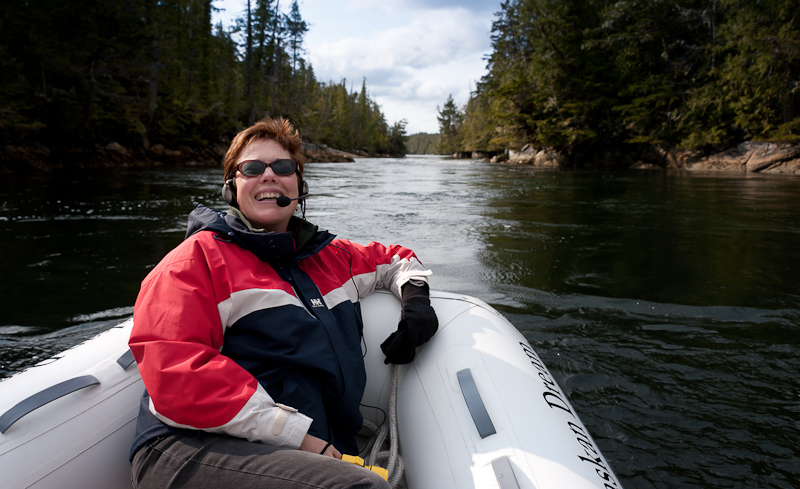
In the morning, we watched the crews of Northwest Explorations’ Mother Goose fleet get underway. I called the lead ship Deception and offered to take some photos of her with the glacier in the background. As the Grand Banks came abeam Arctic Star,the captain chose to make a disparaging comment on my attire; I was still in my “jammies.” His mistake. As they passed I lowered my camera, turned around and mooned the crew. Not exactly how they expected to start their day.

Deception departs Reid Inlet after being "mooned"

One of the big cruise ships (only 2 allowed in per day) passed Reid Inlet on their way north to see the other glaciers. Shortly thereafter a second big cruise ship headed up the same way. We did some calculations and decided to have breakfast before we set off for the same destination. We hoped they would be leaving as we arrived. For the past week, Karen had been watching the weather in hopes of timing our day at the glaciers so that we had the best weather of the week; sunshine was in our hopes. Her calculations and prayers worked. It was a beautiful morning. There were clouds in the area, but where we were, the sun came out and started to dominate the view.

Granite and clouds define the landscape...until the sun comes out

When the clouds retreat, the mountains advance

We left Reid Inlet with a final farewell to this cool glacier and lovely anchorage. The anchor came up covered in thin, sticky glacier silt. Karen had her hands full getting it clean. We decided to head to Lamplugh Glacier first and take a look down Johns Hopkins Inlet (closed to motorized vehicles at the present time) before heading up Tarr Inlet to the Margerie and Grand Pacific Glaciers.

The Coral Princess makes its way from glacier to glacier

As we neared Lamplugh, we saw one of the large cruise ships coming out. I called him on VHF 13 to learn his intentions and set up a port to port pass. This was the Coral Princess, heading from Lamplugh up to Tarr Inlet, and she would be no factor for us. We thought we’d have this area all to ourselves when we heard the 2nd cruise ship call the Coral Princessand arrange a port to port pass as well in Tarr Inlet. That told us that the 2nd cruise ship was likely to be coming into our view shortly.

We spent some time at Lamplugh Glacier, drifting in front of it and snapping away with the cameras. It was so sunny and bright, and the glacier was quite attractive with some snow covered hills in the background. Shortly thereafter, the Norwegian Pearl poked her nose around the corner on the far shore from where we were. I spoke with the captain about his intentions, and we arranged it so that he would follow the far shore to Jaw Point, hover there to afford his passengers a great view, and then we’d kind of trade places. We enjoyed watching him maneuver, and we suspect that many of the passengers took photos of our boat. We were lazing about at idle, with Karen lying in the sun on the bow, one head on a fender as a cushion. Pretty nice.

Lamplugh Glacier's blue is striking against the granite grey and snow white mountains

Waiting for the cruise ship to move on so we can get a good view of the Johns Hopkins glacier

The Johns Hopkins Glacier and its surrounds

It's hard to resist taking lots of pictures around here

Caught you!

You too!


What was even nicer was the view down Johns Hopkins. Wow…it looked like the Matterhorn in the background with a lovely glacier spilling down to the sea. We took lots of pictures before heading north up Tarr Inlet. As we headed North, we passed the Coral Princess again (she was southbound now) and a small pocket cruiser…and then we had the two glaciers all to ourselves for the entire 2 hours or so we hung out there.

The Grand Pacific Glacier at the head of Tarr Inlet is massive at over 34 miles in length and 2 miles wide at its face. However, the face looks like a big pile of dirt; not very photogenic. really unattractive and extremely dirty…it looks like a dirty wall rather than a glacier. Only from a distance can you see the ice “road” of the glacier.

The Grand Pacific Glacier has a very dirty face

Luckily for us, the Margerie Glacier was just off to port, and this was the glacier Karen noted was the primary photo opportunity. It is much more of what you expect in a glacier. White with glacier blue and a sheer face that calves and launch bergie bits into the water with a resounded retort.

Margerie Glacier is the most photogenic of the lot

It was gorgeous, a pretty blue with big spires of ice. We worked our way through all the bergie bits to get close enough for photos and we drifted for a long while, watching the glacier, taking photos and watching some calving. We also noticed that the sun was deciding to go away, and clouds were moving in, especially back down the way we had to depart.

One of the nice features of the glaciers in Glacier Bay is that the approached as not typically clogged with ice. It is not difficult to approach and most of the ice is small and widely spaced. You can do all the glacier watching you want here and never leave and of your hull paint or gel coat behind.

Not hard to understand why we do this, is it?

Karen must have had too much sun today. She's getting goofy.

So around 2, we headed southbound to check out a possibly anchorage at Russell Island, not far from Reid Inlet where we had spent the prior evening. A quick check showed that this was “OK” but not super, and so we decided that we might as well head south to North Sandy Cove. This would allow us to get well south of Blue Mouse Cove, and should also provide some bear watching opportunities. There wasn’t much wind, so the southbound travel was quite pleasant rather than slamming into the wind and seas as we had seen other boats do earlier in the week.

About 7:30 or so we arrived at North Sandy, to find not only our Mother Goose friends, but two other boats. We saw a black bear ashore as we checked out anchorages, and finally dropped anchor in about 35’ of water at high tide. We chatted briefly via VHF with Brian on Deception, and watched some of the dinghy activity going on around us while we had a late dinner and a great bottle of wine. We settled in for a quite night with plans to explore the cove in the morning before heading south to Bartlett Cove.

North Sandy Cove has a lot to recommend it, including the views