Shelter Cove to Cedar Bight

Alaska is Big. No, I mean REALLY BIG!!!!!

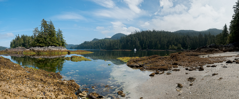
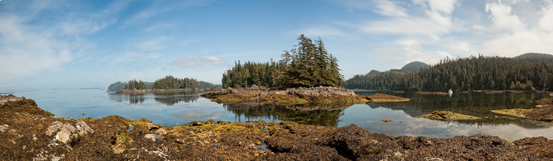
We’re in Tebenkof Bay. When you look at a chart of Alaska, Tebenkof does not appear to be all that large. But once you are here, it is enormous.  As we make our way to the various anchorages in Tebenkof, we continue to be bewildered by the distances. What looks like a mile is 6 miles…or more.

20100624_Eye of the Needle to Cedar Bight_0089-Edit

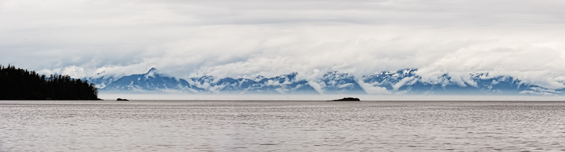
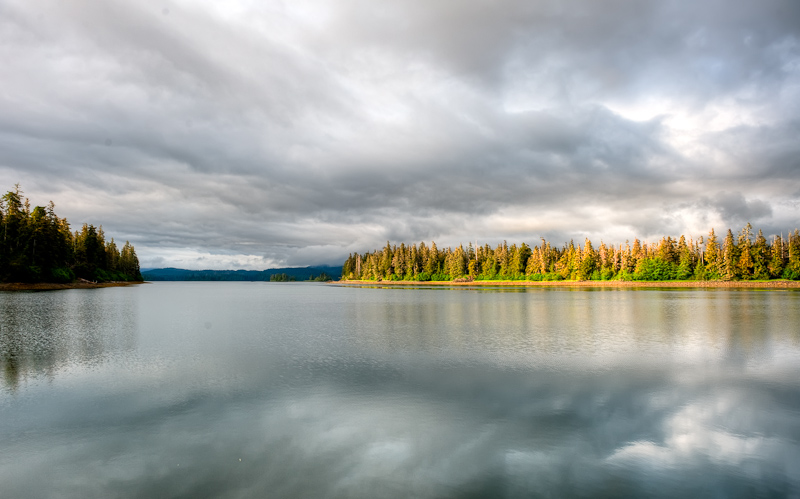
Baranof Island as seen from the entrance to Tebenkof

We’ll see a humpback feeding and decide to investigate further, and 45 minutes later we‘ll just be close enough to take some pictures. We’ve been out twenty days and our internal distance scale has not yet recalibrated. I wonder if when we get home after five weeks in Alaska, if everything will seem too close and cramped. Karen often feels that way anyway…so I suspect this time in Alaska will just intensify that feeling.

20100624_Eye of the Needle to Cedar Bight_0292

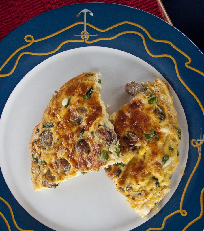
My first every frittata was a success

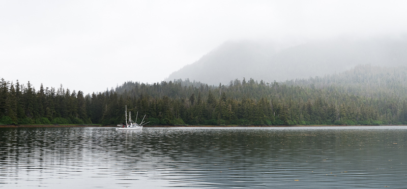
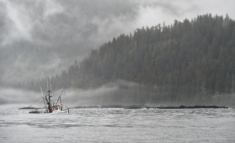
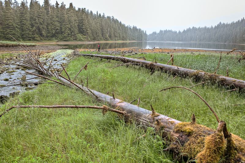
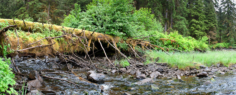
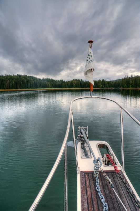
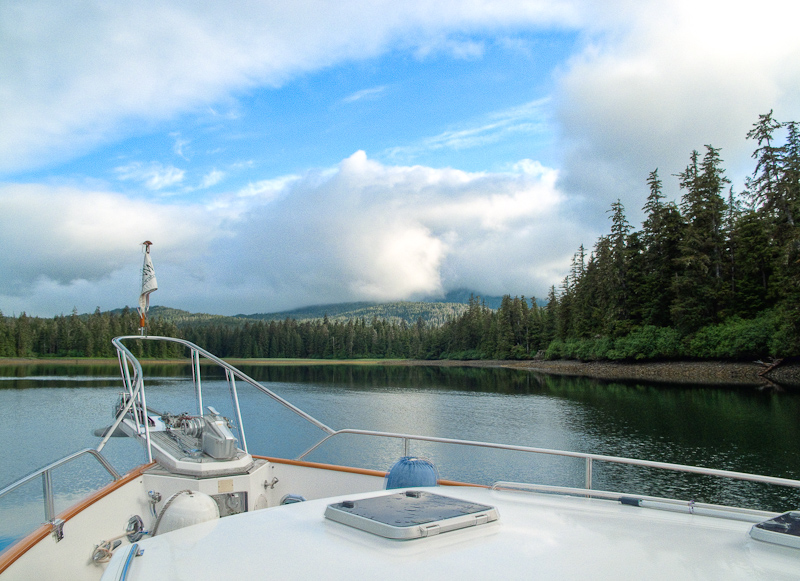
We left Shelter Cove late morning with a goal to visit the Eye of the Needle in Tebenkof. Now the Eye of the Needle sounds small and narrow. And when you look at the charts (and read the sole “guidebook”), it appears exactly that. However, due to the distorted perception of space and distance here, it’s not really that small. Relative to all of Alaska it is small, but in the absolute we have been through much narrower passes, with much less water with critical timings for tides and currents.

20100624_Eye of the Needle to Cedar Bight_0297-Edit

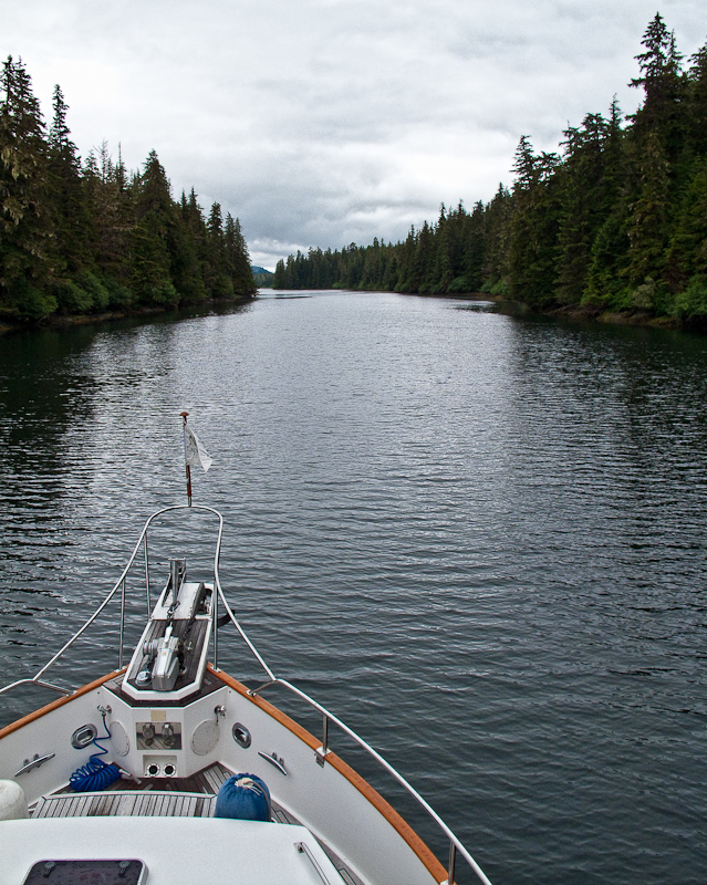
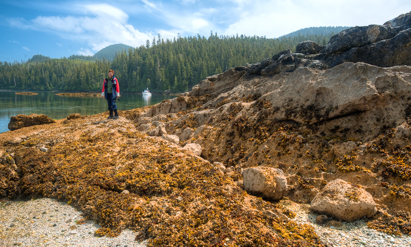
Entering the Eye of the Needle

20100624_Eye of the Needle to Cedar Bight_0038

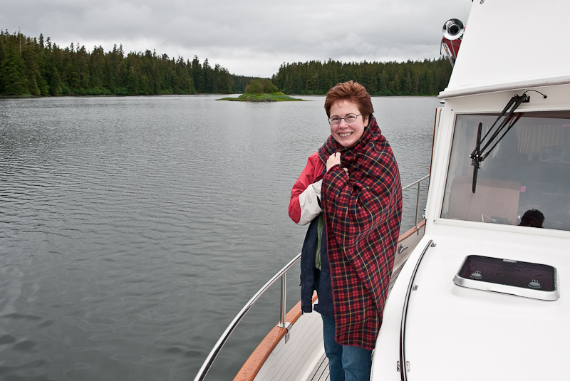
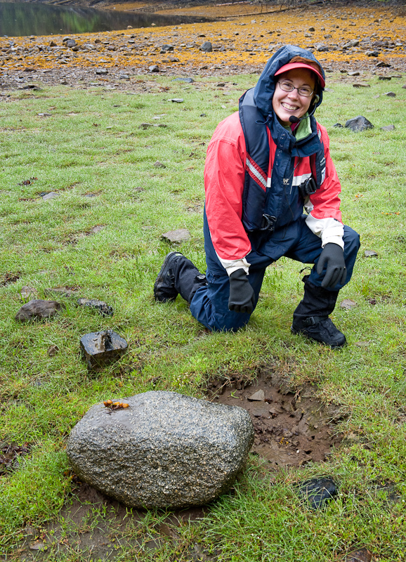
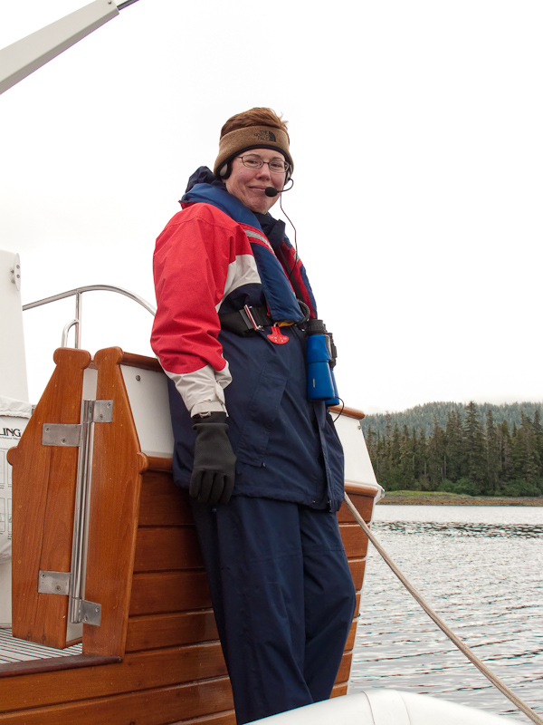
Karen keeping warm at the Eye of the Needle

Our trip started at a plus 6 foot tide and that made the trip very comfortable. At the end, or the Eye, you anchor in 12 feet of water behind a small islet. It is beautiful and almost certainly you will be alone. Although we only stayed for an hour, we would definitely come back and plan to stay a couple of days and explore the back bay via Kayak – especially if the weather was sunny.

Another note on navigation. The word is that much of the charts of Alaska are incomplete in that there are rocks and other obstructions that are not charted. Knock on wood so far… but I have to say that the Nobeltec electronic charts we are using are spot on. Thus far, what we see on the charts matches what we see out our cabin windows. That is reassuring, although we are keenly skeptical and err on the cautious side.

Scale is also impacting our fuel calculations. When we’re in the Broughton Archipelago for three weeks, we never worry about fuel. At the end of our travels, we pull up to the fuel docks and we usually have half tanks or better. If my calculations are correct we have used 250 gallons of diesel to go 218 miles. That means 58% of our fuel remains. So today we did a little planning to make certain we’ll make it to our fuel stop in Kake with a good safety margin. The only way to calculate fuel usage is to look at the site gauge and, using a tape measure, determine how full the tanks are. Old fashioned methodology but compared to the electronic Computank device we have onboard that says we added six gallons of fuel today, I’ll definitely place more trust in the tried and true methods.

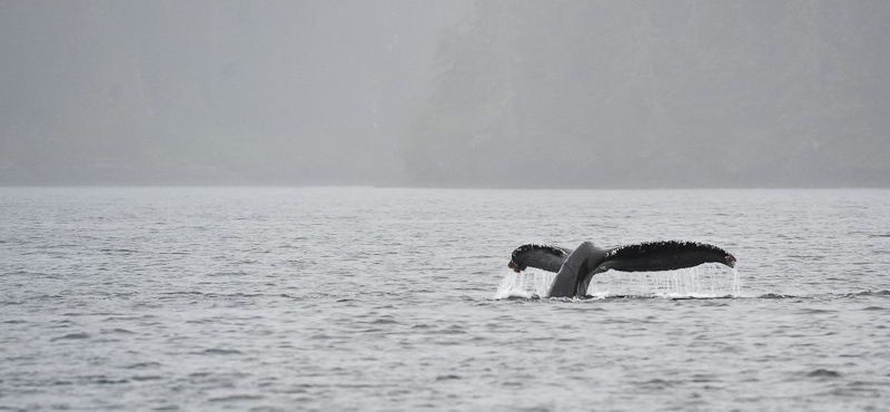
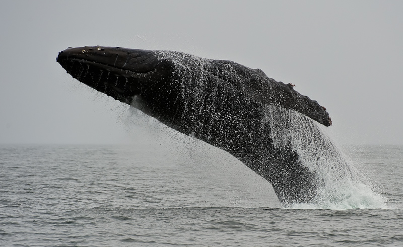
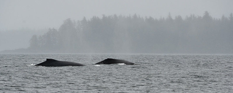
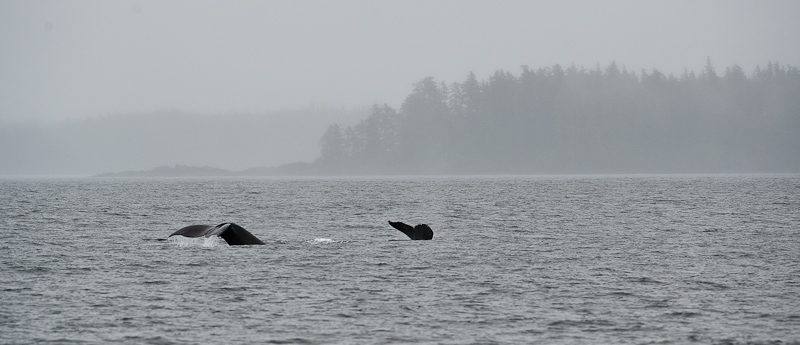
As we were entering The Eye of the Needle Karen, who has become quite a critter spotter, had sighted a humpback feeding out toward the entrance to Tebenkof Bay. So after the Eye and before we made our way down Petrof Bay for the day’s anchor spot, we took a detour to see what the humpback was up to. Sure enough, he was still there. We made our way over and sat and watched and took pictures for a while. He would come up from the depths, show his flipper, pound the surface of the water with it, and then emerge, mouth wide open, before submerging again. He traveled in a large circle near a shallow (60 foot) area. As we looked at our Nobeltec charts, it turns out that this is exactly the same spot we saw a humpback yesterday on our way into Tebenkof. I suspect that this fellow has staked out this area as his own.
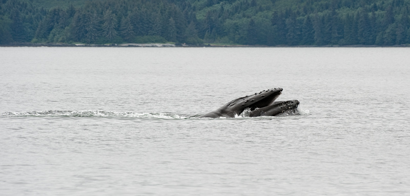
20100624_Eye of the Needle to Cedar Bight_0142-Edit

Humpback feeding

20100624_Eye of the Needle to Cedar Bight_0193-Edit

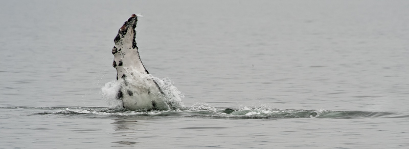
High-Five from our friendly humpback

Petrof Bay is much larger than Shelter Cove, almost too large for us. However, Karen did spot two black bears at the head. Therefore it might be worth a return trip to anchor overnight and wait for low tide with hopes of seeing more bears feeding on the beach.

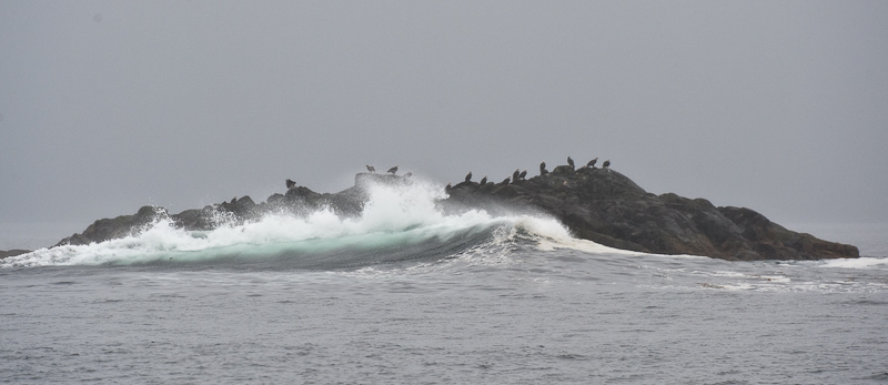
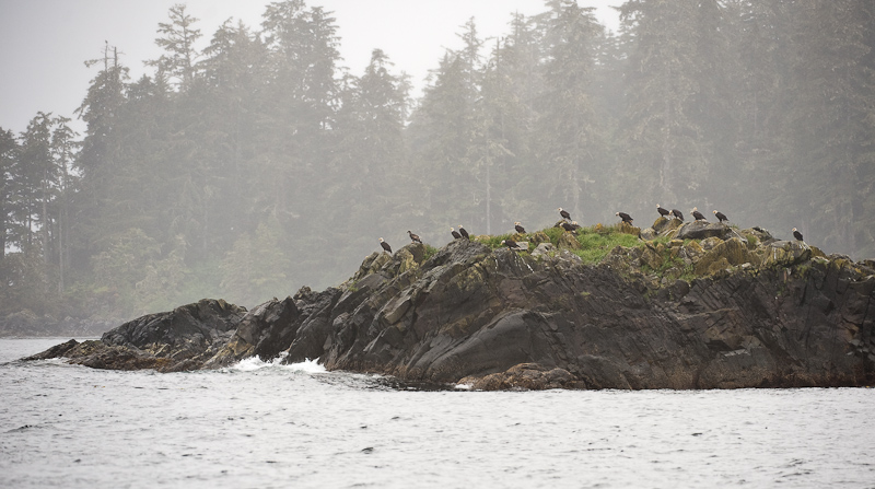
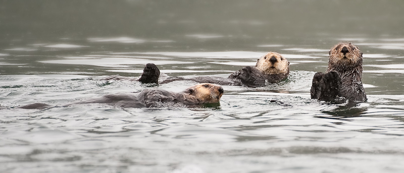
Our next stop was Cedar Bight, the next anchorage west of the head of Petrof bay. We took a small detour to visit a rocky outcropping where we had spotted seals earlier. They had deserted their small rock, but we were able to add seals (other than the ones floating on icebergs in Le Conte glacier) to the list of critters spotted on this trip. So far, seals are much less prevalent here than what we see in British Columbia. I don’t know if it’s just normal or the large population of sea otters keeps them at bay.

Cedar Bight is a cozy (by Alaska standards) anchorage. The large drying area at the south end features a freshwater creek. It has all the makings of a bear beach: flat, fresh water and lots of surface revealed at low tide. As I was fixing dinner in the galley below, Karen found her third black bear of the day. That fellow spent the better part of two hours combing every inch of the beach looking for tasty morsels.

The other big event that occurred while I was making dinner was the appearance of some sun and blue skies. What a change happens to the landscape and your mood when the sun comes out. We took lots of pictures and ran around the boat admiring what seems like a completely new environment. However, an hour later the clouds rolled back in and secured their rightful place in the Alaskan landscape. We come here expecting clouds and rain and tell ourselves we can deal with it. But in reality, we long for some sun.

20100624_Eye of the Needle to Cedar Bight_0323_4_5

Yes! We found the sun.

20100624_Eye of the Needle to Cedar Bight_0277_8_9-Edit

The mix of sun and clouds can be stunning

20100624_Eye of the Needle to Cedar Bight_0313-Edit

Karen ready to go exploring in the dinghy

Our spirits were lifted for a while and we enjoyed some curried chicken salad with flatbread. A no-cook (since I grilled the chicken last night with the pork) dinner.

20100624_Eye of the Needle to Cedar Bight_0357

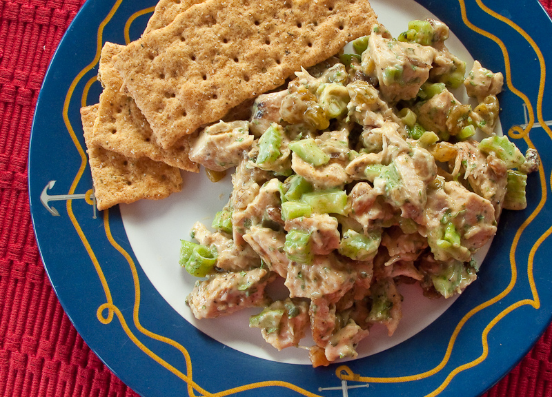
Karen's favorite thing to eat on this trip. Curried chicken salad.

With our fuel plan secure and 50 foot of additional chain sitting on the bottom, we settled in for a quiet night. Tomorrow, we’ll  launch the kayaks and explore the small inlet to our east.

By the way…all we did today was “tool around” Tebenkof Bay. We put on over 28 miles.


Mud Hole to Shelter Cove

Looking out across Mud Hole bay this morning, all but two of the fishing vessels had departed by 7:30 am.

20100623_Mud Hole to Shelter Cove_0129-Edit

Mud Hole morning

We expected a good ride north today with winds forecast 25 knots and seas four feet on our stern. I plotted our course out of Port Malmesbury so we could go back and check out the beach where we spotted the bear feeding two days ago.

To our surprise, as we were making good the course to the “bear beach”,  Karen spotted a humpback whale. Naturally, we slowed and watched and we paralleled his course in the opposite direction. We watched for a while, but he was not in a mood to put on much of a show.

20100623_Mud Hole to Shelter Cove_0433

He was a shy critter. More interesting in eating then us.

With four foot seas predicted, we made certain the stabilizers were up and running long before we arrived at the end of Port Malmesbury and entered Chatham Strait. Looking out as we rounded Port Harris into Chatham Strait, we spotted a fishing fleet, at least twelve boats making a North-South, counterclockwise racetrack pattern with their gear in the water. Arctic Star had to make a run along the shoreline to keep out of the racetrack and the fishermen’s lines they trolled behind their boats. On VHF channel 10, we overheard one captain talking with another that so far they had only landed “a few small ones”.

20100623_Mud Hole to Shelter Cove_0204-Edit-Edit

A tough way to make a living, but you can't top the scenery

Eagle eye Karen let out a shriek. She had spotted a large humpback breaching out of the water just south of Point Cosmos. We steered a course 15 degrees to the west to get a closer look. Breaching whales are something both of us had only seen on TV. It was on our wish list of things to see on this trip, but the odds are thin that you should be so lucky. As you can see from the photos, we were indeed lucky. I counted four breaches, and one was close enough to the boat to get a good picture.

20100623_Mud Hole to Shelter Cove_0224-Edit

What a show! If I was a girl whale I would be impressed.

I suspect that the male was courting his companion. He would breach, and then slap one, then the other of his fins on the water in an attempt to make an impression. Then the pair would swim alongside one another for a while, disappear, and then the display would repeat. It takes a lot of energy to thrust a humpback whale out of the water, so after about 35 minutes things quieted down. Either he was resting, or his advances were successful and they got a room.

20100623_Mud Hole to Shelter Cove_0276

After a lot of splashing and jumping, the two would swim side by side

20100623_Mud Hole to Shelter Cove_0291

Of they went, I'm certain they'll be happy together

Critters were everywhere today. A sea lion surfaced just 30 feet from the boat to the surprise of both us and himself. As we approached the large entrance to Tebenkof bay, there are rocks on both sides of the entrance. Sitting on top of each rock were large birds. Out came the binoculars to determine the species. It was misty and with the reduced visibility, it was impossible to see any color, but the silhouettes looked just like Bald Eagles. It seemed improbable to us that bald eagles would be fishing out here in the ocean. Usually you see them sitting in a quiet cove fishing calm water. But yes, as we neared, there was no doubt that these were eagles.

20100623_Mud Hole to Shelter Cove_0328

Eagle Rock One

20100623_Mud Hole to Shelter Cove_0409

Eagle Rock Two

Continuing into Tebenkof bay, Karen again spotted humpbacks. We sighted at least one pair and a couple of solo animals. Eagles, Whales, a Sea Lion and lots of sea otters -- what a critter day.

Karen took the wheel and practiced her helmsmanship as we wove our way though slalom of islands back into Shelter Cove. Karen was musing that we wanted to see a raft of sea otters. Apparently they will congregate into a large group and float together. Sometimes they will even join up, flipper to flipper I guess, for reasons I know not why. Sure enough, there was a large group, maybe 30 animals floating as one. Not hanging on to one another, but still a tight group. I guess Karen has the magic touch today. Maybe she should ask for some sunshine and we’ll see what transpires.

20100623_Mud Hole to Shelter Cove_0503-Edit

They are all personality

Shelter Cove is just that. Nestled deep in Tebenkof, it is a medium sized cove, flat bottomed with twenty feet of water. We are protected on all sides, it is a great place to anchor.

We launched the dinghy in the rain and proceeded back though a narrow channel to the south that takes you to an inner bay. The channel is narrow and has its shallow spots, but at the right tide you could take a boat as large as Arctic Star in and anchor in the southern-most bay.

At the end is a stream that feeds into the salt water. We got out and walked a short distance up the stream to see what we could see.

20100623_Mud Hole to Shelter Cove_0394-2_5-2_6-2

Karen scopes out the beach and freshwater stream. The streams undermine the roots of the trees on its banks so there are always downed trees on the banks or fallen over the stream.

20100623_Mud Hole to Shelter Cove_0382-2-Edit

Freshwater streams make for great walks. They also signal bear might be in the area.

Karen found this rather large rock on the beach that had been dislodged and turned over. A bear?  We’ll never know, but we always yelled out “Yo bear” when were ashore and near a fresh water stream.

Yo Bear? After all, we’re from Philadelphia!

20100623_Mud Hole to Shelter Cove_0401-2-Edit

How big a bear does it take to lift this size granite rock?

Its dinnertime now…this is a truly spectacular anchorage. There are great views in all directions and the water now is mirror calm. Off for a glass of wine!

 20100623_Mud Hole to Shelter Cove_0494-2_5-2_6-2-Edit

A peaceful anchorage in Mud Hole


Mud Hole

Today was scheduled to be a lazy day. Rain was forecast for most of the day, with clouds and low ceilings. We have been on the go since we left Philadelphia, so today the plan was to do nothing and go nowhere. After all, it’s our vacation.

Karen devoured three books on her Nook. It was always with her. It remains a great purchase for such a voracious reader.

20100622_Mud Hole_0005

Karen and her Nook. What a great addition to travel. Imagine packing 50+ books.

I spent the day working on my pictures and catching up with this blog. It’s easy to get behind, and once you do, it’s the devil to pay to get caught up. We’re in vacation mode, and trying to remember what you did yesterday is a real challenge.

I did check the engine room. Both engines surprised me in that they needed no oil. I guess these long runs are good for them. The fuel is sitting around 75%. Again, given the amount of time we have been underway, this seems about right. We will need to get fuel before the trip concludes in Juneau, but we have that on our agenda. Note to self, the boat I buy will have both fuel flow for each engine and a fuel totalizer. Measuring the site gauge with fuel and then doing some quick calculations is an OK method, but this a perfect function for modern technology.

Last night four fishing boats joined us in the anchorage. We know there is an active fleet fishing just north of Point Harris, so we figure they are part of that group.

We needed a day of rest and we got it. In addition to reading and working on the blog, we did a load of laundry and also watched Chicago, one of my favorite movies and one whose staging never ceases to amaze me.

Tomorrow we’re on the move again up to Tebenkof Bay. This is one of the highlights of the trip. We have set aside three or four days to explore the many anchorages in this large bay. It is regarded as a great place to dinghy and kayak, so we’re excited to do just that. The weather is predicted to be Alaska –like with clouds and a chance of rain, but the weather patterns look better than that to me on the XM Satellite weather charts. It’s anybody’s guess up here, and so far the official weather has been less than spot on.

20100622_Mud Hole_0102

An easy dinner of chili

Egg Harbor, Coronation Island to Mud Hole to Port Malmesbury, Kuiu Island

There was a small swell on and off during the night. There were times also when it was dead calm. Overall it was a moderately peaceful night, though the anchor alarm went off at 2:44am for no good reason.

Egg Harbor has more bird life then we have seen so far this trip. When we awoke, Karen spotted a bald eagle on the shore devouring his catch. Two other mature birds and a juvenile looked longingly at his breakfast. From time to time, there would be a test of the pecking order, feathers would fly and then they would settle back into the established hierarchy. I think everyone eventually got a taste, but not before the dominant bird had his fill.

20100621_Ehh Harbor to Mud Hole_1697

Egg scramble with onion, sausage, green peppers and tomatoes. It makes for a hearty breakfast that holds you until dinner.

The wind is up to 10 knots this morning and the temperature is sitting around 55F. So when you poke you head outside the cabin, it feels cold. The skies are grey, an  interesting mix of low clouds hugging the tops of the 1785 foot mountain at the south end, to peeks of blue skies to the west. When the sun peeks through the clouds, then dances across the water and the pine trees, it’s beautiful. When the sun retreats, the scenery is beautiful in a grey way. We once overheard a conversation about appreciating the S.E. Alaska weather. Once you develop an eye for the beauty contained in all the various shades of grey, you then can understand the full beauty of this place.

20100621_Egg Harbor to Med Hole_1341_2_3_4

Egg Harbor, big and open to the north, but a good anchorage in south winds

Our plan is to explore the beaches and find the caves to visit. The last time we were here in 2006, we were so tired from our travels we slept the day away and never got out to enjoy what Egg Harbor has to offer.

The dinghy was launched in a 15 knot breeze from the SE. We put on our long underwear and multiple layers of fleece and jackets to shield ourselves from the wind. The large beach at the SE end of the harbor is a great place to walk and explore. The beach is gravel, large and flat. In fact it is almost a quarter of a mile at the head. It looks as if you can also continue back up the shoreline to the northwest. And…unlike the forecast, the sun firmly came out and the skies turned blue.

20100621_Egg Harbor to Med Hole_1365-Edit

Karen kept saying “You look so small” because the beach is so large. So I took a picture of her because she too looked small

In the SE corner of the beach, you’ll find a stream coming down from the mountain to the south. It is wide and flat. Looking at the topographic maps, it seems to extend that way for a good distance. We only walked about a hundred yards due to the downed trees in the way, but it was an easy hike.

20100621_Egg Harbor to Med Hole_1278-Edit

The freshwater stream makes its way to the ocean over the drying flats

20100621_Egg Harbor to Med Hole_1311_2_3

The creek made for great exploring

20100621_Ehh Harbor to Mud Hole_1701

Bob dressed for pictures. Note the Neos Foot ware.

One of the great additions to our gear this year were Neos overboots. We had tried the Xtratuf boots that you see everywhere in Alaska. But the fit and feel were not to our liking. They were too hard to get your pants tucked in and they had all the discomforts of big rubber boots. Neos slips over your own shoes so they are very comfortable. They open wide with Velcro seams making it easy to get over any number s of layers of pants and foul weather gear. They are completely waterproof and provided good footing on anything were have encountered. They have our highest recommendation.

20100621_Egg Harbor to Med Hole_1296

Karen taking the above picture. She's also sporting her Neos footwear

The other unusual and welcomed feature of this area is the openness of the forests. I suspect because the forest floor is muskeg, soft underfoot, the tree density is much less than many other places. It was any easy walk with lots of open areas with interesting flora and pretty light filtering into the forest to showcase the moss and ferns.

20100621_Egg Harbor to Med Hole_1331_2_3_4-Edit

The forest floor is like walking on a very firm mattress

Egg Harbor Forrest Pano

You can actually walk though these forests

20100621_Egg Harbor to Med Hole_1271-Edit-Edit-Edit-Edit-Edit

The forest undergrowth can be beautiful

20100621_Ehh Harbor to Mud Hole_1703-Edit

Always keeping looking down to find the smallest details of the large variety of plants

20100621_Egg Harbor to Med Hole_1465_6-Edit

They call this newspaper kelp because of the way it lays flat

20100621_Egg Harbor to Med Hole_1454_5_6-Edit

Karen takes in the rugged spectacle of Egg Harbor

20100621_Egg Harbor to Med Hole_1469-Edit

As expected, the dinghy was high and dry after our long walk

After an hour of exploring the beach, creek and forest, we set off in the dinghy to explore the caves on the west shore. Unfortunately the wind was blowing too strong for a safe approach. They will be on the list for next time. We would have remained at anchor for another days except for the fact the winds were forecast to increase, with rain. Neither of those components of the forecast would make getting to the caves or exploring deeper in to the forest an enjoyable adventure.

So rather than being stuck at Coronation Island, we made our course good to Port Malmesbury and a cove called Mud Hole. It’s well protected for all winds and puts us closer to our next scheduled layover in Tebenkof Bay. And if the winds and waves do come up tomorrow, we should be able to continue north by staying close to shore in the lee. 

20100621_Egg Harbor to Med Hole_1473-Edit

The island that guards the entrance to Egg Harbor were named Bird Island for obvious reasons

As we made our way into Port Malmesbury, Karen spotted a black bear on the shore. We slowed, changed course and made our way over to the beach. He was busy turning over rocks looking for dinner. I don't think he ever bothered to take notice of use. We left him to his foraging after about ten minutes.

20100621_Egg Harbor to Med Hole_1508-Edit

Dinner on bear beach

20100621_Ehh Harbor to Mud Hole_1716

Dinner on Arctic Star

20100621_Egg Harbor to Med Hole_1677-Edit

Sunset at Mud Hole, Port Malmesbuty

Labourchere Bay to Egg Harbor

I slept until 9:30 and I might have gone longer except that Karen came in to see if I was still alive and woke me in the process.

I fixed breakfast out a bunch of bits and pieces I found in the refrigerator. That was all I was up for this morning. Today we wanted to explore this bay given the high recommendation from the crew of the Coastal Messenger. We launched the dinghy and proceeded to land on the central beach on a falling tide. This beach was an easy walk compared to Santa Anna Inlet. It’s easy to traverse over to the “outside” and take a look at Sumner Strait. We saw one humpback whale blow and dive a couple of times as he made his way southwest. And the sun came out!!

20100620_Labouchere Bay to Egg Harbor_1022_3_4

The geology of this area fascinates me

20100620_Labouchere Bay to Egg Harbor_1054_5

The “walk” on the beach is sometimes a bit crunchy as you have to walk over these

20100620_Labouchere Bay to Egg Harbor_1108-Edit

This bay has one of great “beach” to explore. Coastal Messenger was right!

20100620_Labouchere Bay to Egg Harbor_1135_6_7-Edit

Beachcombing” in Labourchere Bay

20100620_Labouchere Bay to Egg Harbor_1121-Edit

Vistas abound around every corner

We then took the dinghy over toward the bay in the northeast corner where there was once a large logging camp. The only remnant now is a road that goes to Port Protection. As we approached the bay, we noticed some movement along the shore. It was strange in that it was white, a color most often found on a bird, but it moved like a mammal. I told Karen to keep an on the critter and I kept an eye on the GPS for any obstructions. As we approached our target, we realized that it was a man, dressed in a white hoodie. He, along with a couple of his friends , were walking the rocky shore. This reinforces the large scale of everything here in Alaska. What we thought was a small mammal with a white patch was just a local out on a Sunday Father’s Day afternoon.

Back to the boat and a decision was made to forego a shower and get underway for Egg Harbor on Coronation Island, some forty miles southwest.

20100620_Labouchere Bay to Egg Harbor_1160-Edit

This guy was looking to hitch a ride to Egg Harbor

The weather was perfect, not as forecast. The skies were partly cloudy and the winds light. We had a fairly good ride with a few 3 foot swells along the way, though as always, they got rougher when Karen was at the helm. Once we were in the lee of the Spanish Islands, it all quieted down.

20100620_Labouchere Bay to Egg Harbor_1162-Edit-Edit

Passing Cape Decision Light

As we approached the entrance to Egg Harbor, two fishing boats that we were watching fishing south of the island headed in to the harbor. They set their anchor and we found a spot between. Egg Harbor is a very popular spot for working fishermen to overnight.

20100620_Labouchere Bay to Egg Harbor_1241

Orange-Sesame Glazed Salmon with Grilled Asparagus

After dinner we were joined by another fishing vessel, the Rosie M. She came in a little too fast for my taste and gave us a bounce or two from her wake. We watched otters play and saw a few eagles before heading off to bed.20100620_Labouchere Bay to Egg Harbor_1234_5_6_7-Edit

 Evening blankets Egg Harbor