Ahclakerho Islands

Ahclakerho Islands

The Northwest weather has returned: cloudy, overcast, a little fog in the morning with a dampness in the light breeze. It has been declared by Karen “a lay day”. I did not get up until 9. Karen was up at 8 and I found her reading her Nook, drinking her second cup of coffee, nestled under her blanket on the settee. It was a perfect morning for her.

_RE79452

Breakfast scramble, lots of veggies and yummy on a sleepy morning

I did not make breakfast until 11am, after we looked at our planned schedule and decided that we would just stay here, tied to the shore and comfortable, rather than head further down the channel to Broad Basin. After a week on the go, it is good just to stop and recharge and slow down.

_RE79474

The stern tie masterfully set by Karen. It's a lot of work, but well worth it for all the small anchorages it opens up to you.

Karen had asked me to buy Season 1 of The Good Wife, and we watched the first two episodes which were quite good. I made some chili for future consumption and worked on the blog and pictures, while Karen continued to commune with her Nook.

Dinner was marinated and glazed pork loin with hoisin sauce and maple glazed carrots. Even Karen’s sweet tooth was satisfied by those carrots!

_RE79480

 Karen loves all things glazed; glazed carrots, glazed pork tenderloin

 _RE79542_3_4_5_6_7-Edit

 Sun starting to set, no wind turns the water into a mirror. What's out your window?

_RE79488

The clouds are still playing with the tops of the mountains after sunset

Fly Basin to Ahclakerho Islands

Fly Basin to Ahclakerho Islands

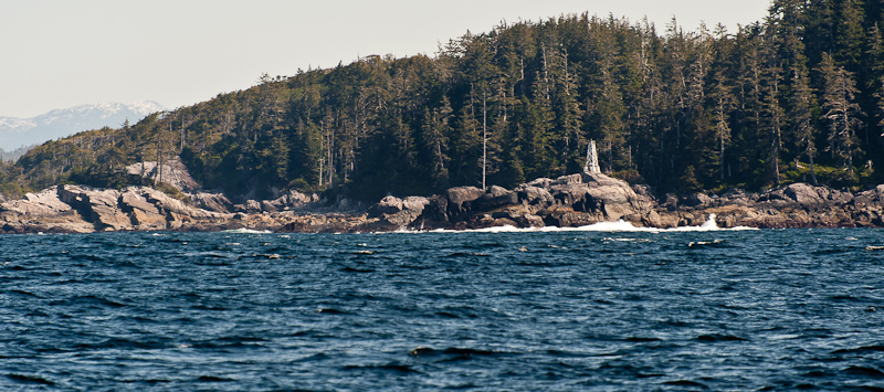
Our neighbor last night left about a half hour before us. We weighed anchor and began our trip at 7:57am in order to arrive at the narrow Ahclakerho Channel at low slack about 10:00am. The channel looks narrow on the chart and there are some rocks that line the fairway, but we found the Nobeltec charts to be spot on and the trip was an easy passage in beautiful sun.

_RE79086_7_8_9-Edit

Beautiful sunrise at anchor

_RE79136_37_38_39_40-Edit

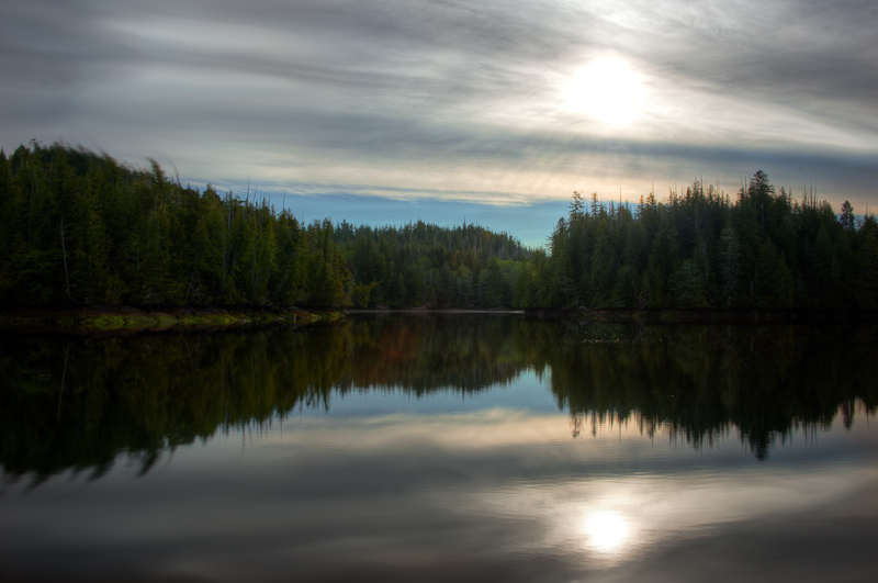
We enjoyed a calm and still night at anchor

_RE79191-Edit

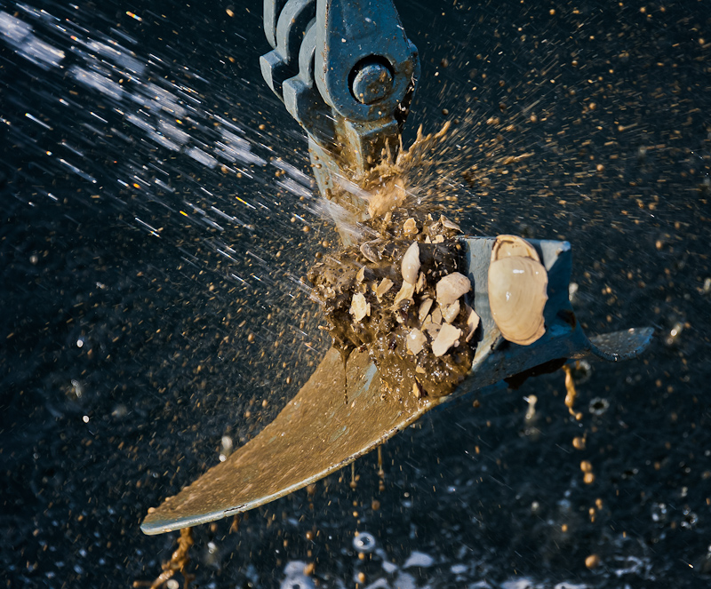
Sticky mud and shells make for good holding

_RE79159-Edit-Edit

Fly Basin is well protected and we enjoyed a calm night

_RE79144-Edit

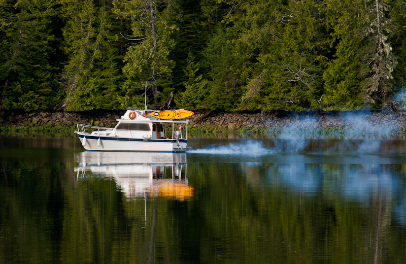
There is a reason power boats got the nickname “stinkpots”

_RE79159-Edit-Edit

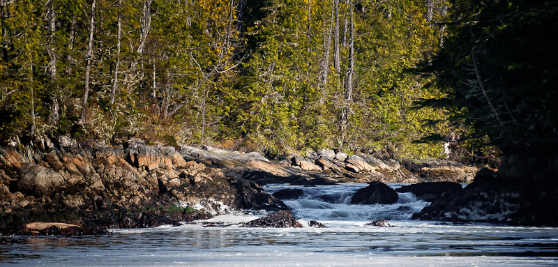
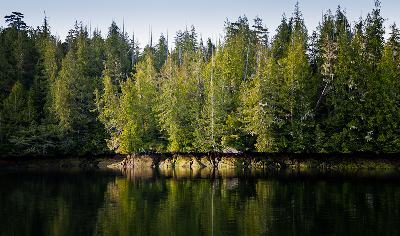
You never are in doubt where the high tide stops. The trees look as if they are trimmed with a laser.

_RE79205_6_7-Edit-Edit-Edit

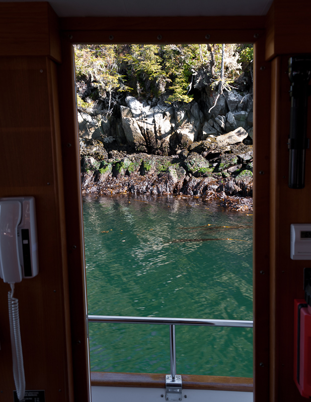
These are the views views you see cruising nowhere else

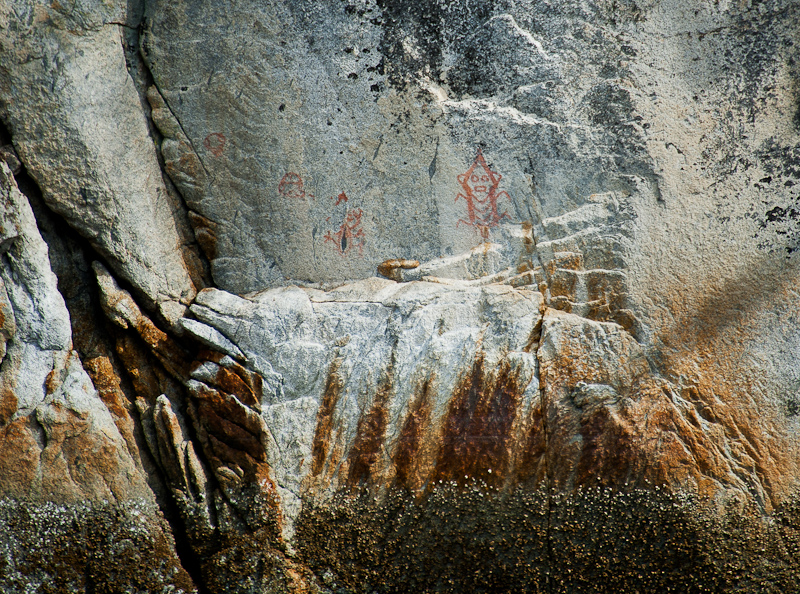
Karen had read about some pictograph in the channel across from one of the small islets. I was able to a get a photo, Karen will have to wait for the return to see it. I find it difficult, at best, to spot these ancient symbols. Often faded, they seldom look like anything you expect. Add to that, the fact that the rocks themselves are emblazoned with marks from Mother Nature, and it’s no wonder we bat about 50/50 in spotting these. I got a picture, and when we later looked at the blow up of the pictograph, it was a crazy bug with eyes and a mouth.

_RE79213-Edit

The anchorage in the small “V” shaped notch at the eastern end of the larger of the two Ahclakerho Islands is cozy but not cramped. Because of the shoaling at the northwest end and the marked (but not seen) rock, we did what most people do and set a stern line to the south shore. We have not done a stern tie in a couple of years; add to that a new (to us) boat with different equipment than we are used to, and it took us about an hour to do the “stern tie dance.”

We set the anchor in about 15 feet of water (rocky bottom!) on a plus 2 foot tide about 85 yards from the rocks. From there we set the anchor at the 50 foot mark on the rode and then proceeded to pay out a total of 250 foot of chain. That allowed Alaskan Dream to sit 30 yards from shore in 33 feet of water.

It was low tide ant only one foot above low water, so Karen had to climb the barnacle-encrusted and slimy, slippery rocks to find a suitable place to run our stern line. We were so close to shore that I just rowed us to and from the boat in the dinghy rather than starting the engine. Our stern line was nicely long enough to get the job done, and we were finally snug in the cove.

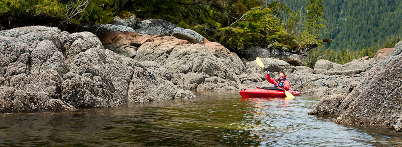
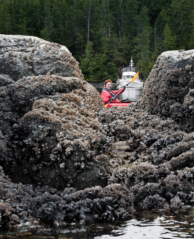
The bonus to this anchorage is the great Kayaking to be had. At first it only looks OK, but once you get out and start to explore the north shore line of the large island, you’ll find some special small spots and passages that are a kayaker’s delight.

_RE79226-Edit

Karen loves to explore what she calls “Kayak Garages”

_RE79249_50_51_R2

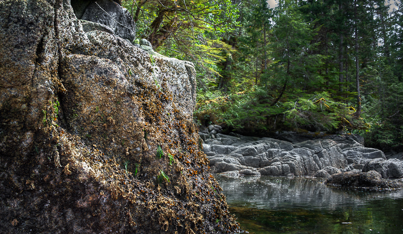
I love all the different textures and colors you find as you look closely from the cockpit of the kayak

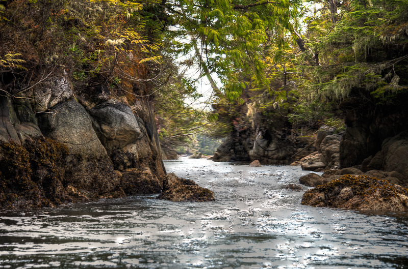
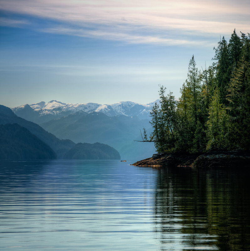
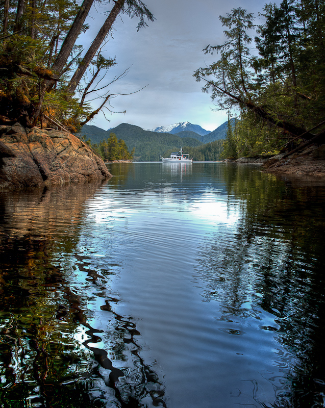
In addition, on the west end of the “v” anchorage you’ll find a drying pass that, at high water can be paddled up for about 150 yards. From there you turn around and get a great photo of your boat with snowcapped (it was May 20th) mountains in the far distance.

_RE79433_4_5-Edit-Edit

The view from the kayaks is not to be missed

_RE79443_4_5-Edit-Edit-Edit

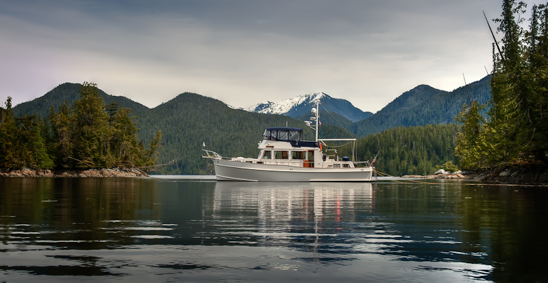
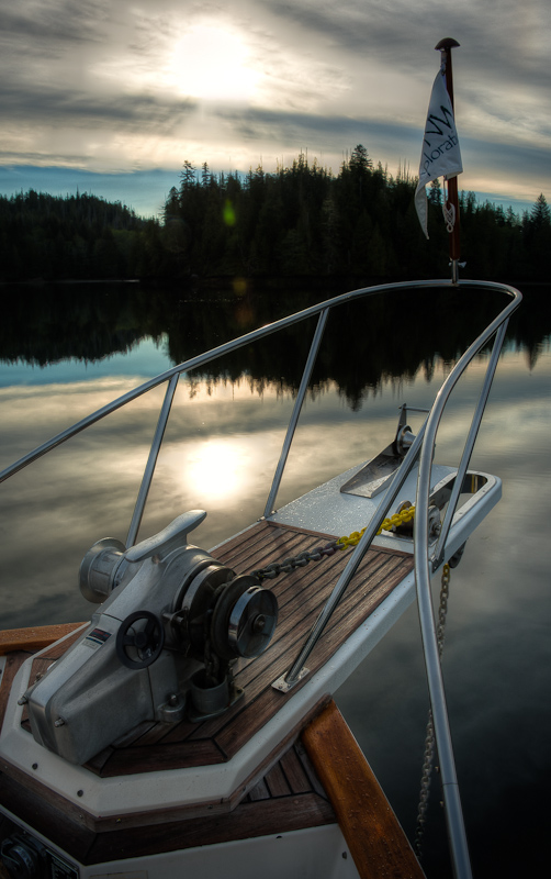
Alaskan Dream framed by the snow capped mountains

Karen and I spent about 2 hours going in and out of every little nook and cranny we could find. Occasionally we were join by the local seals who were as least as interested in us as we they.

_RE79365-Edit-Edit 

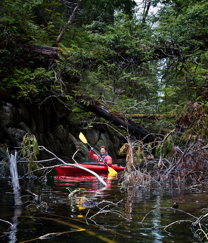
The end of the little drying inlet was messy but still a fun paddle

There were also these triangular (like baby conch) shells everywhere with some sort of sea life inside. We have not seen these before but they were in abundance, along with lots of big clams and mussels.

_RE79334-Edit

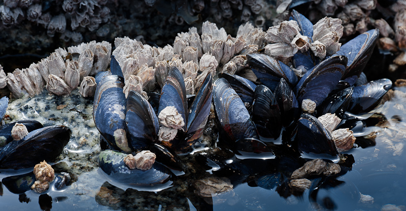
An abundance of mussels, but it's the wrong time of the year to harvest them

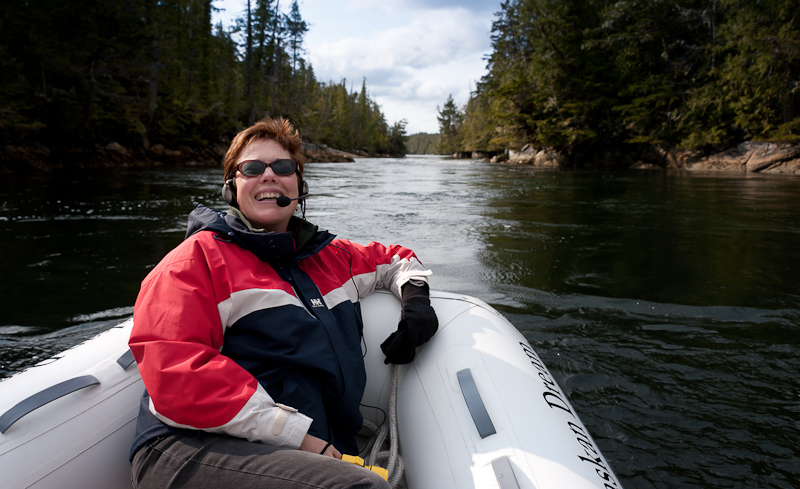
Dinner selection was driven by chef Bob, who wanted “comfort food” and thus made a fusilli gorgonzola with peppers, onions and kielbasa. After dinner, we decided to check out Broad Cove by dinghy as an alternate anchorage. It was about a 3 mile ride, and it was nice, but not as cozy as where we already were. The dinghy on Alaskan Dream is so nice, very stable, and with an electric start, so easy to get going. It also gets up to 14kts, which is nice for those times when kayaking doesn’t cut it!

_RE79446-Edit-Edit

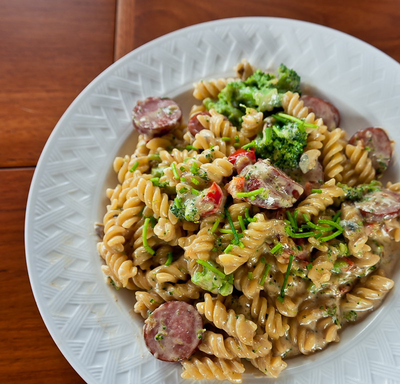
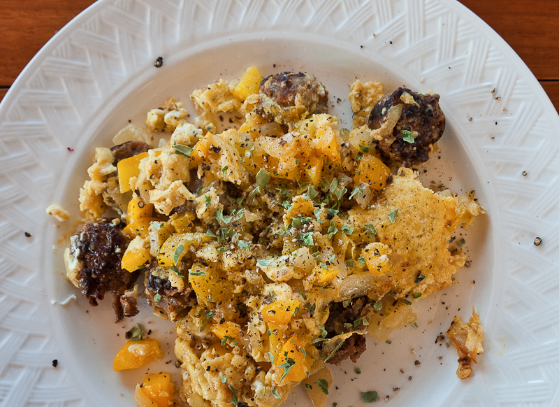
Dinner aboard Alaskan Dream

We were the only pleasure boat in the area, but we did see a fishing boat tending his prawn pots.

_RE79285-Edit

Just us and Mother Nature. Adventure the way we like it.

Miles Inlet to Fly Basin

We awoke to sun and not a cloud in the sky. Today is the day we round the infamous Cape Caution. Renowned for its crappy seas, Karen has read everything she can about making the passage. From the Hamiltons to Waggoner, to an account of a tug boat skipper, she has gleaned all there is to know about the do’s and dont’s. As it turns out, the weather and forecast were almost perfect. Low westerly swells and seas rippled at Pine and Egg Islands were just what we wanted to hear from the VHF radio weather report.

_RE79027-Edit

A good hearty breakfast before rounding Cape Caution

_RE79041_2_3_contrst focus-Edit

Entrance to the north lagoon at full outflow

_RE79045

The channels in some locations are narrow but deep. Here we are in 50 feet of water with the shore only 15 feet to starboard. It feels strange at first, but you get used to it.

Here are the buoy reports at 4am. Many say to not round the Cape if the seas at West Sea Otter are greater than 1.5 meters. However West Sea Otter is out to sea and the other two islands are on the route. With that report of seas rippled, that was the deciding factor.

Buoy Reports:

 West Sea Otter: SE4 Seas 1.7 meters, low westerly swell

Pine Island: Calm, Seas rippled

Egg Island: SE4 Seas rippled

The reports were spot on and though the seas were a bit confused at Slingsby, we had timed avoiding the ebb correctly and we made our way around the Cape in comfort. The outside air temperature was only 52.2F, but the combination of sun and light winds almost made you want to sit outside on the bow.

Again, there is not much traffic to be seen. We did see a large tug towing a monstrous barge of logs, going the opposite direction. The barge sported two cranes for loading and unloading. The only other traffic we saw in Queen Charlotte Sound was on the AIS. The cruise ship Island Princess was in range of the AIS but out of sight as she headed north for our ultimate destination of Ketchikan, Alaska.

_RE79053

The light at Cape Caution. Somehow I expected something more given the reputation of the Cape

It was only as we approached our destination that we saw a couple of fishermen tending their crab pots in Browning Channel.

The entrance to Fly Basin in Takush Harbour is spotted with rocks, but they are well charted and the channel you see on the charts provides a fair passage although it does have a couple of doglegs to contend with. You are rewarded as you arrive in Fly Basin, a large but well protected anchorage with good holding. We dropped in the hook in the east end in 33 feet, expecting to lose about 8 more feet at low tide.

We were happy to have amended our earlier plan to go all the way to Ahclakerho Channel, we were ready to drop the hook and bask in the sun.  We did a couple loads of laundry and about 5pm, a small boat with two kayaks aboard joined us in the anchorage.  We had  curry chicken salad for dinner, Karen’s all time favorite, and then watched via Satellite TV some Jon Stewart and Steven Colbert before heading to bed.

Port McNeill to Miles Inlet

We’re off. To be precise, we cast off the Port McNeill docks at 7:57am, three minutes ahead of schedule; schedule is a very loose term when you’re on vacation and cruising the Pacific Northwest. Fortunately, the weather is cooperating with a high overcast and a fresh breeze out of the northwest.

We were pretty much alone in our travels, only seeing three small boats and one seal. There was not much sightseeing to be had as we made our way to Miles Inlet. Most of our time was spent watching for, and then dodging, debris in the water. It’s a full moon, and the 18 foot tides have been washing logs and all manner of flotsam into our path. The day before, a call came into Port McNeill from a boat requesting a diver to inspect his running gear because he hit a deadhead and one prop was making a lot of vibration. He eventually continued on to Port Hardy where they have a haul out. Mariners beware; these waters can surprise with floating obstacles and during large tides, the risks increase.

The ride was nice; the seas were rippled to one to two foot chop with 1 to 1.5 foot swells. The sun made a couple of valiant attempts to make an appearance, but was too shy to do more than tease.

Miles Inlet is a great place to stop before making the trip around Cape Caution. I checked our tracks from 2009 when we last anchored in Miles Inlet and it said we anchored in the South arm opposite the entrance to the South lagoon. However, when you check the charts it shows the area has only 3 to 4 feet of water at mean low tide. We could not remember if last time the low tide was high and that why we were able to anchor there. So, not confident we could ignore the published soundings, we did what most people do and anchored in the “T” junction. We later checked out the depth in the dinghy and we calculated the depth and low mean water to be more in the 9 to 10 foot range. Karen thinks the Vipond and Kelly book, Best Anchorages of the Inside Passage, is where we found that anchoring in the South arm is a possibility depending on the tides.

_RE78926-Edit-Edit

Karen enjoying her dinghy ride in Miles Inlet as the sun shines

While out in the dinghy, we went to inspect the entrances to both the North and South Lagoons. The tides were just starting to flow out and there was already an impressive display of white water. Every time we are here, we say we should stay an extra day and go into the lagoon at high slack and explore until high slack again. However, it always seems the urge to move on overwhelms our urge to explore. Next time!!

_RE78987_88_89_90-Edit

South Lagoon Entrance with a good outflow. So inviting; so scary if you get the timing wrong.

We were the only boat in Miles Inlet that night, and it was really peaceful. Dinner was delicious pork tenderloin with Mustard Glaze and jasmine rice with crasins, accompanied by a lovely glass of wine.